Survey of London: Volume 23, Lambeth: South Bank and Vauxhall. Originally published by London County Council, London, 1951.
This free content was digitised by double rekeying. All rights reserved.
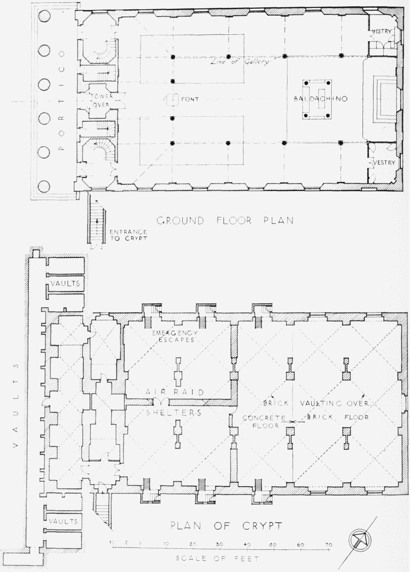
'Plate 15: St. John's Church, plans of crypt and ground floor', in Survey of London: Volume 23, Lambeth: South Bank and Vauxhall, ed. Howard Roberts, Walter H Godfrey (London, 1951), British History Online https://prod.british-history.ac.uk/survey-london/vol23/plate-15 [accessed 30 April 2025].
'Plate 15: St. John's Church, plans of crypt and ground floor', in Survey of London: Volume 23, Lambeth: South Bank and Vauxhall. Edited by Howard Roberts, Walter H Godfrey (London, 1951), British History Online, accessed April 30, 2025, https://prod.british-history.ac.uk/survey-london/vol23/plate-15.
"Plate 15: St. John's Church, plans of crypt and ground floor". Survey of London: Volume 23, Lambeth: South Bank and Vauxhall. Ed. Howard Roberts, Walter H Godfrey (London, 1951), British History Online. Web. 30 April 2025. https://prod.british-history.ac.uk/survey-london/vol23/plate-15.
ST. JOHN'S CHURCH, WATERLOO ROAD
St. John's Church, interior, circa 1930
ST. JOHN'S CHURCH, WATERLOO ROAD