Survey of London: Volume 22, Bankside (The Parishes of St. Saviour and Christchurch Southwark). Originally published by London County Council, London, 1950.
This free content was digitised by double rekeying. All rights reserved.
'Plate 9: Two plans of Borough High Street', in Survey of London: Volume 22, Bankside (The Parishes of St. Saviour and Christchurch Southwark), ed. Howard Roberts, Walter H Godfrey (London, 1950), British History Online https://prod.british-history.ac.uk/survey-london/vol22/plate-9 [accessed 26 April 2025].
'Plate 9: Two plans of Borough High Street', in Survey of London: Volume 22, Bankside (The Parishes of St. Saviour and Christchurch Southwark). Edited by Howard Roberts, Walter H Godfrey (London, 1950), British History Online, accessed April 26, 2025, https://prod.british-history.ac.uk/survey-london/vol22/plate-9.
"Plate 9: Two plans of Borough High Street". Survey of London: Volume 22, Bankside (The Parishes of St. Saviour and Christchurch Southwark). Ed. Howard Roberts, Walter H Godfrey (London, 1950), British History Online. Web. 26 April 2025. https://prod.british-history.ac.uk/survey-london/vol22/plate-9.
In this section
(a) BOROUGH HIGH STREET, 1819 (From Horwood's map)
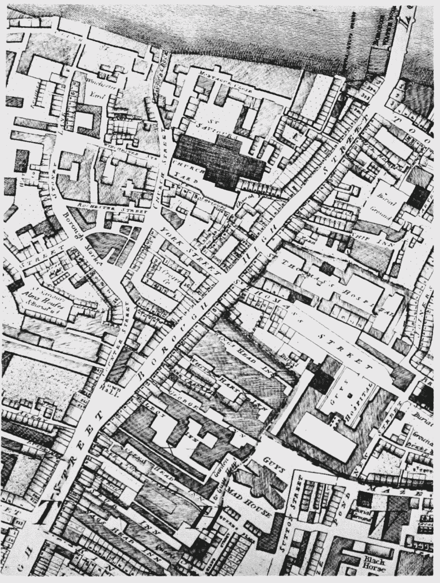
Extract from Horwood's Map, 1819;
(b) BOROUGH HIGH STREET after the erection of new London Bridge and the formation of the railway. (Ordnance Survey, 1875)
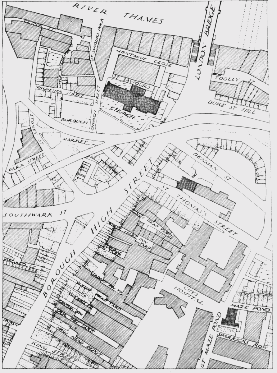
Plan of Borough High Street area based on 1875 Ordnance Survey