Survey of London: Volume 22, Bankside (The Parishes of St. Saviour and Christchurch Southwark). Originally published by London County Council, London, 1950.
This free content was digitised by double rekeying. All rights reserved.
'Plate 78: No. 61 Hopton Street, 1949', in Survey of London: Volume 22, Bankside (The Parishes of St. Saviour and Christchurch Southwark), ed. Howard Roberts, Walter H Godfrey (London, 1950), British History Online https://prod.british-history.ac.uk/survey-london/vol22/plate-78 [accessed 29 April 2025].
'Plate 78: No. 61 Hopton Street, 1949', in Survey of London: Volume 22, Bankside (The Parishes of St. Saviour and Christchurch Southwark). Edited by Howard Roberts, Walter H Godfrey (London, 1950), British History Online, accessed April 29, 2025, https://prod.british-history.ac.uk/survey-london/vol22/plate-78.
"Plate 78: No. 61 Hopton Street, 1949". Survey of London: Volume 22, Bankside (The Parishes of St. Saviour and Christchurch Southwark). Ed. Howard Roberts, Walter H Godfrey (London, 1950), British History Online. Web. 29 April 2025. https://prod.british-history.ac.uk/survey-london/vol22/plate-78.
61, HOPTON STREET, 1949
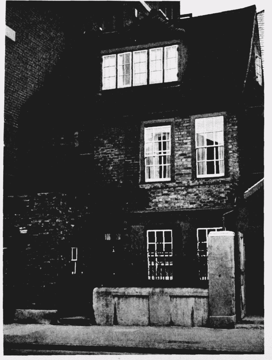
No. 61 Hopton Street, 1949
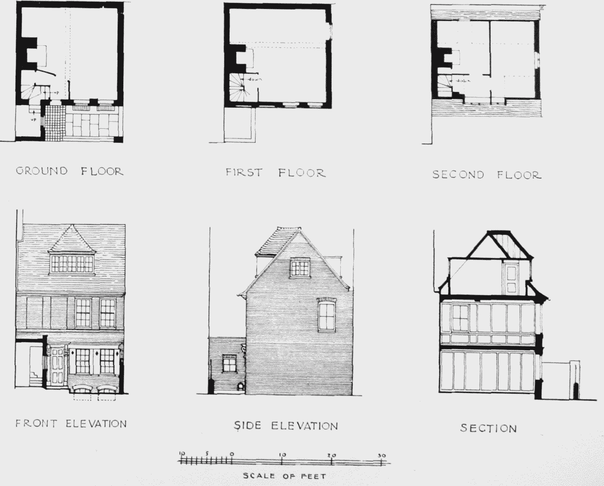
No. 61 Hopton Street. Elevations and plans