Survey of London: Volume 22, Bankside (The Parishes of St. Saviour and Christchurch Southwark). Originally published by London County Council, London, 1950.
This free content was digitised by double rekeying. All rights reserved.
'Plate 59: Plan of Bankside.', in Survey of London: Volume 22, Bankside (The Parishes of St. Saviour and Christchurch Southwark), ed. Howard Roberts, Walter H Godfrey (London, 1950), British History Online https://prod.british-history.ac.uk/survey-london/vol22/plate-59 [accessed 26 April 2025].
'Plate 59: Plan of Bankside.', in Survey of London: Volume 22, Bankside (The Parishes of St. Saviour and Christchurch Southwark). Edited by Howard Roberts, Walter H Godfrey (London, 1950), British History Online, accessed April 26, 2025, https://prod.british-history.ac.uk/survey-london/vol22/plate-59.
"Plate 59: Plan of Bankside.". Survey of London: Volume 22, Bankside (The Parishes of St. Saviour and Christchurch Southwark). Ed. Howard Roberts, Walter H Godfrey (London, 1950), British History Online. Web. 26 April 2025. https://prod.british-history.ac.uk/survey-london/vol22/plate-59.
PLAN OF BANKSIDE (BASED ON THE 1875 ORDNANCE SURVEY)
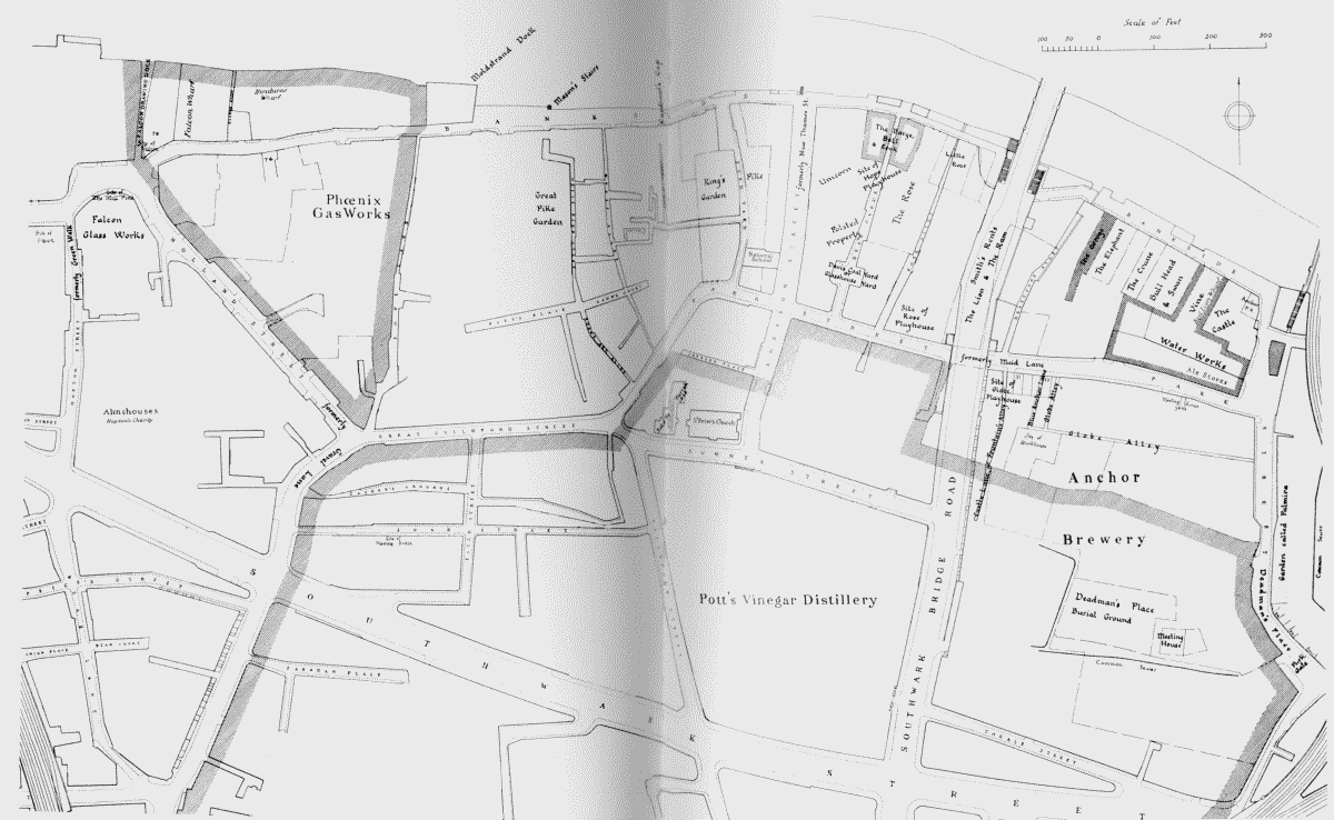
Plan of Bankside, showing the Bishop of Winchester's property and the sites of the Elizabethan playhouses, inns, etc.
The Bishop of Winchester's property is indicated by single hatching, parish property by cross hatching