Survey of London: Volume 19, the Parish of St Pancras Part 2: Old St Pancras and Kentish Town. Originally published by London County Council, London, 1938.
This free content was digitised by double rekeying. All rights reserved.
'Sketch map of the parish of St. Pancras', in Survey of London: Volume 19, the Parish of St Pancras Part 2: Old St Pancras and Kentish Town, ed. Percy Lovell, William McB. Marcham (London, 1938), British History Online https://prod.british-history.ac.uk/survey-london/vol19/pt2/sketch-map-st-pancras [accessed 15 April 2025].
'Sketch map of the parish of St. Pancras', in Survey of London: Volume 19, the Parish of St Pancras Part 2: Old St Pancras and Kentish Town. Edited by Percy Lovell, William McB. Marcham (London, 1938), British History Online, accessed April 15, 2025, https://prod.british-history.ac.uk/survey-london/vol19/pt2/sketch-map-st-pancras.
"Sketch map of the parish of St. Pancras". Survey of London: Volume 19, the Parish of St Pancras Part 2: Old St Pancras and Kentish Town. Ed. Percy Lovell, William McB. Marcham (London, 1938), British History Online. Web. 15 April 2025. https://prod.british-history.ac.uk/survey-london/vol19/pt2/sketch-map-st-pancras.
HISTORICAL SKETCH MAP OF ST PANCRAS
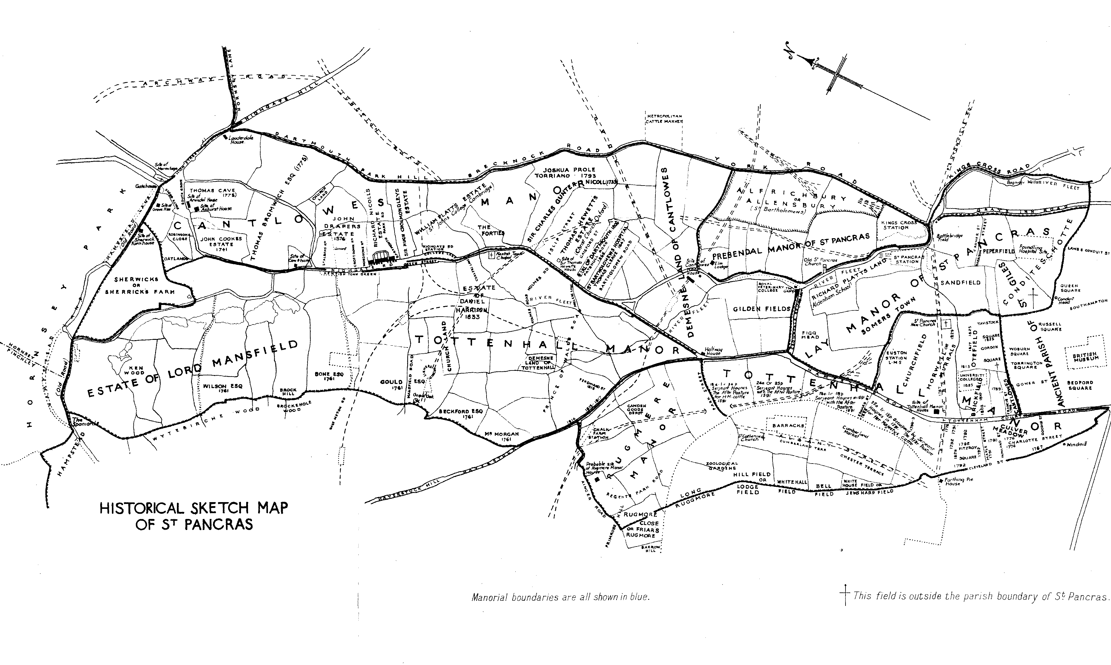
Sketch-Map of St. Pancras showing the principal Manors and estates