Survey of London: Volume 18, St Martin-in-The-Fields II: the Strand. Originally published by London County Council, London, 1937.
This free content was digitised by double rekeying. All rights reserved.
'Plate 32: York Watergate, elevations', in Survey of London: Volume 18, St Martin-in-The-Fields II: the Strand, ed. G H Gater, E P Wheeler (London, 1937), British History Online https://prod.british-history.ac.uk/survey-london/vol18/pt2/plate-32 [accessed 28 April 2025].
'Plate 32: York Watergate, elevations', in Survey of London: Volume 18, St Martin-in-The-Fields II: the Strand. Edited by G H Gater, E P Wheeler (London, 1937), British History Online, accessed April 28, 2025, https://prod.british-history.ac.uk/survey-london/vol18/pt2/plate-32.
"Plate 32: York Watergate, elevations". Survey of London: Volume 18, St Martin-in-The-Fields II: the Strand. Ed. G H Gater, E P Wheeler (London, 1937), British History Online. Web. 28 April 2025. https://prod.british-history.ac.uk/survey-london/vol18/pt2/plate-32.
In this section
YORK WATERGATE
(a) ELEVATION TO EMBANKMENT GARDENS Formerly the River
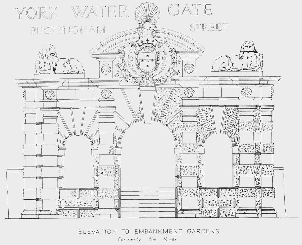
elevation to Embankment Gardens
(b) ELEVATION TO YORK TERRACE
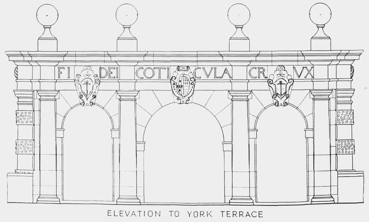
elevation to York Terrace