Survey of London: Volume 17, the Parish of St Pancras Part 1: the Village of Highgate. Originally published by London County Council, London, 1936.
This free content was digitised by double rekeying. All rights reserved.
'Plate 26: Church House, No. 10, South Grove, Elevations and Sections', in Survey of London: Volume 17, the Parish of St Pancras Part 1: the Village of Highgate, ed. Percy Lovell, William McB. Marcham (London, 1936), British History Online https://prod.british-history.ac.uk/survey-london/vol17/pt1/plate-26 [accessed 15 April 2025].
'Plate 26: Church House, No. 10, South Grove, Elevations and Sections', in Survey of London: Volume 17, the Parish of St Pancras Part 1: the Village of Highgate. Edited by Percy Lovell, William McB. Marcham (London, 1936), British History Online, accessed April 15, 2025, https://prod.british-history.ac.uk/survey-london/vol17/pt1/plate-26.
"Plate 26: Church House, No. 10, South Grove, Elevations and Sections". Survey of London: Volume 17, the Parish of St Pancras Part 1: the Village of Highgate. Ed. Percy Lovell, William McB. Marcham (London, 1936), British History Online. Web. 15 April 2025. https://prod.british-history.ac.uk/survey-london/vol17/pt1/plate-26.
No. 10, SOUTH GROVE, CHURCH HOUSE (pp. 32–3)
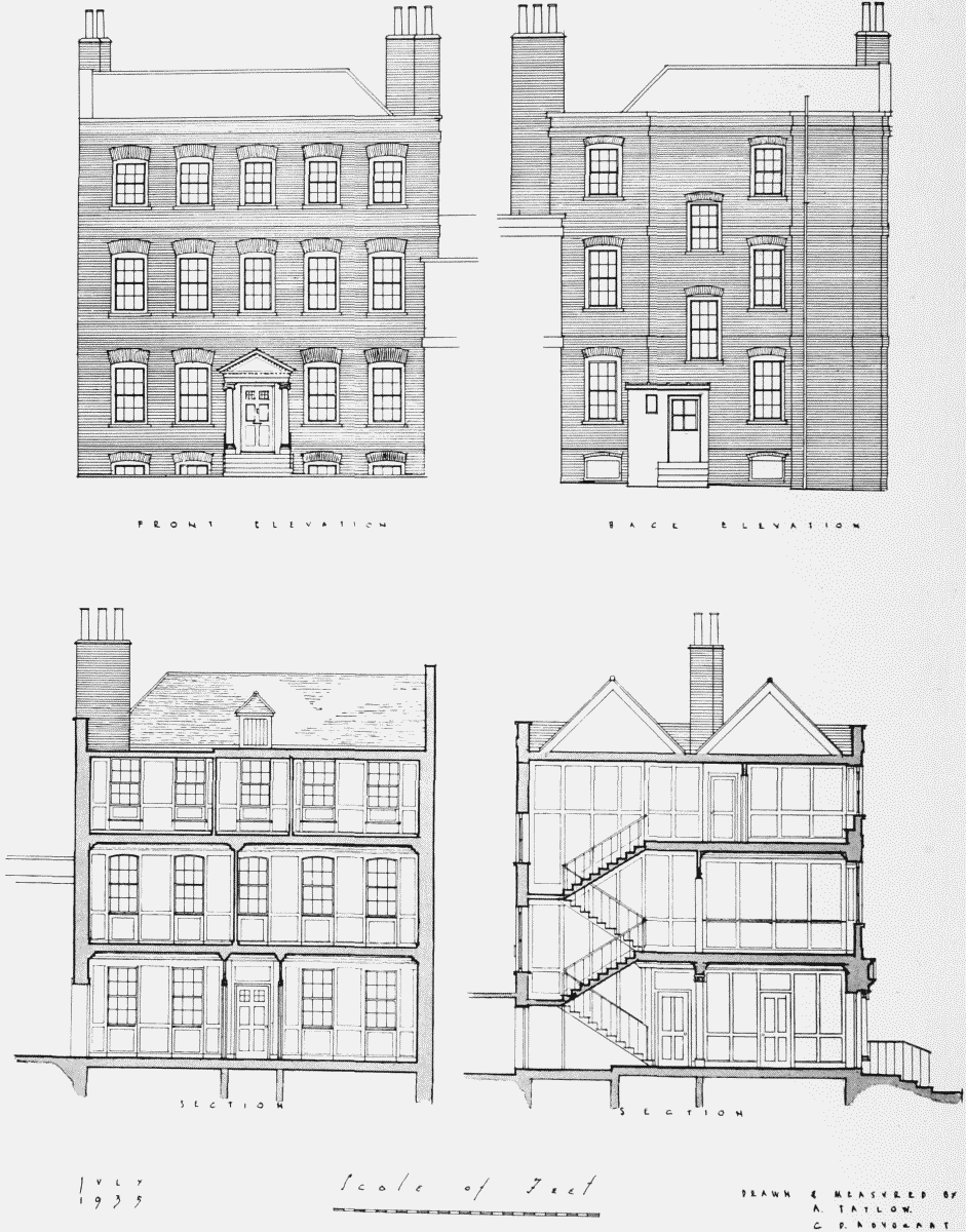
Church House, No. 10, South Grove: Elevations and Sections