Survey of London: Volume 14, St Margaret, Westminster, Part III: Whitehall II. Originally published by London County Council, London, 1931.
This free content was digitised by double rekeying. All rights reserved.
'Plate 132: Nos. 11 and 12, Downing Street, elevation and sections', in Survey of London: Volume 14, St Margaret, Westminster, Part III: Whitehall II, ed. Montagu H Cox, G Topham Forrest (London, 1931), British History Online https://prod.british-history.ac.uk/survey-london/vol14/pt3/plate-132 [accessed 4 April 2025].
'Plate 132: Nos. 11 and 12, Downing Street, elevation and sections', in Survey of London: Volume 14, St Margaret, Westminster, Part III: Whitehall II. Edited by Montagu H Cox, G Topham Forrest (London, 1931), British History Online, accessed April 4, 2025, https://prod.british-history.ac.uk/survey-london/vol14/pt3/plate-132.
"Plate 132: Nos. 11 and 12, Downing Street, elevation and sections". Survey of London: Volume 14, St Margaret, Westminster, Part III: Whitehall II. Ed. Montagu H Cox, G Topham Forrest (London, 1931), British History Online. Web. 4 April 2025. https://prod.british-history.ac.uk/survey-london/vol14/pt3/plate-132.
NOS 11 & 12 DOWNING STREET
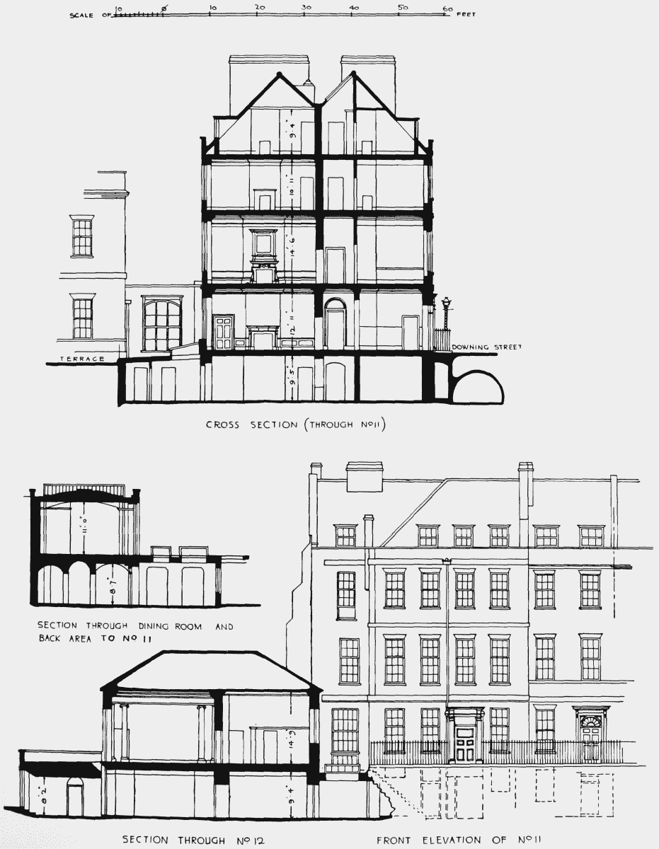
Nos. 11 and 12, Downing Street, elevation and sections