Survey of London: Volume 10, St. Margaret, Westminster, Part I: Queen Anne's Gate Area. Originally published by [s.n.], [s.l.], 1926.
This free content was digitised by double rekeying. All rights reserved.
'Plate 13: Plan of part of the parish of St. Margaret (1734-1748)', in Survey of London: Volume 10, St. Margaret, Westminster, Part I: Queen Anne's Gate Area, ed. Montagu H Cox ([s.l.], 1926), British History Online https://prod.british-history.ac.uk/survey-london/vol10/pt1/plate-13 [accessed 13 April 2025].
'Plate 13: Plan of part of the parish of St. Margaret (1734-1748)', in Survey of London: Volume 10, St. Margaret, Westminster, Part I: Queen Anne's Gate Area. Edited by Montagu H Cox ([s.l.], 1926), British History Online, accessed April 13, 2025, https://prod.british-history.ac.uk/survey-london/vol10/pt1/plate-13.
"Plate 13: Plan of part of the parish of St. Margaret (1734-1748)". Survey of London: Volume 10, St. Margaret, Westminster, Part I: Queen Anne's Gate Area. Ed. Montagu H Cox ([s.l.], 1926), British History Online. Web. 13 April 2025. https://prod.british-history.ac.uk/survey-london/vol10/pt1/plate-13.
A Plan of part of the Parish of St. Margaret showing the improvement of Great George Street from Westminster Bridge to the Park
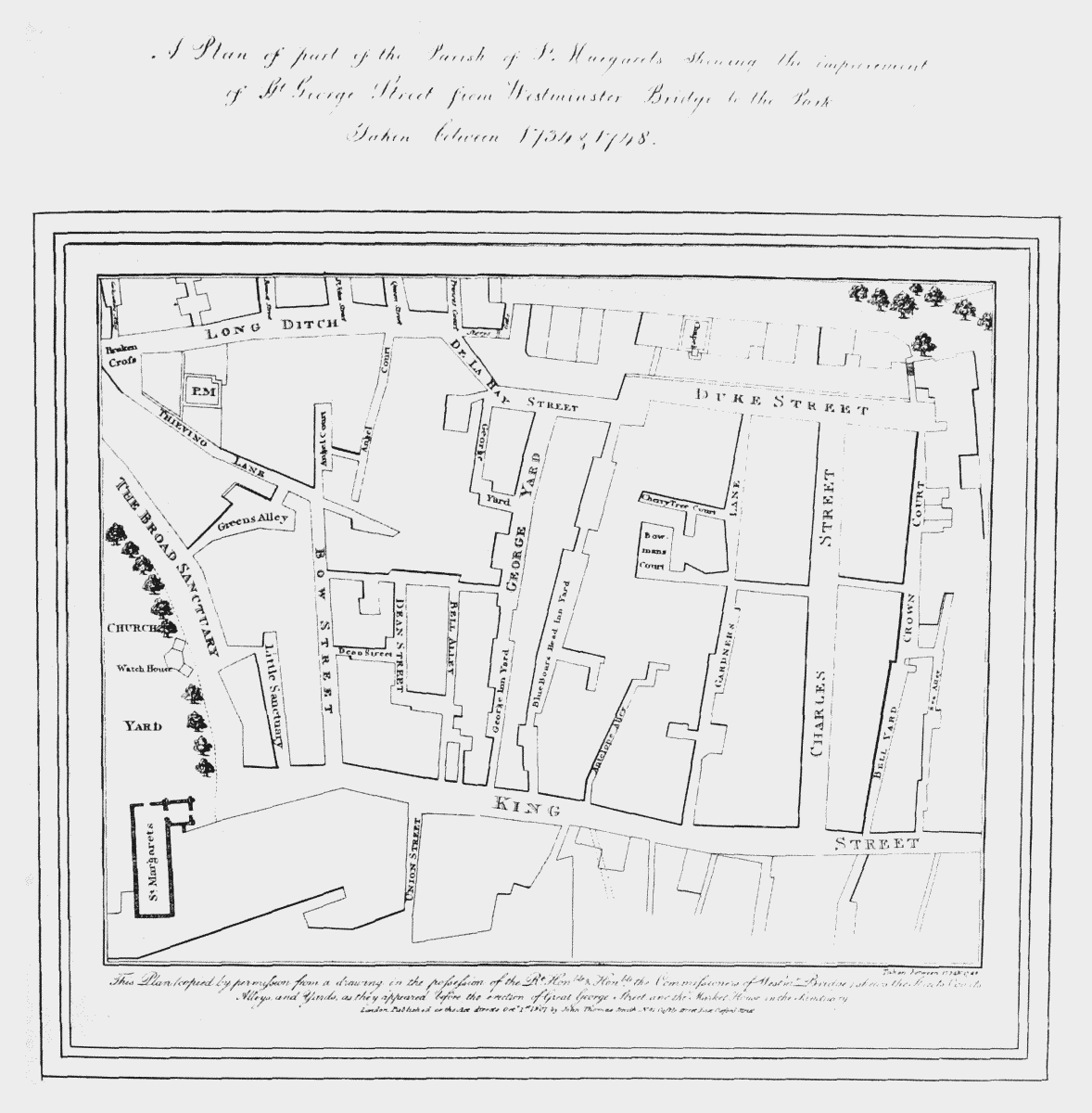
Plan of part of the parish of St. Margaret showing the improvement of Great George Street … taken between 1734 and 1748