Survey of London: Volume 10, St. Margaret, Westminster, Part I: Queen Anne's Gate Area. Originally published by [s.n.], [s.l.], 1926.
This free content was digitised by double rekeying. All rights reserved.
'Plan pocket', in Survey of London: Volume 10, St. Margaret, Westminster, Part I: Queen Anne's Gate Area, ed. Montagu H Cox ([s.l.], 1926), British History Online https://prod.british-history.ac.uk/survey-london/vol10/pt1/plan-pocket [accessed 13 April 2025].
'Plan pocket', in Survey of London: Volume 10, St. Margaret, Westminster, Part I: Queen Anne's Gate Area. Edited by Montagu H Cox ([s.l.], 1926), British History Online, accessed April 13, 2025, https://prod.british-history.ac.uk/survey-london/vol10/pt1/plan-pocket.
"Plan pocket". Survey of London: Volume 10, St. Margaret, Westminster, Part I: Queen Anne's Gate Area. Ed. Montagu H Cox ([s.l.], 1926), British History Online. Web. 13 April 2025. https://prod.british-history.ac.uk/survey-london/vol10/pt1/plan-pocket.
PLAN OF PART OF THE PARISH OF ST MARGARET, WESTMINSTER, IN 1894.
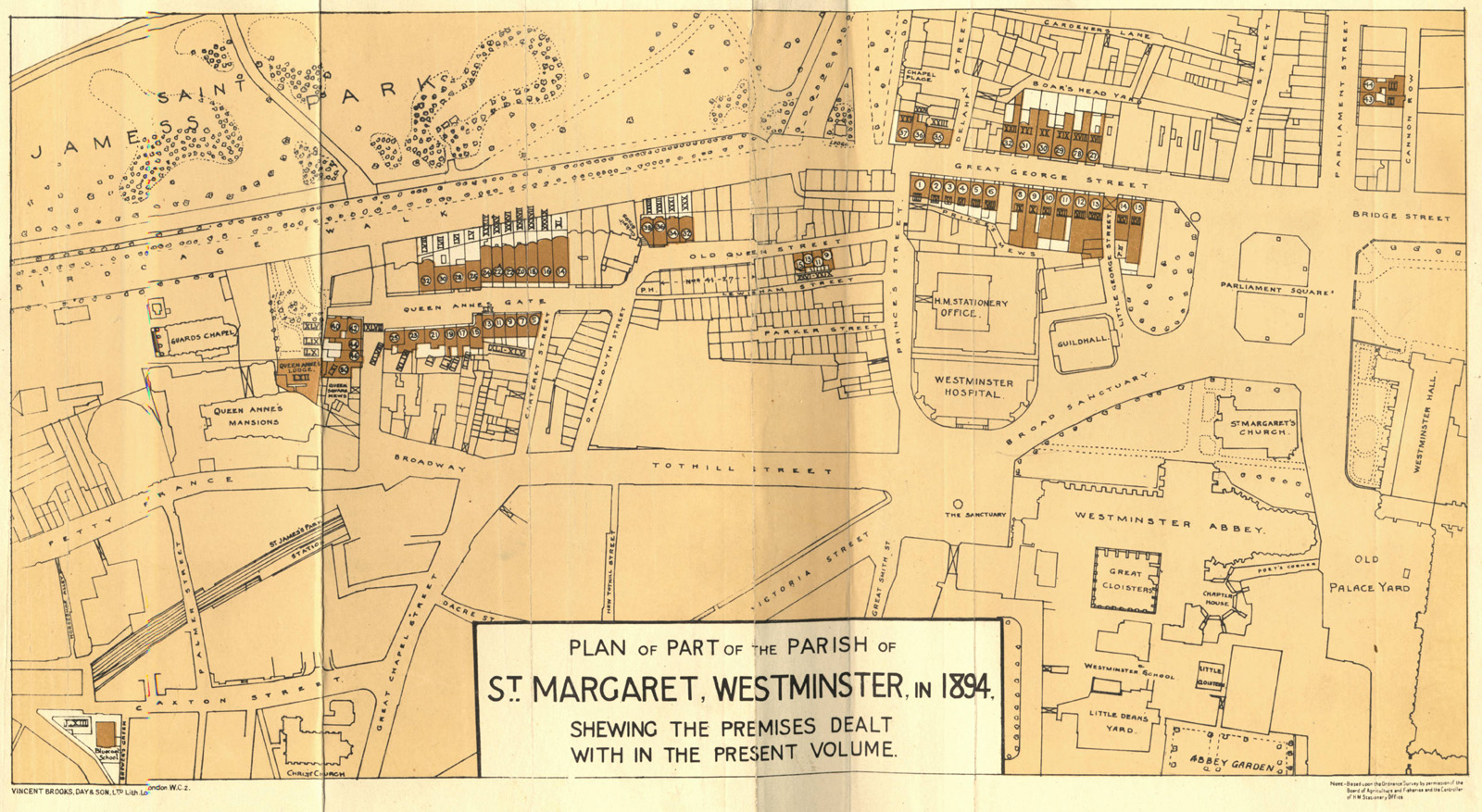
Plan, shewing the premises dealt with in the present volume.