The History and Topographical Survey of the County of Kent: Volume 4. Originally published by W Bristow, Canterbury, 1798.
This free content was digitised by double rekeying. All rights reserved.
Edward Hasted, 'The hundred of Maidstone: Introduction and map', in The History and Topographical Survey of the County of Kent: Volume 4(Canterbury, 1798), British History Online https://prod.british-history.ac.uk/survey-kent/vol4/p259 [accessed 24 April 2025].
Edward Hasted, 'The hundred of Maidstone: Introduction and map', in The History and Topographical Survey of the County of Kent: Volume 4(Canterbury, 1798), British History Online, accessed April 24, 2025, https://prod.british-history.ac.uk/survey-kent/vol4/p259.
Edward Hasted. "The hundred of Maidstone: Introduction and map". The History and Topographical Survey of the County of Kent: Volume 4. (Canterbury, 1798), British History Online. Web. 24 April 2025. https://prod.british-history.ac.uk/survey-kent/vol4/p259.
THE HUNDRED OF MAIDSTONE.
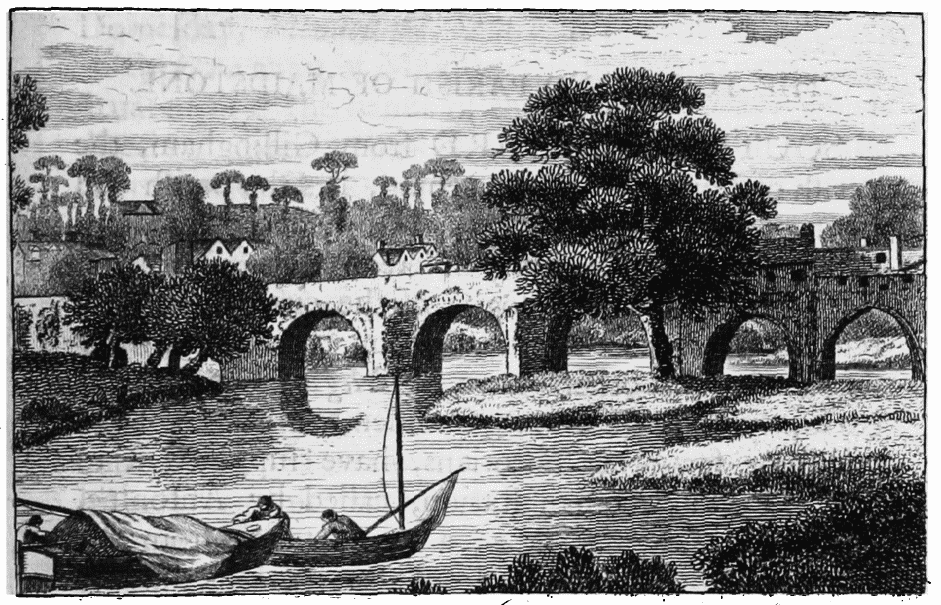
Maidstone Bridge
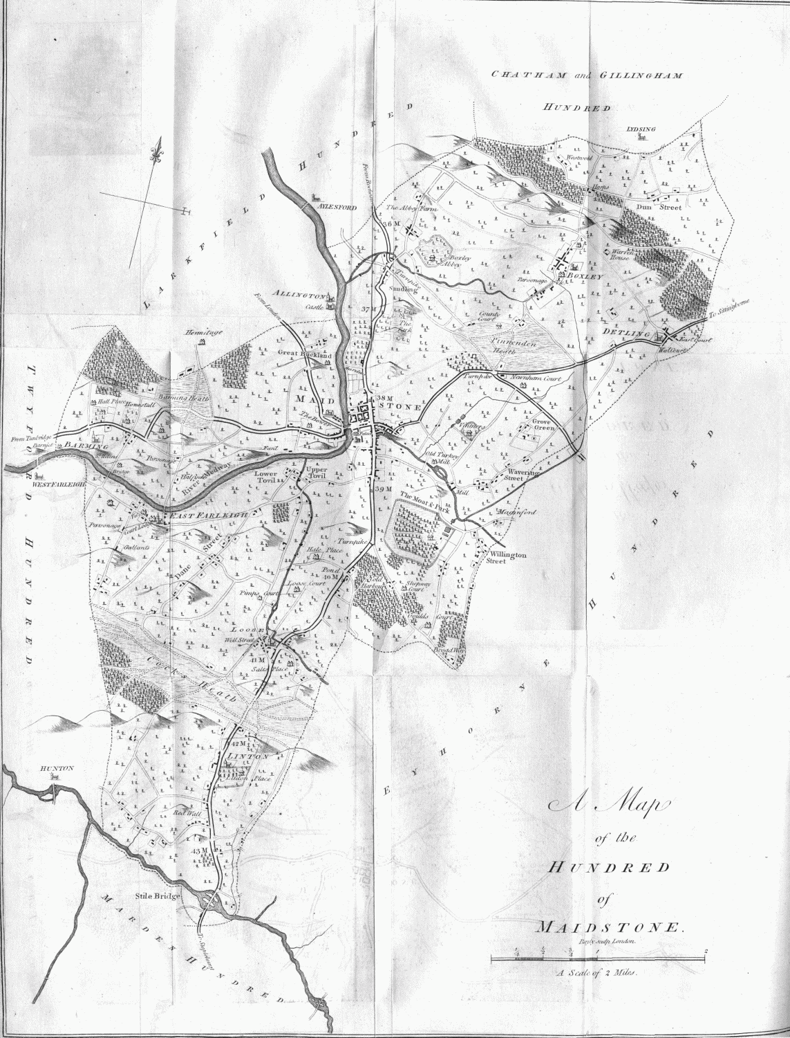
Map of the hundred of Maidstone
THE next hundred south-westward is that of Maidstone, which contains within its bounds the parishes of
1. BOXLEY.
2. DETLING.
3. LOOSE.
4. LINTON.
5. EAST FARLEY; and
6. EAST and WEST BARMING.
With the churches of the same: And part of the parishes of BERSTED, HUNTON, MARDEN, and STAPLEHURST.
IT formerly contained likewise, within its bounds, the town and parish of Maidstone , which has long since been made a separate jurisdiction, having a constable of its own, the liberty of the corporation claiming over it. This hundred is written, in the book of Domesday, Meddestan , and in other records, Maydestane . In the 8th year of king Edward II. the archbishop was lord of this hundred; the Right Hon. lord Romney is the present owner of it.