An Inventory of the Historical Monuments in the County of Northamptonshire, Volume 3, Archaeological Sites in North-West Northamptonshire. Originally published by Her Majesty's Stationery Office, London, 1981.
This free content was digitised by double rekeying. All rights reserved.
'Plate 7: Lamport, Tithe Map of Faxton, 1840', in An Inventory of the Historical Monuments in the County of Northamptonshire, Volume 3, Archaeological Sites in North-West Northamptonshire(London, 1981), British History Online https://prod.british-history.ac.uk/rchme/northants/vol3/plate-7 [accessed 19 April 2025].
'Plate 7: Lamport, Tithe Map of Faxton, 1840', in An Inventory of the Historical Monuments in the County of Northamptonshire, Volume 3, Archaeological Sites in North-West Northamptonshire(London, 1981), British History Online, accessed April 19, 2025, https://prod.british-history.ac.uk/rchme/northants/vol3/plate-7.
"Plate 7: Lamport, Tithe Map of Faxton, 1840". An Inventory of the Historical Monuments in the County of Northamptonshire, Volume 3, Archaeological Sites in North-West Northamptonshire. (London, 1981), British History Online. Web. 19 April 2025. https://prod.british-history.ac.uk/rchme/northants/vol3/plate-7.
Lamport: Tithe Map of Faxton, 1840
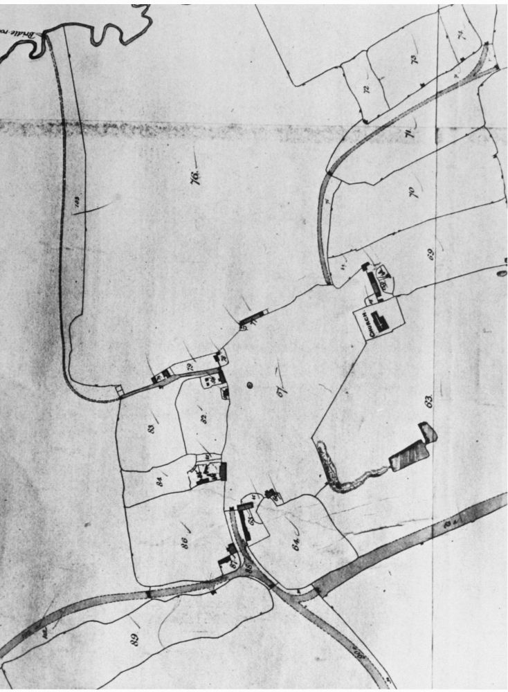
Lamport (15, 16). Tithe Map of Faxton, 1840, showing parts of village surviving at that date. (NRO)