An Inventory of the Historical Monuments in the County of Northamptonshire, Volume 2, Archaeological Sites in Central Northamptonshire. Originally published by Her Majesty's Stationery Office, London, 1979.
This free content was digitised by double rekeying. All rights reserved.
'Plate 13: Cransley, Village Remains and Map of 1598', in An Inventory of the Historical Monuments in the County of Northamptonshire, Volume 2, Archaeological Sites in Central Northamptonshire(London, 1979), British History Online https://prod.british-history.ac.uk/rchme/northants/vol2/plate-13 [accessed 28 April 2025].
'Plate 13: Cransley, Village Remains and Map of 1598', in An Inventory of the Historical Monuments in the County of Northamptonshire, Volume 2, Archaeological Sites in Central Northamptonshire(London, 1979), British History Online, accessed April 28, 2025, https://prod.british-history.ac.uk/rchme/northants/vol2/plate-13.
"Plate 13: Cransley, Village Remains and Map of 1598". An Inventory of the Historical Monuments in the County of Northamptonshire, Volume 2, Archaeological Sites in Central Northamptonshire. (London, 1979), British History Online. Web. 28 April 2025. https://prod.british-history.ac.uk/rchme/northants/vol2/plate-13.
Cransley: Village Remains and Map of 1598
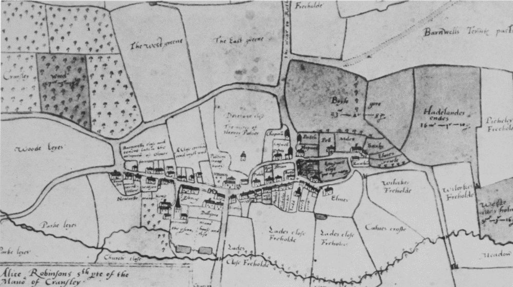
Cransley (8). Map of 1598, showing former street pattern. (NRO)

Cransley (8, 11). Village remains and cultivation remains, from N.W. (CUAP)