An Inventory of the Historical Monuments in Dorset, Volume 3, Central. Originally published by Her Majesty's Stationery Office, London, 1970.
This free content was digitised by double rekeying. All rights reserved.
'Plate 86: Celtic' Field Groups', in An Inventory of the Historical Monuments in Dorset, Volume 3, Central(London, 1970), British History Online https://prod.british-history.ac.uk/rchme/dorset/vol3/plate-86 [accessed 18 April 2025].
'Plate 86: Celtic' Field Groups', in An Inventory of the Historical Monuments in Dorset, Volume 3, Central(London, 1970), British History Online, accessed April 18, 2025, https://prod.british-history.ac.uk/rchme/dorset/vol3/plate-86.
"Plate 86: Celtic' Field Groups". An Inventory of the Historical Monuments in Dorset, Volume 3, Central. (London, 1970), British History Online. Web. 18 April 2025. https://prod.british-history.ac.uk/rchme/dorset/vol3/plate-86.
'Celtic' Field Groups
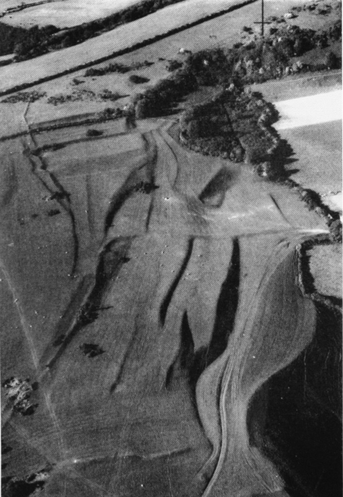
Group (42). Watcombe Plain, Alton Pancras, looking N.; bank 'N' in foreground. 'Celtic' fields associated with track best seen in background, left. (Centre of photograph: ST 712032)
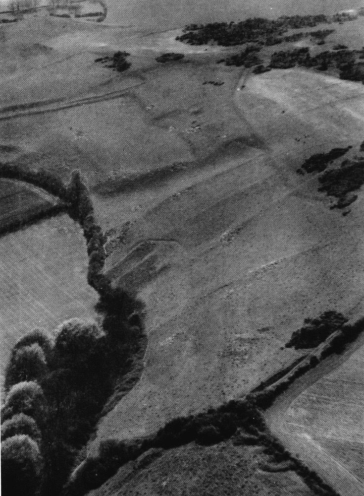
Group (43). Ball Hill, Piddletrenthide, looking S.W. towards settlement area 'a', at top centre. (Centre of photograph: ST 723031)