An Inventory of the Historical Monuments in Dorset, Volume 2, South east. Originally published by Her Majesty's Stationery Office, London, 1970.
This free content was digitised by double rekeying. All rights reserved.
'Plate 158: Studland, Brownsea Castle, Map in Hatfield MSS', in An Inventory of the Historical Monuments in Dorset, Volume 2, South east(London, 1970), British History Online https://prod.british-history.ac.uk/rchme/dorset/vol2/plate-158 [accessed 19 April 2025].
'Plate 158: Studland, Brownsea Castle, Map in Hatfield MSS', in An Inventory of the Historical Monuments in Dorset, Volume 2, South east(London, 1970), British History Online, accessed April 19, 2025, https://prod.british-history.ac.uk/rchme/dorset/vol2/plate-158.
"Plate 158: Studland, Brownsea Castle, Map in Hatfield MSS". An Inventory of the Historical Monuments in Dorset, Volume 2, South east. (London, 1970), British History Online. Web. 19 April 2025. https://prod.british-history.ac.uk/rchme/dorset/vol2/plate-158.
Studland. Brownsea Castle. Map in Hatfield MSS.
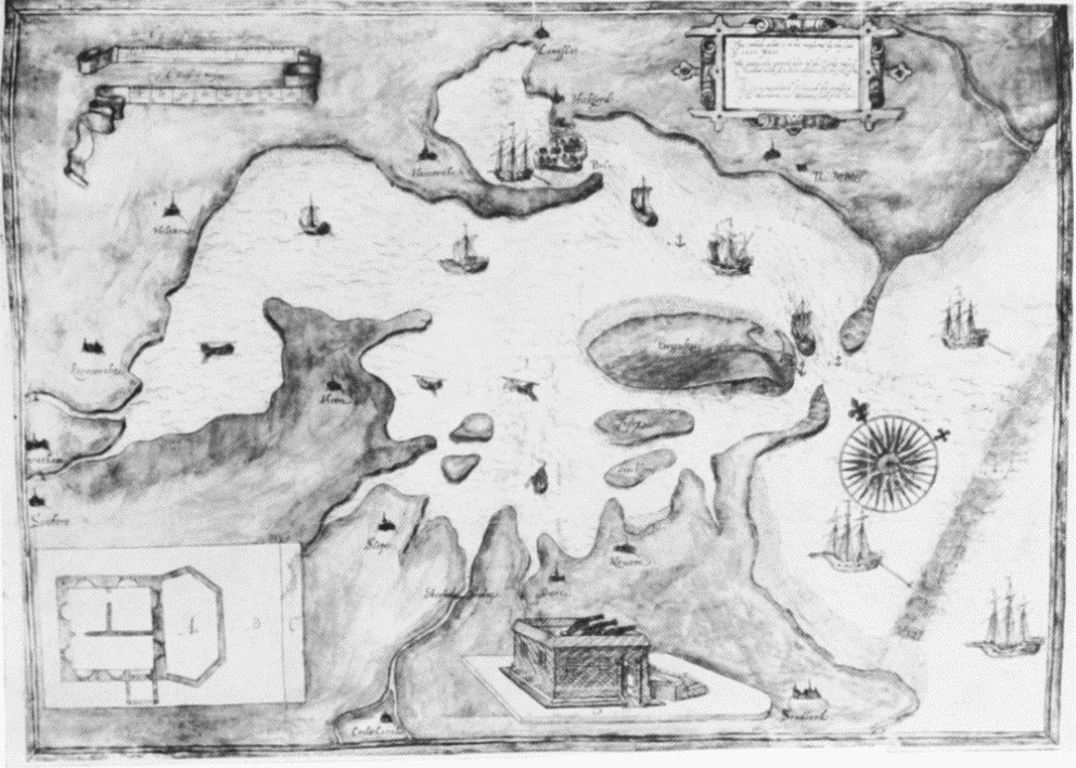
Poole Harbour in 1597. Map showing Brownsea Island etc. Copied in B.M.: Maps 186h 2(32).


Details of plan and perspective view of Castle on 1597 map.