Ancient and Historical Monuments in the County of Gloucester Iron Age and Romano-British Monuments in the Gloucestershire Cotswolds. Originally published by Her Majesty's Stationery Office, London, 1976.
This free content was digitised by double rekeying. All rights reserved.
'Driffield', in Ancient and Historical Monuments in the County of Gloucester Iron Age and Romano-British Monuments in the Gloucestershire Cotswolds(London, 1976), British History Online https://prod.british-history.ac.uk/rchme/ancient-glos/pp45-47 [accessed 5 May 2025].
'Driffield', in Ancient and Historical Monuments in the County of Gloucester Iron Age and Romano-British Monuments in the Gloucestershire Cotswolds(London, 1976), British History Online, accessed May 5, 2025, https://prod.british-history.ac.uk/rchme/ancient-glos/pp45-47.
"Driffield". Ancient and Historical Monuments in the County of Gloucester Iron Age and Romano-British Monuments in the Gloucestershire Cotswolds. (London, 1976), British History Online. Web. 5 May 2025. https://prod.british-history.ac.uk/rchme/ancient-glos/pp45-47.
DRIFFIELD
(3 miles E.S.E. of Cirencester)
A Romano-British stone coffin containing bones, an iron axe-head, a flagon, a dish and other pottery, was found in 1861 beside the Ampney Brook, on or close to the boundary between this parish and Latton, Wiltshire. (fn. 1)
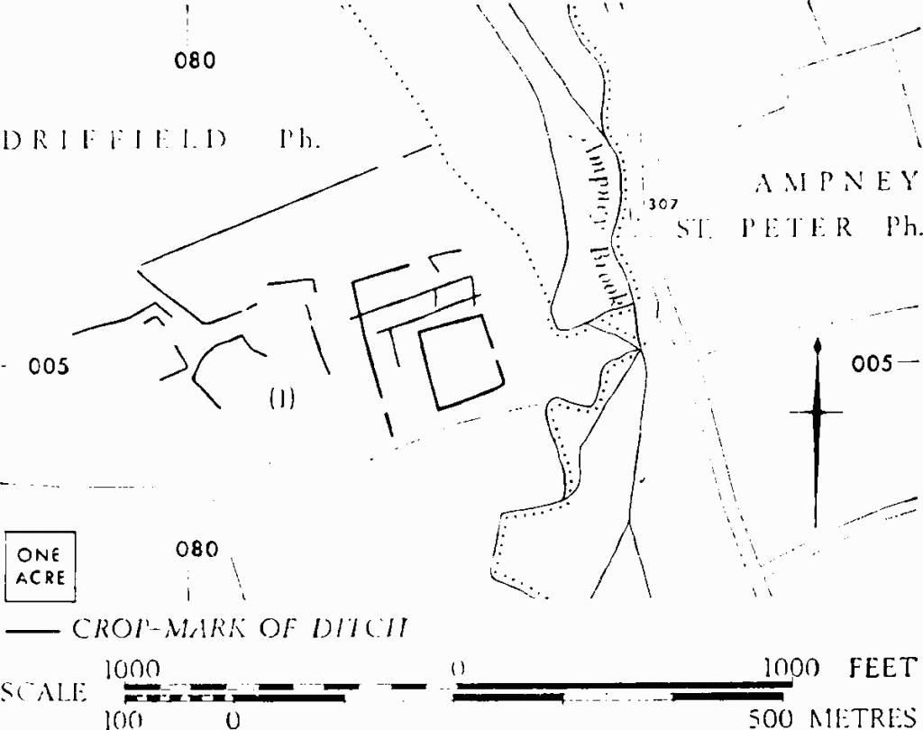
(1) Roman Villa and Enclosures (SP 082005), now ploughed out, lay 2/3 mile N.E. of the village on level ground W. of the Ampney Brook (Plate 49). The villa is marked by an ill-defined platform about 1½ ft. high, its surface and vicinity strewn with tiles, tesserae and limestone blocks. The platform lies inside a 1-acre enclosure, possibly walled, with an entrance on the east.

Doynton. (1) 'Royal Camp'.
Crop-marks indicate that the enclosure was itself set within traces of other enclosures and surrounded by other ditches which covered an area of 12 acres or more. Finds on the building site include coarse red, grey and white tesserae, fragments of imbrex, tegula and box-tiles, tiles with nail holes, dressed stone and sandstone, and a little pottery. An area of dark soil S.E. of the inner ditch yielded sherds of late 1st-century samian ware, coarse pottery of the 3rd–4th century, and part of a box tile. Finds are in Gloucester City Museum.
C.U.A.P., OAP AOO 30.
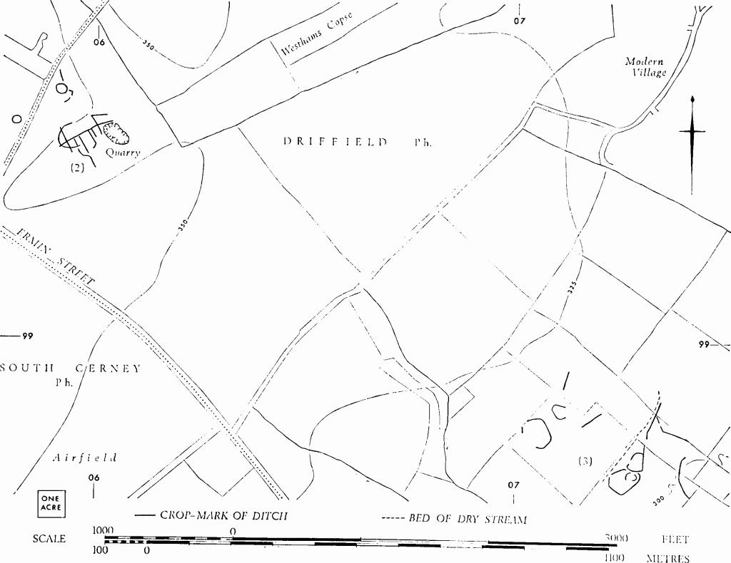
(2) Enclosures and Linear Ditches (SU 059996), undated, show as faint crop-marks 600 yds. W.S.W. of Westhams Copse and 300 yds. N. of Ermin Street; a ring-ditch adjacent on the N.W. is presumably a barrow.
N.M.R., OAP SU 0599/1.
(3) Enclosures and Linear Ditches (SU 072987), undated, show as crop-marks ½ mile S. of the village. Of two conjoined enclosures with entrances on the W., the larger, covering nearly an acre, retains traces of internal ditches semicircular on plan.
N.M.R., OAP SU 0798/1/259–60; 0798/2.

Driffield. (1) Roman Villa and Enclosures.

Driffield. (2), (3) Enclosures and Linear Ditches.