Ancient and Historical Monuments in the County of Gloucester Iron Age and Romano-British Monuments in the Gloucestershire Cotswolds. Originally published by Her Majesty's Stationery Office, London, 1976.
This free content was digitised by double rekeying. All rights reserved.
'Daglingworth', in Ancient and Historical Monuments in the County of Gloucester Iron Age and Romano-British Monuments in the Gloucestershire Cotswolds(London, 1976), British History Online https://prod.british-history.ac.uk/rchme/ancient-glos/pp41-42 [accessed 5 May 2025].
'Daglingworth', in Ancient and Historical Monuments in the County of Gloucester Iron Age and Romano-British Monuments in the Gloucestershire Cotswolds(London, 1976), British History Online, accessed May 5, 2025, https://prod.british-history.ac.uk/rchme/ancient-glos/pp41-42.
"Daglingworth". Ancient and Historical Monuments in the County of Gloucester Iron Age and Romano-British Monuments in the Gloucestershire Cotswolds. (London, 1976), British History Online. Web. 5 May 2025. https://prod.british-history.ac.uk/rchme/ancient-glos/pp41-42.
DAGLINGWORTH
(3 miles N.W. of Cirencester)
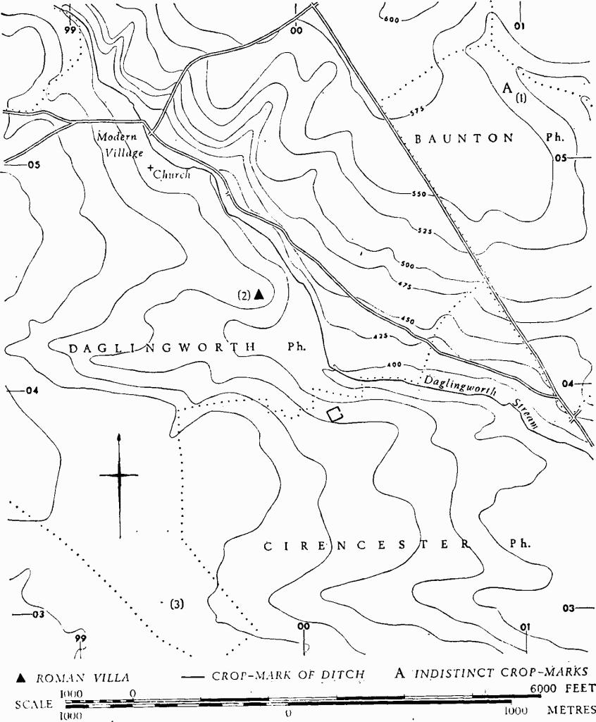
A linear dyke (1) may form part of the system of dykes at Bagendon.
A dedication slab mutilated by the cutting of window lights is built upside down into the outer N. wall of the vestry of the parish church. (fn. 1) Two fragmentary votive tablets bearing representations of genii cucullati, one retaining also the figure of a seated goddess and part of an inscription, (fn. 2) are recorded from a field in the vicinity of monument (2); two 4th-century bronze coins have been recovered from the same field. (fn. 3) It has been suggested that the inscribed and carved stones come from a temple. (fn. 4)
Ermin Street forms part of the E. boundary of the parish. Map, p. 42.
(1) Linear Dyke. See Bagendon (1), p. 8.
(2) Roman Villa? (SO 99850443, according to O.S.), 'Cave Close', occupied the level top of a slight promontory above a stream, 800 yds. S.E. of the parish church. A tessellated pavement was reported here towards the end of the 17th century. Recent finds from the vicinity of the building are described above.
R. Atkyns, The Ancient and Present State of Glostershire (1712), 379. Rudder (1779), 400. Witts (1883), 61, No. 11.
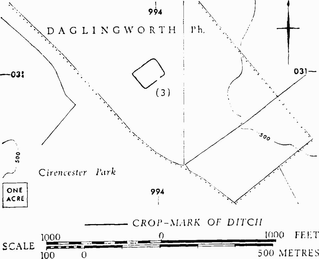
(3) Enclosure (SO 99400310), undated, is revealed by crop-marks N.E. of Cirencester Park. It occupies nearly an acre, on level ground.

Monuments in Daglingworth.
C.U.A.P., OAP AOR 94; N.M.R., OAP SO 9903/1/345–6.

Daglingworth. (3) Enclosure.