Ancient and Historical Monuments in the County of Gloucester Iron Age and Romano-British Monuments in the Gloucestershire Cotswolds. Originally published by Her Majesty's Stationery Office, London, 1976.
This free content was digitised by double rekeying. All rights reserved.
'Yanworth', in Ancient and Historical Monuments in the County of Gloucester Iron Age and Romano-British Monuments in the Gloucestershire Cotswolds(London, 1976), British History Online https://prod.british-history.ac.uk/rchme/ancient-glos/pp135-136 [accessed 7 April 2025].
'Yanworth', in Ancient and Historical Monuments in the County of Gloucester Iron Age and Romano-British Monuments in the Gloucestershire Cotswolds(London, 1976), British History Online, accessed April 7, 2025, https://prod.british-history.ac.uk/rchme/ancient-glos/pp135-136.
"Yanworth". Ancient and Historical Monuments in the County of Gloucester Iron Age and Romano-British Monuments in the Gloucestershire Cotswolds. (London, 1976), British History Online. Web. 7 April 2025. https://prod.british-history.ac.uk/rchme/ancient-glos/pp135-136.
In this section
YANWORTH
(8 miles N.E. of Cirencester)
Disjointed traces of a terrace-way in Streetfold lie along the N. side of copse banks between about SP 06651384 and 06741387, where the remains of a terrace 10 ft. wide are overlain by the E. bank of a wood. A modern field ¼ mile to the E. is known locally as Street Acres. Another terrace-way approaches Monument (1) from S.W. (map, p. 25, s.v. Chedworth).
(1) Romano-British Settlement (SP 06051390– 06151395) in Yanworth Wood lies on almost level ground. It is marked by a feature, probably a building platform, approximately 25 ft. by 17 ft., at SP 06051390, and by building stones (including a rectangular block 2 ft. 5 in. by 1 ft. 6 in., possibly in situ) which break the surface 65 yds. further N.E.
Finds, all now lost, said to have been scattered over the area between the two presumed buildings noted above and on arable ground immediately S. of the wood, include coins (one of Crispus), 4th-century pottery, and tile fragments.
A prominent terrace-way 10 ft. wide extends from a point in the wood about 25 yds. S.W. of the supposed building platform, for some 200 yds. S.W. of the site.
Arch J, LXXVIII (1921), 453; CXXII (1965), 178, fig. 2, No. 10, 'East Chedworth'. TBGAS, XLVII (1925), 77, note 14.
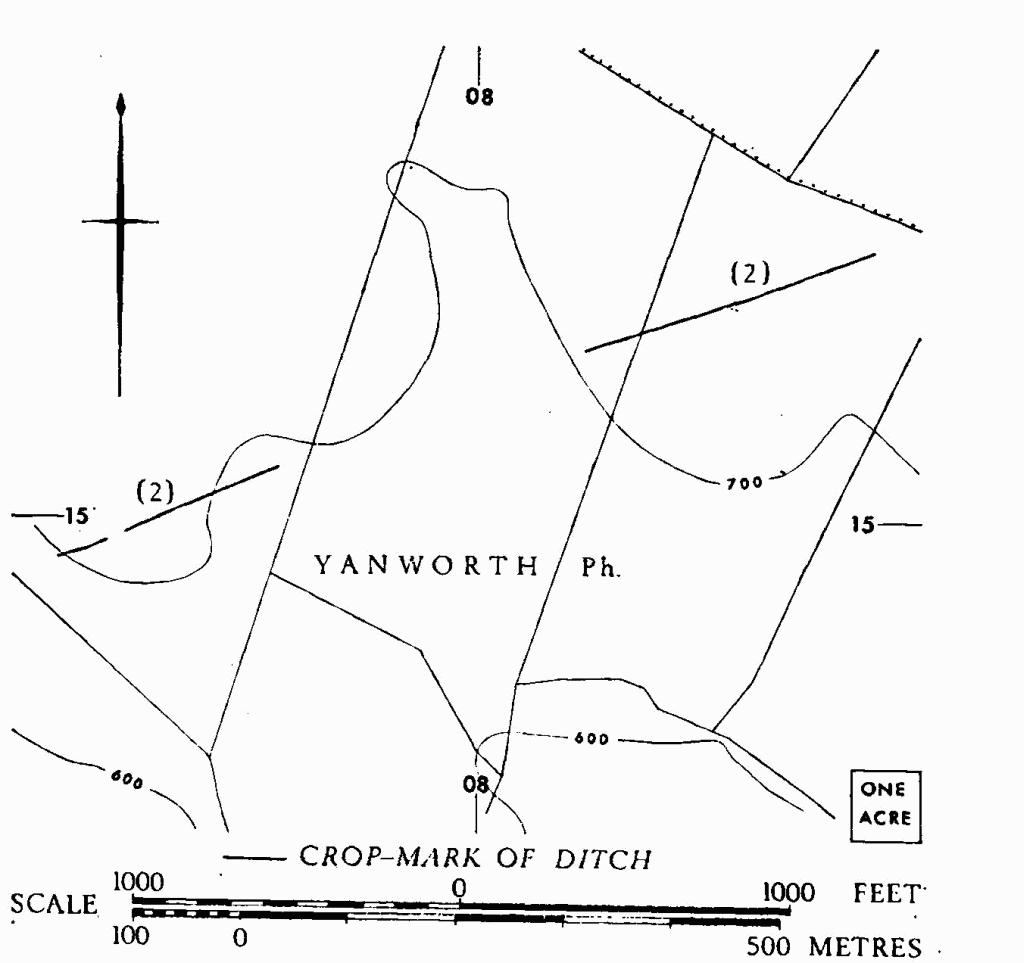
(2) Ditches (SP 076149–084152), undated, show as crop-marks in two sections, following a S.W.-N.E. line on almost flat ground, interrupted by a shallow re-entrant around the 700-ft. contour. A narrow gap, apparently original, occurs in the S.W. section.
C.U.A.P., OAP AYB 65–6.

Yanworth. (2) Ditches.
END OF INVENTORY
TABLES
CHRONOLOGY
Rulers named on coinage and mentioned in the Inventory
Emperors and members of the Imperial families:
Note: The Flavian dynasty is represented by Vespasian, Titus and Domitian (69–96). 'The Tetrici' means Tetricus and his son, who was Caesar in 271. 'House of Theodosius' means the dynasty founded by Theodosius I, but the latest references in the Inventory are to Arcadius and Honorius.
Native rulers:
Tasciovanus king of the Catuvellauni, c. 20 B.C.–c. A.D. 10.
Epaticcu son of Tasciovanus, c. A.D. 25–35.
| Anted | rulers of the Dobunni within the decade following c. A.D. 30. |
| Eisu | |
| Catti | |
| Bodvoc | rulers of the Dobunni shortly after the foregoing. |
| Corio | |
Bibliography:
D. F. Allen in E. M. Clifford, Bagendon (1961), 68–149 (study of the uninscribed and inscribed coinage of the Dobunni); in IASB, 97–308 (study of the early Celtic coinage and gazetteer of the find-spots of all Celtic coins in Britain). J. R. Collis, World Archaeology (1971), 3–71; and in D. Hill and M. Jesson (ed.), The Iron Age and its Hill-forts (1971), 97–103 (nucleated settlements as market centres and use of coins in trade).
CONVERSION TABLES
Imperial and Metric Dimensions