Survey of London: Volume 18, St Martin-in-The-Fields II: the Strand. Originally published by London County Council, London, 1937.
This free content was digitised by double rekeying. All rights reserved.
'Plan pocket', in Survey of London: Volume 18, St Martin-in-The-Fields II: the Strand, ed. G H Gater, E P Wheeler (London, 1937), British History Online https://prod.british-history.ac.uk/survey-london/vol18/pt2/plan-pocket [accessed 12 February 2025].
'Plan pocket', in Survey of London: Volume 18, St Martin-in-The-Fields II: the Strand. Edited by G H Gater, E P Wheeler (London, 1937), British History Online, accessed February 12, 2025, https://prod.british-history.ac.uk/survey-london/vol18/pt2/plan-pocket.
"Plan pocket". Survey of London: Volume 18, St Martin-in-The-Fields II: the Strand. Ed. G H Gater, E P Wheeler (London, 1937), British History Online. Web. 12 February 2025. https://prod.british-history.ac.uk/survey-london/vol18/pt2/plan-pocket.
PLAN OF PART OF THE PARISH OF ST. MARTIN-IN-THE-FIELDS IN 1894 SHOWING THE PREMISES DEALT WITH IN THE PRESENT VOLUME.
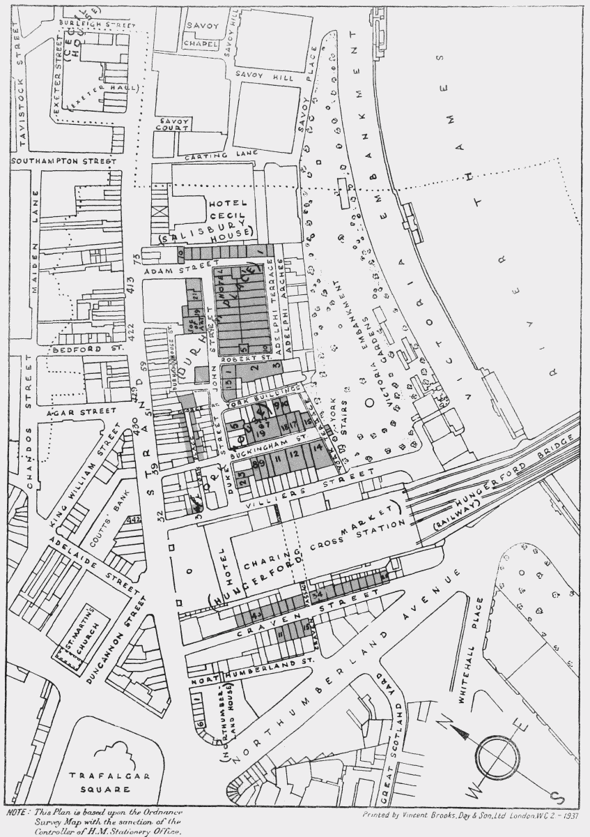
NOTE: This Plan is based upon Ordnance Survey Map with the sanction of the Controller of H.M. Stationery Office.