Survey of London: Volume 16, St Martin-in-The-Fields I: Charing Cross. Originally published by London County Council, London, 1935.
This free content was digitised by double rekeying. All rights reserved.
'Plate 46: Admiralty House, elevation towards Whitehall and cross-section', in Survey of London: Volume 16, St Martin-in-The-Fields I: Charing Cross, ed. G H Gater, E P Wheeler (London, 1935), British History Online https://prod.british-history.ac.uk/survey-london/vol16/pt1/plate-46 [accessed 26 February 2025].
'Plate 46: Admiralty House, elevation towards Whitehall and cross-section', in Survey of London: Volume 16, St Martin-in-The-Fields I: Charing Cross. Edited by G H Gater, E P Wheeler (London, 1935), British History Online, accessed February 26, 2025, https://prod.british-history.ac.uk/survey-london/vol16/pt1/plate-46.
"Plate 46: Admiralty House, elevation towards Whitehall and cross-section". Survey of London: Volume 16, St Martin-in-The-Fields I: Charing Cross. Ed. G H Gater, E P Wheeler (London, 1935), British History Online. Web. 26 February 2025. https://prod.british-history.ac.uk/survey-london/vol16/pt1/plate-46.
THE ADMIRALTY FIRST LORD'S RESIDENCE
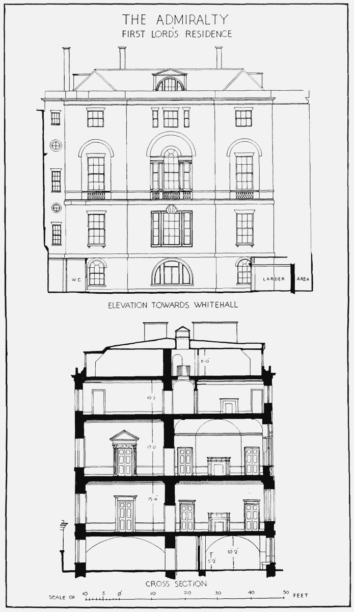
Admiralty House, elevation towards Whitehall and cross-section