Survey of London: Volume 22, Bankside (The Parishes of St. Saviour and Christchurch Southwark). Originally published by London County Council, London, 1950.
This free content was digitised by double rekeying. All rights reserved.
'Plate 74: Hopton's Almshouses. Ground plan', in Survey of London: Volume 22, Bankside (The Parishes of St. Saviour and Christchurch Southwark), ed. Howard Roberts, Walter H Godfrey( London, 1950), British History Online https://prod.british-history.ac.uk/survey-london/vol22/plate-74 [accessed 23 November 2024].
'Plate 74: Hopton's Almshouses. Ground plan', in Survey of London: Volume 22, Bankside (The Parishes of St. Saviour and Christchurch Southwark). Edited by Howard Roberts, Walter H Godfrey( London, 1950), British History Online, accessed November 23, 2024, https://prod.british-history.ac.uk/survey-london/vol22/plate-74.
"Plate 74: Hopton's Almshouses. Ground plan". Survey of London: Volume 22, Bankside (The Parishes of St. Saviour and Christchurch Southwark). Ed. Howard Roberts, Walter H Godfrey(London, 1950), , British History Online. Web. 23 November 2024. https://prod.british-history.ac.uk/survey-london/vol22/plate-74.
PLAN OF HOPTON'S ALMSHOUSES
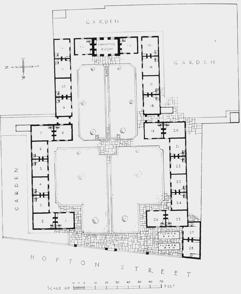
Hopton's Almshouses. Ground plan