A History of the County of Lancaster: Volume 8. Originally published by Victoria County History, London, 1914.
This free content was digitised by double rekeying. All rights reserved.
'Townships: Carnforth', in A History of the County of Lancaster: Volume 8, ed. William Farrer, J Brownbill (London, 1914), British History Online https://prod.british-history.ac.uk/vch/lancs/vol8/pp165-170 [accessed 7 February 2025].
'Townships: Carnforth', in A History of the County of Lancaster: Volume 8. Edited by William Farrer, J Brownbill (London, 1914), British History Online, accessed February 7, 2025, https://prod.british-history.ac.uk/vch/lancs/vol8/pp165-170.
"Townships: Carnforth". A History of the County of Lancaster: Volume 8. Ed. William Farrer, J Brownbill (London, 1914), British History Online. Web. 7 February 2025. https://prod.british-history.ac.uk/vch/lancs/vol8/pp165-170.
In this section
CARNFORTH
Chrenefbrde, Dom. Bk.; Carneford, 1212; Kerneford, 1261.
The township of Carnforth, having an area of 1,459½ acres, (fn. 1) lies on the south bank of the River Keer, from which it derives its name, and which divides it from the main portion of the parish of Warton, then flowing into Morecambe Bay. The seaward course of this stream has been very erratic within the period covered by local records. Stout, the noted tradesman of Lancaster, who flourished during the period 1665–1732, records under the year 1687 that 'for 7 years past the sea continually wasted their (the Stouts') marsh and Kear which used to run near Lindeth now drew towards Boulton Holmes and to within Prescear and also drew in the main river Kent so that all the marsh to the west and north of us was washed away.' (fn. 2) A ridge of higher land, attaining 200 ft. above the sea, juts into the southern end; upon it stands the older part of the village, and from it the surface descends in all directions, but chiefly to the north and west. There is an isolated mount, called Hunters Hill, to the west. The population in 1901 was 3,040.
The principal road is the North Road from Lancaster to Carlisle, which passes through Carnforth in two branches. The older one goes along the higher land and through the old village; the newer is straighter, taking a lower level to the west of the former. There is a road from Warton, by a bridge over the Keer, past the ironworks and railway station, and through the modern part of the town, known as Market Street; crossing the North Road, it then goes east to Over Kellet and Kirkby Lonsdale. The newer part of the town lies chiefly on the westerly slope of the ridge, from Market Street south to the border of Bolton-le-Sands. There is also the hamlet of Crag Bank, about half a mile south-west of the railway station. This station, finished about 1880, is used by three companies. It lies on the main line of the London and North-Western railway from London to Scotland, and is the terminus of the Furness railway line, connecting with the northwest coast, and of the Furness and Midland Companies' joint line which runs eastward to Wennington and Hellifield. The Lancaster and Kendal Canal winds through the township, partly by a cutting through the eastern slope of the ridge above mentioned.
The railway companies and the iron furnaces, established in 1864, give the chief employment to the people. Gravel-pits are worked. There are two banks, a co-operative stores, and other business places. A Conservative club was opened in 1887. A customary fair for cattle is held yearly on the last Friday in April. A market used to be held on Monday.
The geological formation consists of the Carboniferous Limestone covered by a deep deposit of alluvial gravel. The soil is a light loam, overlying the gravel; barley, oats and roots are grown, but much of the land is pasture.
The town is governed by an urban district council of nine members; it was constituted in 1895. (fn. 3) Gas and water are supplied by private companies, the works having been formed in 1872 and 1879 respectively. (fn. 4)
The chief worthies of the place are John Lucas, the historian of Warton, who was born near Keer Bridge, and William Cowherd, born 1763, noteworthy in the religious history of Salford. (fn. 5) Lucas has left an elaborate account of the place as it was at the beginning of the 18th century. The following is a summary:—
The village consisted of about forty families whose houses, two or three excepted, were thatched; some were unlofted and open to the roof and one had no chimney, the smoke finding its way out at a little sloping hole on each side of the roof, the hearth being at one end of the house. (fn. 6) Economists considered that there was too much inclosed land, and the inhabitants would be better off if half were 'laid common.' (fn. 7)
He mentions the Moothaw, a hillock still to be seen on the north side of the canal, with a stone guide-post near it. To the north-west was the meadow called Bartherholme, used for the encampment of Charles II in August 1651; it had a spring called Stank Well close by. (fn. 8) To the west were the Keer meadows, and to the south of these lands called Hallgowins. Here was a field called the Hall Croft (fn. 9); a large hollow in an adjacent field was called the Oven. Hellbank (or Hallbank) was about the middle of the town, near the meeting of four ways, where there was a long barrow or tumulus. Whitelands, Thostlegillwell, the Banks, Cow Close, Whinney Closes, the Ellers and the Butterwell are noticed.
The mill was supplied with water from three springs. A hundred yards west of it, by Keer Bridge, was the house called Brig End, Lucas's birthplace. On the south side were closes called Potter's Parks, and north, by the river side, a blue clay known as Potter clay was found. Near by was the Hag, another Lucas residence. To the north-we3t was a spring called the Holy Well, because of the virtue of its waters in scorbutic cases.
A little west from Hellbank was high ground called the Haas or Haws, where the children yearly made a bonfire, called St. John's Fires or Cam Fires, diverting themselves by running about it or leaping over it. It was a custom to carry lighted torches on Midsummer Eve as an emblem of St. John Baptist. On the Haws also the children used to play at hand ball in the Easter holidays. At the foot of the Haws was a pond called Toad Plud; between it and Hall Yate was a moss called Crae Pits. (fn. 10) Tradition affirmed that the township was once nearly covered with wood, though scarce a tree was then to be found.
In the western part of the township were five large common fields, one called Thwaite, the others Huthwaites. They were known as the Demesne lands of Carnforth. Tradition said that the hall stood at the end of one of the fields nearest the village; some foundations had been found near the Kitching Hill, and the gate to the field was still called the Hall Gate, and adjacent land the Orchard. Lucas slates that his father was one of the first to adopt the practice of exchanging detached strips in the common fields for contiguous ones. In one Huthwaite every man ploughed or mowed his part as he thought fit, and so it was never pastured; but the other three the proprietors ploughed each for three years running, so that each field was alternately three years corn and six years pasture. (fn. 11) Woods Tarn, Sand Hill (where fine sand was found), Foul Flush, Gait Cotes and Lang-haws Moss turbary are mentioned; also Gallihaw (fn. 12) and Salt Cotes, where salt used to be made.
The inner and outer marshes, separated by a bank called the Strand, were of great service to the people, giving rich food and physic for their cattle, turf for fuel, sods for the garden walls and roofing, rushes for the parlour floors, and seaweed for manure.
The following field-names occur in the Tithe Award of 1845:—Barderholme, Hewthwaite, Long Haws, Elfa, Gate Coat, Gammering Gap, Hall Gowan, Ora, Pingles, Robin Cross, Salter Flat, Stankeld, Sleeping Dub, Toad Pludd and Lineriggs.
Manor
In 1066 CARNFORTH, assessed as two plough-lands, was part of Earl Tostig's great lordship of Halton. (fn. 13) About 1130–40 it was included in the feoffment made to William son of Gilbert de Lancaster, whereby it afterwards became a member of the barony of Kendal, and descended in the same way as Nether Wyresdale and Ashton. (fn. 14) After the death of William de Lancaster III, (fn. 15) in 1246, a division of the manor was made between Lindsay and Brus. The pourparty of the former subsequently descended through Coucy and reverted to the Crown, whilst that of the latter descended, like Ashton, to the Gerards.
The former moiety was held in demesne with Warton, (fn. 16) and in 1333 Christiana de Gynes died holding it of Henry Earl of Lancaster, paying 1d. yearly for castle ward and doing suit to county and wapentake. (fn. 17) Carnforth was included in the grant of free warren to William de Coucy in 1340. (fn. 18) At his death in 1344 it was found that there were 36 acres of arable land of the demesne of Carnforth let to farm at 18s. yearly and 5 acres of meadow at 5s.; tenants at will held 64 acres of land and twelve cottages, and there were seven free tenants. (fn. 19) It was granted in 1574 to Gilbert Gerard and Anne his wife, with the associated manors of Nether Wyresdale, Ashton and Scotforth. (fn. 20) In 1604 their son Sir Thomas, who had been created Lord Gerard of Gerard's Bromley, (fn. 21) demised the demesne lands to ten persons to hold in fee farm, rendering to the king £3 a year and other services. (fn. 22) He demised other lands on leases for lives, and before his death in 1618 devised the manor to his third son, John Gerard, by whom it was in 1629 sold to Hugh Cooper. (fn. 23) He was followed by another Hugh, who was sheriff in 1657, (fn. 24) and recorded a pedigree at the visitation of 1664 (fn. 25); he died in 1682. His only child, Anne, married John son and heir of Edward Warren of Poynton, in Cheshire. (fn. 26) John Warren died in 1706, (fn. 27) his son Edward in 1720, and Edward's son John in 1729. (fn. 28) By his will of 1720 John Warren devised his estates to his brothers Edward and Talbot Warren and their sons in turn, and authorized his executors to sell any part for the discharge of certain mortgages. They accordingly raised considerable sums in 1731 by enfranchising a number of customary tenants in Carnforth, reserving the seigniory or royalties and the quit-rents, suits and services of court at all times due at the court baron of Carnforth upon usual notice thereof. (fn. 29) In the same year they sold the manor itself to William Greenbank of Halton, with all its rights, liberties, suits of court, &c. (fn. 30)

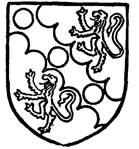
Cooper of Carnforth. Argent on a bend engrailed between two lions rampant sable three plates.

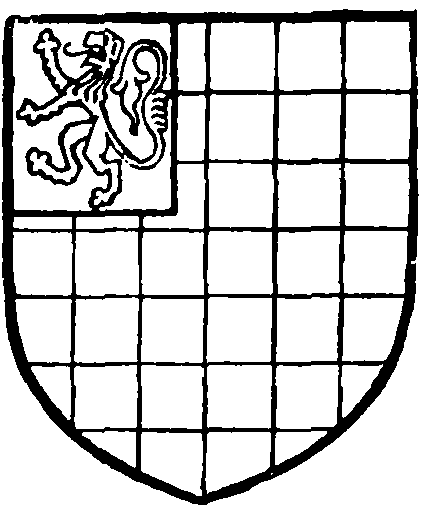
Warren of Poynton. Chequy or and azure, on a canton gules a lion rampant argent.
William Greenbank died about 1750, aged fiftyone, intestate and without issue. His heir was his only sister Elizabeth wife of Henry Johnes Wilson of Hall Garth in Over Kellet, and she in 1751 passed it to her husband. (fn. 31) Their daughters Mary and Elizabeth left no issue, the latter dying unmarried in 1818, while the former, the second wife of James Ainslie, died in 1820, having in 1808 conveyed this manor to her husband's eldest son by a former wife. (fn. 32) This son, Montague Farrer Ainslie, died in 1830; he devised the manor to his brother Henry for life, with remainder to his younger son Gilbert. Accordingly on Henry's death in 1834 it descended to the Rev. Gilbert Ainslie, D.D., Master of Pembroke College, Cambridge, who held it till his death in 1870. His son Gilbert in 1891 joined with another person in conveying the manor to James Henry Johnson of Bickershaw. Mr. Johnson died in 1895, and his executors sold the manor to William Farrer, editor of the present History, the conveyance being dated 30 September 1904.

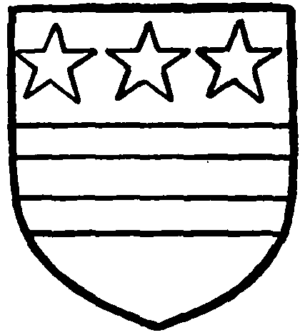
Washington. Argent two bars gules, in chief three mullets of the last.
A court baron used to be held yearly in December. (fn. 33)
The Brus moiety of Carnforth was held by the Stricklands of Sizergh, by one of whom it was given to Robert de Washington, who had married Joan daughter of William de Strickland. (fn. 34) The Washingtons were farmers of the other moiety, (fn. 35) and thus by one title or the other held the whole manor. This descended to their successors the Lawrences, (fn. 36) and by inheritance to Gilbert Gerard in right of his wife. (fn. 37) As already shown, he purchased the Crown manor, and thus had an undisputed title to the whole. (fn. 38)

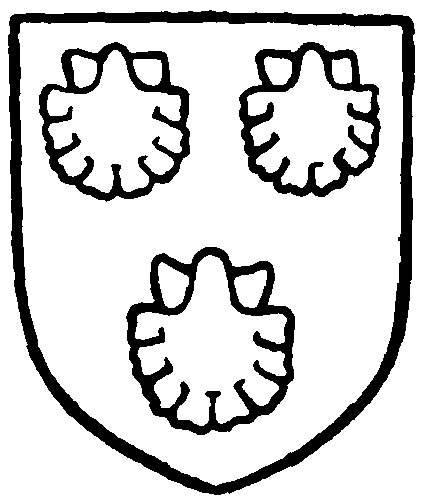
Strickland of Sizergh. Sable three escallops argent.
There were one or two freeholders in Carnforth at an early date. William de Lancaster I granted 2 oxgangs of land there to Robert the Falconer (fn. 39); this estate probably descended to Godith daughter of Bernard de Carnforth in 1246. (fn. 40) William de Lancaster III, about 1230, gave land to Robert de Carnforth. (fn. 41) These two estates probably reverted to the demesne of the manor. Somewhat later the Conyers family had a tenement here. (fn. 42)
Saltersflat or Salteracre was a plot of land in Carnforth to which at one time the advowson of Warton Church was supposed to be annexed. (fn. 43) In 1570, after this connexion had been severed, the land was sold to Alan Bellingham. (fn. 44) There does not seem to have been any church land in the township, but 5s. a year was paid to St. Mary Magdalene's Abbey at Shap. (fn. 45)
From a rental of 1519 (fn. 46) it appears that the rent and grain paid by the customary tenants—who were said to hold their lands at the will of the lord— amounted to £39 13s. 3d. In addition rents of about £21 were derived from various closes of the demesne lands—Bartherholme, Huthwaites, Halcroft, Copelandfield or Stonewray and Milnerfield Wood. The twenty-one boon-days for ploughing at the time of sowing oats and the same number for harrowing were rented at 21s., the 86 days'-works of reaping in the autumn at 28s. 8d., and the 129 boon cocks and hens at 19s. 8d. The perquisites of the court came to 22s. 1d. A list of the customary tenants has been preserved. (fn. 47) The town-fields named were the Marshfield, Highfield and Townfield; trie Thwaite Close was held by all the tenants of Carnforth without payment. A place called Spindlehead in the townfield occurs in 1394. (fn. 48)
A few names of landowners can be obtained from the inquisitions—Hadwen, (fn. 49) Starnfield, (fn. 50) Bainbridge, (fn. 51) Simpkinson (fn. 52) and Hawes. (fn. 53) Charles Dickonson was defendant in 1635 concerning a building agreement. (fn. 54)
The hearth tax return of 1666 shows that there were forty-six hearths liable. The largest houses were those of Richard Mason with four and Robert Dawson with three; eight houses had two each and the others one. (fn. 55)
Under an inclosure award made in 1864 some small parcels of reputed waste were sold or otherwise awarded to certain landowners in the manor.
From field-names such as Chapel Flat it is presumed that there was anciently a chapel of ease in the township, which belonged originally to Bolton parish and was transferred to Warton about 1208. (fn. 56)
The present churches are modern. For the Church of England Christ Church was begun in 1871 and finished in 1873 (fn. 57); it has since been enlarged and a tower added. The benefice is in the gift of the vicar of Warton.
The Wesleyan Methodists used the old Nonconformist chapel from 1849 till their church on the Lancaster road was opened in 1870. (fn. 58)
The building spoken of was known as the old Presbyterian Chapel. There was about 1720 a congregation of 138, (fn. 59) but the cause declined and the chapel was closed, the township authorities taking possession. The building, which still stands near the canal bridge, was at one time used as a school. The present Congregational interest goes back to about 1865, when an unsuccessful attempt was made to establish a congregation. A secession from the Wesleyans in 1878 led to a new foundation, a schoolchapel being opened in 1881 (fn. 60) and the present church in 1897.
The Salvation Army has a meeting-place.
