A History of the County of Lancaster: Volume 6. Originally published by Victoria County History, London, 1911.
This free content was digitised by double rekeying. All rights reserved.
'Townships: Cliviger', in A History of the County of Lancaster: Volume 6, ed. William Farrer, J Brownbill( London, 1911), British History Online https://prod.british-history.ac.uk/vch/lancs/vol6/pp478-487 [accessed 26 November 2024].
'Townships: Cliviger', in A History of the County of Lancaster: Volume 6. Edited by William Farrer, J Brownbill( London, 1911), British History Online, accessed November 26, 2024, https://prod.british-history.ac.uk/vch/lancs/vol6/pp478-487.
"Townships: Cliviger". A History of the County of Lancaster: Volume 6. Ed. William Farrer, J Brownbill(London, 1911), , British History Online. Web. 26 November 2024. https://prod.british-history.ac.uk/vch/lancs/vol6/pp478-487.
In this section
CLIVIGER
Clyvechir, 1258; Clyuacher, 1290.
The township of Cliviger extends south-eastward from Burnley to the border of Yorkshire, the northeast boundary being marked by the River Brun, while the Lancashire Calder flows north-west through the centre. The south-eastern half of the township is occupied by lofty moorlands; from Stiperden Moor in the north-east, where 1,573 ft. is attained at the county boundary, the surface descends to Calder Head, from which point the Lancashire Calder flows north-west and the Yorkshire Calder south-east; then the hills rise again to the west, as Heald Moor and Deerplay or Dirpley Moor, attaining 1,470 ft. at Thieveley Pike. On this height there was formerly a beacon. The highest land is mostly within the township, there being a downward slope towards Yorkshire and Todmorden. From the moorlands the surface descends towards the north-west, being broken by many cloughs, down which flow brooks to augment the main streams. On the right bank of the Calder stands the village of Holme with its chapel; lower down is Walk Mill, where a modern hamlet has risen around a factory; and then Barcroft, with Cliviger Mill adjacent. On the left bank of the same river are Thieveley, Stonehouse and Dineley, these last being divided by Easden Clough; Buck Clough, Grimshaw, and Hole House lie to the north of Dineley, and Everage Clough marks the northern limit on this side. On the Worsthorne boundary the Brun descends through Shedden Clough, having on its left bank Ormerod, by which is Salterford. Near Holme is Helly Platt, and between Holme and Ormerod stand the hamlets of Overtown and Mere Clough. In the south-west corner of the township is Red Moss. The area is 6,818 acres, but in 1897 part of the township called Cornholme or Portsmouth, adjoining Todmorden, was added to that township and taken into Yorkshire, the area of the reduced township of Cliviger being 6,724 acres, including 10 of inland water. The population of this in 1901 was 1,669.
The principal road is that which leads from Burnley through the Calder Valley to Todmorden, with branches southward to Bacup and Rawtenstall; and there is a parallel road on high ground to the north, in one part called the Long Causeway, from Burnley by Mere Clough to Hebden Bridge. A cross road from Walk Mill to Mere Clough continues by Salterford Bridge into Worsthorne. The Burnley and Todmorden branch of the Lancashire and Yorkshire railway runs along near the first-named highway, and has stations at Holme in the centre of the township, and at Portsmouth on the extreme southeast boundary.
There are collieries and quarries in the township, and cotton-mills at Walk Mill and Cornholme. The soil is clay, with shale subsoil, and the land is chiefly used for pasturage. (fn. 1)
There is a parish council.
An earthwork of uncertain age, called the Old Dyke, crosses Heald Moor from north-west to southeast, and was the traditional limit of Rossendale Forest. (fn. 2) Flint instruments and other remains of the prehistoric period have been discovered; and a large horde of Roman coins was found at Mere Clough in 1695, and other Roman remains more recently. (fn. 3) A number of mediaeval crosses, or pedestals, remain. (fn. 4)
The most noteworthy persons springing from Cliviger were Dr. William Whitaker, a famous Elizabethan divine, and Dr. Thomas Dunham Whitaker, author of the histories of Whalley, Richmondshire and Craven, who are mentioned below in the account of Holme.
Manor
The lords of Clitheroe at an early time granted Cliviger to the Elland family, and about 1160 a plough-land in Cliviger, possibly the whole of the township, was granted to the newly-founded Kirkstall Abbey. (fn. 5) The grantor was perhaps Hugh de Elland, for Robert de Lacy son of the founder of Kirkstall confirmed to the house whatever he held in Cliviger which Hugh de Elland father of Richard held of his father, rendering 20s. rent. (fn. 6) Afterwards Richard de Elland reclaimed Cliviger, where the monks had made a grange, and the abbot finding his claim to be just, though the reason for it is not given, surrendered it to Robert de Lacy. (fn. 7) It then seems to have been granted by Richard to his son Henry de Elland, (fn. 8) who held it of his brother Hugh, and afterwards gave it to the abbey, desiring his body to be buried in the abbey church. (fn. 9) This grant was confirmed by Roger de Lacy, then lord of Clitheroe, (fn. 10) and the monks held Cliviger till 1287, when they again surrendered it to the chief lord. Henry de Lacy promised them a certain rent in lieu of it, (fn. 11) and in 1294 he obtained the king's charter of free warren in his demesne lands in Cliviger. (fn. 12) The accounts of 1296 show receipts of over £15 from this place. (fn. 13) In 1311 Henry de Lacy held in Cliviger 80 acres demised to tenants at will at the usual rent of 4d. an acre, and a water-mill worth 20s. a year. The agistment of beasts on the common pasture was worth 1s. There were thirty-three free tenants, paying in all £8 19s. 3½d. (fn. 14) The net sum received in 1323 was £13 17s. 1½d. (fn. 15)
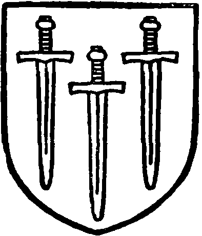
Kirkstall Abbey. Azure three swords points downwards argent hilted or.
The Abbots of Kirkstall had made grants from time to time, (fn. 16) and Henry de Lacy ratified or added to these grants; in 1292 he gave to Gilbert son of Michael de la Legh the lands lately belonging to Adam de Hargreaves, (fn. 17) and in 1302 he added other of Adam's lands and those of Ellis de Brownbirks, 6s. 8d. to be paid yearly. (fn. 18) In 1302 also he gave to William de Middlemore and Margery his wife the lands lately held of the Abbot of Kirkstall by Robert del Holme, at a rent of 5s. 6d. (fn. 19) In 1311 the free tenants held 598 acres, the largest holding being that of the above-named Gilbert de Legh, ancestor of the Towneley family, who had 140 acres and rendered 46s. 11d. yearly. The complete list is (fn. 20) :—
There does not seem to have been any manor properly so called, but the Towneley holding, that of Legh augmented by a number of purchases, (fn. 21) was known as the manor of CLIVIGER as early as 1381, when Gilbert de Legh grandson of the tenant of 1311 was found to hold it of the duke in socage, rendering £4 15s. a year on St. Giles's Day. (fn. 22) His widow Alice in 1388 held only certain lands in socage, paying 12s. 8½d. for all services. (fn. 23) The 'manor' continued to be recorded in the Towneley inquisitions, recoveries (fn. 24) and other deeds down to the middle of the 18th century, but it does not appear that courts were held or any rights of lordship exercised.
DINELEY is named soon after 1218, when Henry son of Richard de Elland gave land there to Robert son of Siward de Worsthorne. (fn. 25) Later it was held by a family who had taken a surname from it. (fn. 26) It descended through an heiress or by purchase to the Dutton branch of the Towneleys, (fn. 27) and was by Richard Townley sold in 1493 to Lawrence Townley of Barnside. (fn. 28) He fifteen years afterwards sold it to Sir John Towneley of Towneley, (fn. 29) and from that time it descended with the principal estate or manor. The estate of a junior family of Legh was also acquired by the Towneleys, (fn. 30) and that of the Taylor family. (fn. 31)
HOLME (fn. 32) became the property of the Whitaker family about the 15th century, (fn. 33) and has continued to descend regularly till the present time. (fn. 34) A settlement of ten messuages, &c., was made in 1583. (fn. 35) William Whitaker died in 1641 holding the capital messuage called Holme, with 34 acres of land, and other messuages called Thieveley, Grimshaw and Backclough with 42 acres. The whole was held of the king as of his castle of Clitheroe in socage by a rent of 23s. 7½d. Thomas Whitaker son and heir of William was ten years old. (fn. 36) Two of the family attained distinction. Dr. William Whitaker, a younger son of Thomas Whitaker, who died in 1595, was one of the leading Protestant divines in the time of Elizabeth. Through Lord Burghley's influence he became Master of St. John's College, Cambridge, in 1586, having been Regius Professor in the university since 1580, and was made canon of Canterbury in 1585, in which year he died. He published numerous works, including a reply to Bellarmine, and left others in manuscript; all are of the extreme Calvinistic school in doctrine, and though he conformed to the queen's authority in matters of ceremonial he was favourable to the Puritans. (fn. 37) Dr. Thomas Dunham Whitaker, the often quoted author of the History of Whalley, has been noticed in the accounts of the churches of Blackburn and Whalley, of which he was vicar. He died in 1821, and was buried in the chapel at Holme. (fn. 38)
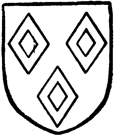
Whitaker of Holme. Sable three mascles argent.
The Holme is a picturesque two-story stonebuilt house, with stone-slated roofs, standing amidst beautiful scenery in the vale of Cliviger, facing south. The plan follows the usual type of central hall and projecting end-wings, but in the course of time and as the result of rebuildings and alterations has lost most of its original features, though retaining many of the characteristics of the earlier building. It is said to have been constructed originally of wood, but the middle and east wings appear to have been rebuilt in stone about the year 1603 or before, (fn. 39) the west wing, however, which is wider than the other, remaining of wood till 1717. The end-wings had originally hipped roofs, but in a later restoration stone gables were substituted and a projecting central one-story porch added. The windows, which are mostly new, are long low mullioned openings without transoms but with hood moulds, those in the west wing having ten lights on each floor and those in the east eight lights each. There is also an upper window of ten lights in the middle wing over the hall. Some work appears to have been done in 1786, which date is on a spouthead on the east wing, and in 1854 a north-east wing was added at the back. The interior of the house is almost wholly modernized, but the rooms are low and picturesque and contain some old furniture belonging to Dr. Whitaker.
BARCROFT was held by a family of that name. (fn. 40) William Barcroft died in 1525 holding nine messuages, &c., in Cliviger and Worsthorne of the king as duke in socage by a rent of 20s. 5d.; he had another messuage in Cliviger called Hole House. His heir was a son Robert, aged forty or more. (fn. 41) A later Robert Barcroft died in 1612 holding various messuages in Cliviger of the king in socage by a rent of 23s. 9d. and other estates in Worsthorne, Hurstwood and Blackburn. (fn. 42) His son William, then fifty-six years old, died in 1621 holding similarly and leaving a son Robert, aged twenty-seven. (fn. 43) Robert Barcroft in 1631 compounded for having declined knighthood by a fine of £13 6s. 6s. 8d. (fn. 44) He was one of the lay members of the Presbyterian Classis formed in 1646, but died the following year. (fn. 45) The estate descended to his brother Thomas Barcroft, who recorded a pedigree in 1664. (fn. 46) He died in 1668, leaving several daughters to inherit. Susan, daughter by his first marriage, was wife of Peter Ormerod of Ormerod; but most of the estate was devised to the issue of the second marriage—Elizabeth wife of Henry Bradshaw of Marple; Sarah wife of Nicholas Townley of Royle; Ruth wife of Peter Leigh of Norbury Booths; and Anne wife of John Brockholes of Claughton near Garstang. A large part of the estate became united with Royle and has descended with it. The house and demesne descended through Bradshaw to Isherwood and was in 1795 sold to Charles Towneley of Towneley. (fn. 47) A tradition of the district says that one of the Barcrofts, alleging that his elder brother was a lunatic, put him in confinement, where he became mad, and seized the estate himself; but according to 'the Idiot's curse' the lands soon passed away to strangers. (fn. 48)
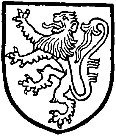
Barcroft of Barcroft Argent a lion rampant sable.
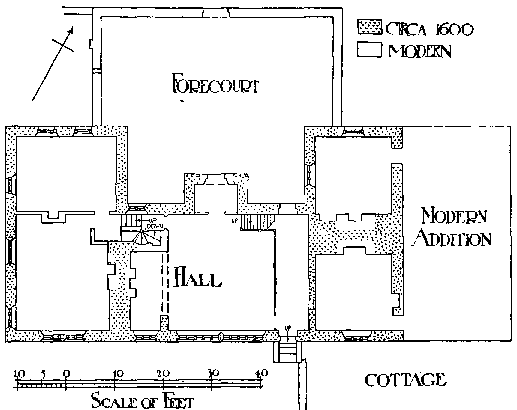
Plan of Barcroft Hall
BARCROFT HALL is situated on the outskirts of Towneley Park near the north-west boundary of the township and is a massively built two-story house of gritstone with projecting end-wings and stoneslated roofs. The gables are quite plain without coping or ornaments, and the original windows in the principal front, which faces north, are small, giving an appearance of great solidity to the elevation. The house consists of the usual arrangement of central hall with kitchen and offices at the east and the living rooms in the west wing, but modern alterations have deprived the interior of much of its interest. The house is now divided into two and an addition has been made at the east end, which, with the original kitchen wing, now forms a separate dwelling. The present kitchen is in the basement of the west wing, which owing to the fall of the ground and the raising of the floor is sufficiently lofty, and this end of the house is otherwise modernized, sash windows having been inserted in the ground floor rooms, as also in the east wing, on the north front. The building is said to be of late 16th-century date and the east wing is stated to be the older part, but the evidence of the masonry is inconclusive, and it is likely enough that the house was erected substantially on the present lines all at one time. The total length of the front is about 80 ft., the end wings, which project 16 ft., being of slightly different width and 36 ft. 9 in. apart, with a central projecting gabled porch the height of both stories.
The hall is now entered from the porch in the middle of the north side, but the original entrance, which is built up, was by the door to the screens in the north-east corner. Its total length including the passage is 29 ft. and its width 24 ft. 4 in., but the fireplace at the west end has an ingle-nook 7 ft. 6 in. deep and 16 ft. 6 in. wide open to the hall by an arch 13 ft. wide, which practically increases the length of the room to 36 ft. From the north-west corner a mutilated spiral stone staircase leads to the upper floors, and at the south end of the screens the old doorway still remains, retaining its original oak nailstudded door. The screen itself, however, and the front of the gallery were removed about 1901, (fn. 49) though the old gallery floor remains and modern panelling and a balustrade have been erected altogether out of keeping with the rest of the room. The hall, however, retains some of its ancient features. It is lit on the south side by a long mullioned and transomed window of ten lights and there is a two-light window to the ingle-nook and one of four lights high up in the north-east corner above the gallery. The floor is flagged, and the roof, which is 12 ft. 8 in. high to the underside of the beams, is the original flat one of oak, with two chamfered beams forming three bays and divided by intermediate pieces into eight panels. The high table dated 1613 and with the initials W. B., S. B. formerly stood under the window on the south side but is now at Towneley Hall. The porch has on the outside over the square-headed doorway the name of William Barcroft and the date 1614, but this inscription appears to belong to an alteration in the original plan whereby a square bay window on the north side was altered to its present purpose, at the time probably when the doorway at the north end of the passage was built up. The porch doorway, which has classic detail and a moulded string immediately above the inscription, is manifestly an insertion in an older wall, the wider hood mould of the previously existing window being still in position above. On the inside the opening to the bay is now filled in with a modern glazed screen forming an inner doorway.
The rooms in the west wing are almost entirely modernized and of little interest, one of them, however, on the ground floor having a 17th-century plaster panel with vine ornament in the ceiling. The roofs are apparently the old ones restored, and have clay floors in the roof space in the gables. At the back the wings are flush with the south wall of the hall and the east gable has been rebuilt, but though the windows are more numerous than on the front the elevation is of little interest.
In front of the house is a small grass forecourt 47 ft. by 38 ft. 6 in., inclosed by high stone walls with moulded copings, and entered in the middle through a semicircular headed gateway with picturesque stepped gable bearing the date 1636. The inclosing end walls are set back a few feet from the inner angles of the wings and project 22 ft. 6 in. in front of them. The fact of the forecourt being confined to the middle part of the elevation, leaving the wings partly outside, adds much to the good general effect of the front, the ornamental detail being in this manner more concentrated.
ORMEROD also was held by a family of the same surname. (fn. 50) John Ormerod died in 1525 holding of the king as duke four messuages, lands, &c., in Cliviger in socage by a rent of 2½d. yearly. His son and heir Peter was twenty-two years of age. (fn. 51) Peter Ormerod died in 1578 holding similarly and leaving as heir a son Lawrence, aged fourteen. (fn. 52) Peter Ormerod of Ormerod and John Ormerod of Cliviger each paid £10 in 1631 as composition on declining knighthood. (fn. 53) The estate descended to Lawrence Ormerod, who died in 1793 (fn. 54); his only child, Charlotte Anne, married John Hargreaves of Goodshaw, and died in 1806, leaving a son, who died in 1826 unmarried, and two daughters, of whom an account has been given under Bank Hall in Burnley. Sir John Ormerod Scarlett Thursby, bart., is the present owner of Ormerod.
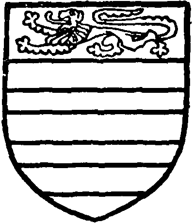
Ormerod of Ormerod. Or three bars gules in chief a lion passant of the second.
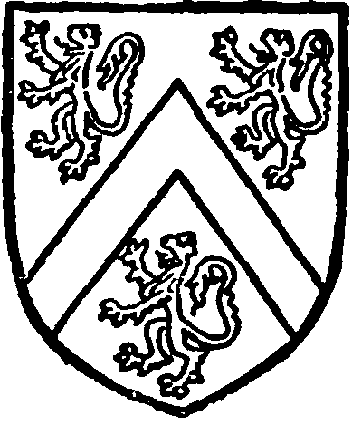
Thursby, baronet. Argent a cheveron between three lions rampant sable.
Ormerod House is situated at the extreme northwest of the township on the top of a steep declivity forming the south bank of the River Brun. The front faces south, and as the ground continues to slope upwards from the river the building appears to some disadvantage when approached in the usual way from higher ground on the south side. The house is almost entirely modern, but some portions of the original late 16th-century building remain at the back with their old mullioned windows, and an inscribed stone is preserved in the grounds with the date 1595 and the initials of Lawrence Ormerod, the builder, and Elizabeth (Barcroft) his wife. The plan of the original building is now lost, but was probably the usual one of central and projecting end-wings, and work seems to have been in progress for some years after the date mentioned. (fn. 55) An old undated picture preserved at the house, which is said to represent the building as it was in 1734, (fn. 56) shows the south front then rebuilt in a rather plain classic style, with straight parapets, square-headed sash windows and central porch. This 18th-century elevation now forms the middle part of the principal elevation, but the house was greatly added to in the early part of the last century, when a third gable was added to the front at the east end, and at the other a considerable extension was made with two similar gables facing west, the classic style of the former rebuilding being retained. The house is of two stories, and is faced with narrow-coursed stones with chamfered quoins, and the roofs are covered with stone slates. The entrance is now at the east end under a porch erected in 1833, and two staircase towers which form a prominent external feature of the building belong to the early 19th-century additions. The towers, together with the rest of the modern work, are architecturally uninteresting, except as they are used to concentrate all the chimneys of the house, the shafts breaking through the parapets on each side. (fn. 57) The absence of ordinary chimney shafts from the rather low-pitched roofs of the house gives them a very undistinguished appearance. The interior is almost entirely modern, but there is a good 17th-century carved oak mantelpiece in one of the rooms, and there is some furniture of the same period, including a good four-poster bed. There is also preserved an old carved oak panel with the arms of Spenser of Hurstwood, which is said to have been taken from 'Spenser's House' in Hurstwood village when that building passed to the Ormerods. (fn. 58)
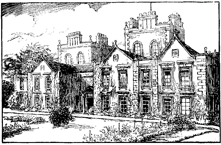
Ormerod House
Cliviger was used as a surname in the 14th century, (fn. 59) and other local names occur. (fn. 60) John Towne of Cliviger in 1631 was among the compounders for having refused knighthood (fn. 61) John Watson of Cliviger in 1632 was charged £3 a year in lieu of having two-thirds of his estate sequestered for recusancy. (fn. 62)
Common rights were in the time of Elizabeth disputed between the tenants of Cliviger and those of Accrington (fn. 63); also between the freeholders and copyholders in Cliviger itself. (fn. 64) The coal mines are mentioned about the same time. (fn. 65) Some parts of the Crown lands in Cliviger were sold in the time of James I. (fn. 66)
'By a survey made in 1602 it appears that the inclosed grounds within Cliviger amounted to 952 acres: in the year 1734 they were increased by inclosures to 1,324, partly including and partly excluding 300 acres decreed to be inclosed in 1618; and, in 1795, a grant was made to the several freeholders of 300 acres more, all of 8 yards to the perch; the remainder was granted out for inclosure in 1809.' (fn. 67)
Thomas Whitaker and John Ormerod were the landowners who contributed to the subsidy of 1524. (fn. 68) Thomas Whitaker of Holme and the widow of John Thompson paid in 1543. (fn. 69) John Towneley, John Holker, Thomas Whitaker and William Barcroft paid for lands to the subsidy of 1564 (fn. 70); and Thomas Whitaker and Robert Barcroft to that of 1597. (fn. 71) The same names occur in the 1626 list, in which Thomas Hurdus and his wife were entered as convicted recusants. (fn. 72)
In Cliviger freehold in 1666 there were 110 hearths liable to the tax. The largest house was that of Mr. Thomas Barcroft of Barcroft with six hearths; two others had five, those of Peter Ormerod of Ormerod and Thomas Whitaker of Holme. (fn. 73)
Church
The chapel at HOLME (fn. 74) was probably built in the time of Henry VIII, and at the Reformation fell into disuse, being considered the property of the Whitaker family. (fn. 75) What endowment had belonged to it was confiscated by Edward VI and the chapel remained without a minister, (fn. 76) except under the Commonwealth, (fn. 77) for nearly 200 years, though about 1717 Bishop Gastrell recorded that the curate of Burnley preached there once a quarter. (fn. 78) A curate was licensed in 1742 and by the gifts of various benefactors, including Dr. Whitaker, the historian, sometime incumbent of this family chapel, an endowment was provided, and the net value is now £263 a year.
The old chapel (fn. 79) which stood near the road at the lower end of the graveyard was pulled down in 1788, and the present church of St. John the Divine erected in the same year on higher ground and consecrated in 1794. It is a plain stone structure, in plan a rectangle 62 ft. 6 in. long internally by 28 ft. wide, built of rough square chiselled stones with dressed quoins at the angles. At the west end is an octagonal stone cupola springing from a square base; and the west elevation has some architectural merit, the doorway being flanked by Tuscan columns supporting a pedimented head, the whole under a lofty semicircular arch. The windows are roundheaded and at the west end in two tiers, the upper ones lighting a west gallery.
The old east window was of three lights divided by two columns carrying architrave, frieze and cornice over the side lights, and with a semicircular head springing from the level of the cornice over the central wider light, but this window was removed in 1897, when a new chancel 25 ft. by 19 ft. with vestry on the north side was added, and the columns are now at each side of a gate at the west end of the building.
The original plan comprised a chancel arrangement at the east end formed by two wide piers placed about 8 ft. from the wall carrying an arcade of three semicircular arches, the middle recessed space of which was the sanctuary proper, while north and south were private pews, that on the south belonging to the Whitaker family and the other to the Ormerods. At the west end there is a somewhat similar arrangement with three semicircular arches below and above in front of the gallery, the central space being occupied by the entrance porch, while that on the north is the baptistery and on the south a stone staircase leads to the gallery. The floor space, or nave proper, is therefore reduced to about 44 ft. in length, and is lit by three lofty semicircular-headed windows on each side. In the external south-east corner facing east is a shield with the arms and initials of the Rev. T. D. Whitaker and the date 1788, while a spout head on the south side has the initials and date T.W. 1797. The roof is new and of plain king-post type and the floor is flagged. The building underwent a restoration when the new chancel was added, an old three-decker pulpit, a very fine example of its kind which stood against the south wall, being removed. At the same time a late 15th or early 16th-century octagonal oak pulpit, said to have been in the old church at Holme in the reign of Henry VIII, was removed from the Whitaker pew, where it had long stood, and erected on the north side of the old chancel. It has open sides with Gothic tracery in the heads and an embattled top. In the old Whitaker pew, which is now thrown open to the church, is some linen pattern panelling with carved rails, and there is also some 18th-century square panelling on both the north and south sides of the old sanctuary. There are also four of the oak stalls from the old Blackburn Parish Church pulled down in 1820, two of them having carved misericordes.
The walls are plastered and there are mural monuments to William Whitaker (d. 1782), Laurence Ormerod (d. 1793), the Rev. T. T. Whitaker (d. 1817) and John Hargreaves (d. 1834), and there is a bust of the Rev. T. D. Whitaker, the historian of Whalley.
The cupola contained one bell till 1895, in which year a ring of eleven hemispherical bells by Mears & Stainbank was added.
Over the arched gateway on the south side of the chapel is a foliated cross-head brought by Dr. Whitaker from Whalley.
General Sir James York Scarlett, who led the Heavy Brigade at Balaclava, is buried in the churchyard.
The posts of the stocks still stand near the churchyard gate at the bottom of the hill.
A district was assigned to the church in 1843. (fn. 80) Mrs. A. Master-Whitaker is the patron.
The following have been curates and vicars (fn. 81) :—
| 1742 | Anthony Weatherhead, M.A. (Christ's Coll., Camb.) |
| 1759–63 | William Halliwell |
| 1797 | Thomas Dunham Whitaker, LL.D. (fn. 82) (St.John's Coll., Camb.) |
| 1822 | William Tindall, M.A. (fn. 83) (University Coll., Oxf.) |
| 1830 | Robert Nowell Whitaker, M.A. (fn. 84) (St. John's Coll., Camb.) |
| 1840 | John Langfield |
| 1860 | Daniel Sutcliffe, M.A. (St. Catharine's Coll., Camb.) |
| 1896 | Alfred Master-Whitaker, M.A. (fn. 85) (Dur.) |
The Wesleyan Methodist chapel at Mere Clough was built in 1824; the Independent Methodist one at Walk Mill in 1853 superseded the first building of 1835. The Congregationalists hold services in the schools.
