A History of the County of Lancaster: Volume 6. Originally published by Victoria County History, London, 1911.
This free content was digitised by double rekeying. All rights reserved.
'Townships: Shevington', in A History of the County of Lancaster: Volume 6, ed. William Farrer, J Brownbill (London, 1911), British History Online https://prod.british-history.ac.uk/vch/lancs/vol6/pp199-203 [accessed 31 January 2025].
'Townships: Shevington', in A History of the County of Lancaster: Volume 6. Edited by William Farrer, J Brownbill (London, 1911), British History Online, accessed January 31, 2025, https://prod.british-history.ac.uk/vch/lancs/vol6/pp199-203.
"Townships: Shevington". A History of the County of Lancaster: Volume 6. Ed. William Farrer, J Brownbill (London, 1911), British History Online. Web. 31 January 2025. https://prod.british-history.ac.uk/vch/lancs/vol6/pp199-203.
In this section
SHEVINGTON
Scheuynton, 1253; Sheuington, 1277; Sewinton, 1288; Sheuynton, 1292; the spelling with 'g' became usual about 1350.
Shevington has an area of 1,728 acres. (fn. 1) It is bounded on the south-west by the River Douglas, on the east by the Mill Brook and on the west by another brook, which has two small tributaries, the Calico Brook and another, crossing the township westwards. The surface gradually rises from these streams, attaining about 350 ft. at the northern corner. There was in 1901 a population of 1,753. (fn. 2)
A road winding north and west from Wigan traverses the southern end, passing the hamlets of Crook, Shevington and the Vale, at the second of which it is crossed by another lane from the south. From the Vale, on the western boundary, Back Lane goes north-east and east through the hamlet of Shevington Moor to the village of Standish. The southern part of the township, bordering on the Douglas, is known as Gathurst. The Lancashire and Yorkshire Company's line from Wigan to Southport runs near the south-western boundary, and the Leeds and Liverpool Canal passes through Crook.
The soil is clay, with marl subsoil; wheat and oats are grown, and there is some pasture land. There are large glue-works.
In 1666 the hearth tax return shows that there were eighty-six hearths chargeable. The largest house was that of Mr. Catterall, with nine hearths. (fn. 3)
The township is governed by a parish council. A school board was formed in 1875.
Manor
The history of SHEVINGTON is obscure. The manor appears to have been greatly subdivided from an early time, and none of the resident families attained a predominant position. It appears to have been assessed as one plough-land and to have been given by the lord of Penwortham, of whose fee it formed part, to Randle de Marsey, (fn. 4) and in the 17th century land in Shevington was said to be held of the lords of Leylandshire. (fn. 5) On the other hand the heir of Robert Banastre in 1242 held of Penwortham the fourth part of a knight's fee in Shevington, Charnock Richard and Welch Whittle (fn. 6); the Shevington part descended to the Harringtons, (fn. 7) and was acquired by Sir Edward Stanley Lord Mounteagle, (fn. 8) and the manor of Shevington was mortgaged or sold in 1574 to Alexander Rigby. (fn. 9)
A branch of the Hulton family were possessed of the whole or most of the land in the 13th century. (fn. 10) Crook was part of their estate. (fn. 11) It appears to have been alienated in parcels, for several different families are found to have held 1 or 2 oxgangs, and what remained to the Hultons descended to one Thurstan Standish in the 15th century. (fn. 12) This was about 1562 acquired by Edward Standish of Standish, (fn. 13) whose ancestors as early as 1396 are found to have held of Sir Nicholas de Harrington a fourth part of the manor. (fn. 14)
An eighth part of the manor was early in the 14th century held by a family surnamed Witte and descended to the Faircloughs, who long remained among the more prominent residents (fn. 15); it was in 1506 sold to the Heskeths. (fn. 16) The Nevills of Hornby also held an eighth part. (fn. 17) One family assumed the local name, (fn. 18) but appear to have sold their estate to the Wrightingtons in 1348. (fn. 19) Other surnames occurring in early deeds are those of Holland, (fn. 20) Perpoint, (fn. 21) Shuttleworth, (fn. 22) Catterall (fn. 23) and Worthington. (fn. 24)
The Hospitallers had a fair estate from an early time, (fn. 25) and Cockersand Abbey also had land, (fn. 26) which was held of the canons by the Woodward family. (fn. 27) In the 17th century, however, the Woodwards are stated to have held of the lords of Leylandshire. (fn. 28) Burscough Priory long held an estate there (fn. 29); their tenants at the Dissolution were James Standish of Arley and Lawrence Bimson. (fn. 30)

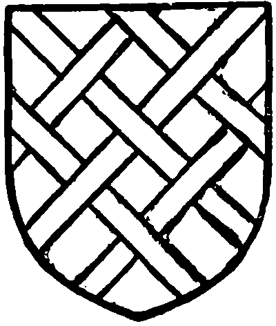
Harrington. Sable fretty argent.
From the subdivisions described it is not surprising to find that a 'manor of Shevington' has been claimed by several landowners (fn. 31) —Standish of Standish, Chisnall, Hesketh and Dicconson of Wrightington. The Ashhursts of Dalton also held lands in the township. (fn. 32) Sir George Stanley made purchases in 1562–4. (fn. 33) The Langtree (fn. 34) and Legh of Lyme (fn. 35) families were landowners.

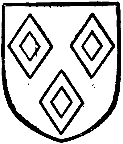
Catterall of Crook. Azure three mascles argent.
The landowners contributing to the subsidy of 1542–3 were Nicholas Worthington and Alexander Catterall (fn. 36); Peter Catterall is named in 1564. (fn. 37) The freeholders recorded in 1600 were Alexander Woodward, Roger Bimson and Nicholas Worthington. (fn. 38) Edward Prescott of Shevington had his leasehold estate sequestered by the Parliament for 'delinquency' during the Civil War. (fn. 39) The principal landowners in 1798 were Edward Standish, William Dicconson, Edward Holt and Sir Thomas Hesketh. (fn. 40)
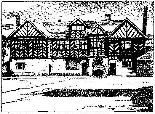
CROOK HALL, the former seat of the Catterall family, stands on low ground on the north bank of the River Douglas about 2 miles below Wigan, and at the extreme south-eastern end of the township. The canal now passes between the house and the river, and the surroundings are desolate and sordid owing to the working of collieries in the immediate neighbourhood. The ground close to the house on the south and east sides often lies for long periods under water, and the building itself, which is let as cottages, has suffered much from decay and damp. On the north and west an ugly colliery village has sprung up. The house is a good specimen of the two-story half-timber building of the early 17th century with central hall and projecting gabled end wings. The principal front faces north, and is about 68 ft. in length, the lower part of the wall to the height of the first floor being built with 2 in. bricks on a low stone base, above which it is of timber with uprights and diagonal bracings. The roofs are covered with stone slates.
The end gables have lost their barge-boards and have been renewed in deal, but the greater part of the timber work is original though much dilapidated. In the recess formed by the projection of the west wing is a porch, 9 ft. wide, carried up the full height of the building with gable over, and there is another smaller dormer gable in the roof, forming together a picturesque and somewhat irregular composition. A plaster cove marks the line of the floor, and another under the eaves is carried across the end gables.
Below the sill of the window over the porch is an
inscription between two carved brackets,
ANNO DNI 1608: PEC RR + IR § CARP
The south elevation facing the river is built of brick and has two plain gables. Most of the windows are modern insertions as in the timber portion of the front, but the hall preserves its original seven-light stone mullioned and transomed window with label over on this side, as well as a five-light window of similar design on the north. The hall, (fn. 41) which has a flagged floor, is 22 ft. 6 in. long by 19 ft. 6 in. wide, and the ceiling, which is crossed by three moulded beams, is 10 ft. 9 in. high. There is now a fireplace at each end with modern grates, but the door at the north-west corner is the old nail-studded oak one with good iron hinges and knocker. The rest of the house has been modernized and is without interest.

Crook Hall, Shevington
In connexion with the Church of England St. Ann's was built in 1887, but a district had been formed as early as 1873. (fn. 42) The rector of Standish is the patron.
There is a Primitive Methodist church at Crook.
