A History of the County of Lancaster: Volume 5. Originally published by Victoria County History, London, 1911.
This free content was digitised by double rekeying. All rights reserved.
'Townships: Bury', in A History of the County of Lancaster: Volume 5, ed. William Farrer, J Brownbill( London, 1911), British History Online https://prod.british-history.ac.uk/vch/lancs/vol5/pp128-133 [accessed 25 November 2024].
'Townships: Bury', in A History of the County of Lancaster: Volume 5. Edited by William Farrer, J Brownbill( London, 1911), British History Online, accessed November 25, 2024, https://prod.british-history.ac.uk/vch/lancs/vol5/pp128-133.
"Townships: Bury". A History of the County of Lancaster: Volume 5. Ed. William Farrer, J Brownbill(London, 1911), , British History Online. Web. 25 November 2024. https://prod.british-history.ac.uk/vch/lancs/vol5/pp128-133.
In this section
BURY
Biri, 1194; Buri, 1212; Bury, 1227, and usual; Byry, 1292; Bery, 1323.
The township of Bury lies principally in the narrow tongue of land between the Irwell and the Roch, stretching north for over 4 miles from the confluence of these streams. The surface is generally level, but rises on the north-east border to a height of 600 ft. The area is 2,329½ acres. (fn. 1) The population of the township in 1901 was 44,032 and of the borough 58,029.
The town of Bury occupies the centre of the township. The church is situated above what was the old course of the Irwell, the ground falling rapidly to the north of the Bolton and Rochdale road leading past the church. Just at the south-west corner of the church this road is joined by that from Manchester, and the open space or Wylde (fn. 2) at that point is still known as the Market-place. The statue of Sir Robert Peel, erected in 1852, stands here; and to the west was formerly the fortified manor-house of the Pilkingtons. The road leading west to Bolton descends to cross the Irwell at Bury Bridge; the district to the south of it is called Tentersfield. Going east from the church it passes through Freetown and Pits o' th' Moor, to the north-east of the last-named being Woodgate Hill. One branch of this road takes a more southerly course, crossing the Roch at Heap Bridge and leading to Heywood; to the south of it lies Pimhole. Another branch runs almost due north, passing Chesham and its park on the right, and going through Little Wood Cross and Limefield to Walmersley and Haslingden. The Manchester road goes southerly from the church, passing through Buckley Wells, Fishpool, and Redvales, to Blackford Bridge over the Roch.
The Lancashire and Yorkshire Company's railway from Manchester to Accrington passes north through the township, with a station (Bolton Street) near the church. A line to Tottington branches off from this. The same company's line from Bolton to Rochdale crosses the other at right angles, with a station (Knowsley Street) to the south of the former. (fn. 3) Electric tramcars run along the main thoroughfares in all directions.
Bury has long been a seat of the woollen manufacture; Bury blankets are known everywhere. Leland, about 1535, speaks of 'yarn sometime made about Bury, a market town on Irwell'; (fn. 4) a deputy aulnager was appointed in 1564 to stamp woollen cloth. (fn. 5) Defoe, writing about 1730, observed that at Bury 'the manufacture of cotton . . . was ended, and the woollen manufacture of coarse sorts, called half-thicks and kerseys, begun; which employs this and all the villages about it.' (fn. 6) There are also extensive cotton mills, iron and brass foundries, paper mills, and bleach works. Bury is also noted for simnel cakes, and the fourth Sunday in Lent is kept as a festival; (fn. 7) parkin, a corruption of Tharcake, was made at the beginning of November. (fn. 8)
The old festivals were those of the Royal Oak, Robin Hood, and 'Maying Night.' (fn. 9) Football games were played at certain seasons. (fn. 10) Otter-hunting was one of the sports of the district. (fn. 11)
Fairs are held on 5 March, 3 May, and 18 September. The wakes begin on the Saturday after August Bank Holiday.
The dungeon, (fn. 12) pillory, (fn. 13) and town cross (fn. 14) have disappeared. The ghosts or 'boggarts' have also gone. (fn. 15)
The printing press was introduced in 1789. (fn. 16) The first newspaper was the Bury Mercury, issued in 1831. (fn. 17) There are now four—the Times (begun in 1855) and the Guardian (1857), published twice a week, and the Visitor and the Advertiser, each once. (fn. 18)
There is a theatre. (fn. 19)
A halfpenny token was issued in 1667. (fn. 20)
In Bury town there were 114 hearths liable to the tax; John Greenhalgh's rectory had ten hearths, John Brook's house eight, Richard Tootell's seven, those of John Eckersall and John Redferne six each. In Bury Upper End were fifty-two hearths. (fn. 21)
Various changes in the boundaries have taken place in recent years, (fn. 22) and the present township or civil parish of Bury contains not only the ancient hamlet or township, but parts of Elton, Walmersley-withShuttleworth, and Heap. (fn. 23)
Manors
The manor of BURY was held of the lord of Tottington as one knight's fee. (fn. 24) The tenant bore the local surname, and in 1193–4 Adam de Bury offered 5 marks for having the king's good will after the rebellion of John, Count of Mortain. (fn. 25) Under Roger de Montbegon Adam de Bury, son of Ailward de Bury by his wife Alice de Montbegon, (fn. 26) in 1212 held the fee of one knight 'of ancient tenure'; (fn. 27) the formation of this holding may therefore date from the early part of the 12th century. In 1302 Henry de Bury held the fee of the Earl of Lincoln. (fn. 28) In 1313 he made a settlement of the manor, (fn. 29) and two years later was killed in some of the disturbances raised by Adam Banastre. (fn. 30)
His son Henry died without issue, on which his daughter Alice, wife of Roger de Pilkington, and her son Roger succeeded in establishing their right to the manor, although her mother Margery, daughter of Richard de Radcliffe, had endeavoured to secure it or a portion of the estate for her younger son Henry. (fn. 31)

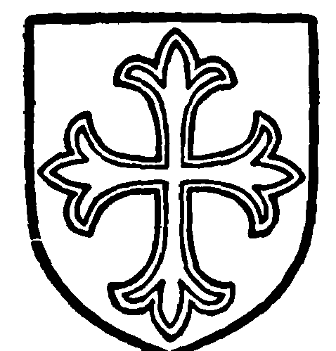
Pilkington. Argent a cross patonce voided gules.

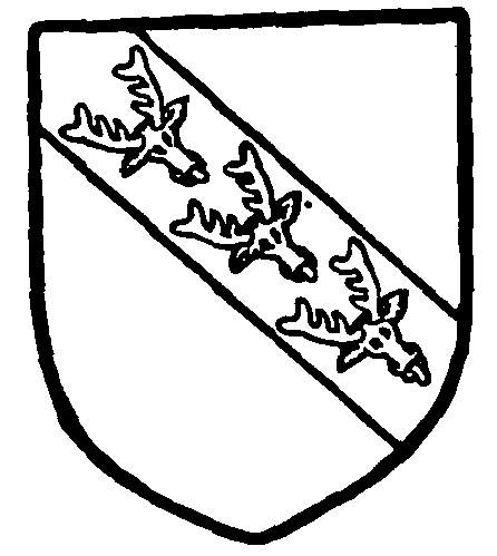
Stanley, Earl of Derby. Argent on a bend azure three harts' heads cabossed or.
The Pilkingtons remained in possession till 1485, (fn. 32) when all the manors and lands of Sir Thomas Pilkington were forfeited for his adherence to Richard III, the new king granting them to the Earl of Derby in 1489. (fn. 33) The manor of Bury then de scended regularly to the fifteenth earl, (fn. 34) who in 1872 sold his rights, the advowson excepted, to the Improvement Commissioners, who have been succeeded by the present corporation. He remained the principal landowner, as his successor, the present earl, still is.
The principal incidents of the tenure by the Pilkingtons were the grant of a weekly market and two fairs about 1440, (fn. 35) and the licence in 1465 to fortify the manor-house of Bury, afterwards known as the Castle. (fn. 36)
At the beginning of last century three courts leet were held annually for the manor of Bury—in April, at Whitsuntide, and in October; a court baron was held every three weeks for the recovery of debts under 40s. (fn. 37)
A family bearing the local surname long continued to have lands within the parish; (fn. 38) they may have been descended from the former lords of the manor. The bridge appears to have given a surname to a resident family. (fn. 39) CHESHAM, sometimes called a manor, was once owned by the Holts of Stubley. (fn. 40)
A family named Allen formerly lived at Redvales. (fn. 41) Haslum also occurs. (fn. 42) The Hulmes of Davyhulme had property in Bury. (fn. 43)
A petition for the delimitation of the bounds of Bury and Middleton was addressed to the Chancellor of the Duchy about 1520. (fn. 44)
The custom of the county as to the distribution of the goods of intestates led to disputes in the latter part of the same century. (fn. 45) There were also disputes as to the mills. (fn. 46)
Borough
The township was formerly governed by the constables appointed at the manor court at Whitsuntide. (fn. 47) In 1846, however, the inhabitants obtained an Improvement Act, under which the government was entrusted to twenty-seven commissioners elected by the ratepayers; (fn. 48) and after thirty years a royal charter was granted incorporating a borough. (fn. 49) The council consists of a mayor, ten aldermen, and thirty councillors. The area, more exten sive than the old township, (fn. 50) is divided into five wards— Church, Redvales, East, Moorside, and Elton, each electing six councillors. Bury became a parliamentary borough on the passing of the Reform Act of 1832; it returns one member. (fn. 51) The municipal and parliamentary boroughs are conterminous. Bury became a county borough in 1888. A coat of arms was granted in 1877.

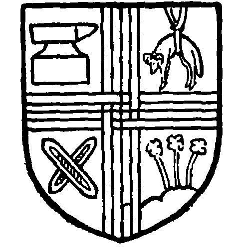
Borough of Bury. Quarterly argent and azure a cross double parted., fretted and counterchanged between, in the first quarter an anvil sable, in the second a fleece or, in the third two shuttles crossed saltirewise of the fourth, and in the fourth quarter a papyrus plant proper.
Gas (fn. 52) and water (fn. 53) were formerly supplied by private companies, but are now under public control. The corporation have established electric lighting works and work the electric tramways. The market, formerly held in the open square by the church, was in 1841 transferred to an inclosure erected by the Earl of Derby, who received the tolls; it was roofed with glass in 1867, (fn. 54) and, with the market rights, became the property of the town in 1872. The present market was built in 1901. The Town Hall was erected by the Earl of Derby in 1850. The Improvement Commissioners and Corporation have provided baths, recreation grounds, art gallery, (fn. 55) library, and technical schools, (fn. 56) fire brigade, abattoirs, a cemetery, opened in 1866–9, (fn. 57) and an infectious diseases hospital. The Bury Hospital and Dispensary are due to private benevolence. (fn. 58)
The Athenæum, began in 1836 as a mechanics' institution, was built in 1850; it has a library, reading and other rooms, and a large hall for meetings. (fn. 59)
Bury County Court district was formed in 1847. (fn. 60)
The parish church was adequate for the established
worship until 1770, when St. John's was built on
glebe land called Listerfield; a district was assigned
to it in 1860. (fn. 61) St. Paul's, built in 1841, had a
district assigned two years later. (fn. 62) Holy Trinity,
opened in 1863, had also to wait two years for a
legal district. (fn. 63) St. Thomas's was built by Thomas
Openshaw, a local benefactor, in 1866, (fn. 64) St. Peter's,
Redvales, in 1872, (fn. 65) and St. Mark's, Freetown, in
1883. (fn. 66) The rector of Bury holds the patronage of
all these churches except St. Paul's, which is in the
gift of five trustees.
John Wesley visited Bury seven times, the first in
1774, the last in 1778. The Wesleyan Methodists have
two churches, the Primitive Methodists one, and the
United Methodist Church six, of which Brunswick, the
principal, was opened in 1837 and rebuilt in 1862. (fn. 67)
The Baptists have three churches. (fn. 68)
The Congregationalists began services about 1790, the first chapel, now known as New Road Chapel, being opened in 1793; it was rebuilt in 1884–5. A second, Bethel, was started by a secession from the former in 1804, due probably to a desire for more liberal doctrine; the chapel was built in 1807, and enlarged in 1882. A second secession led to the building of Castlecroft Church in 1837–40. The chapel at Blackford Bridge originated with services in 1869; a school chapel was opened in 1875, and on this being destroyed by fire, the present building was erected in 1888. (fn. 69)
There are also a Welsh Calvinistic Methodist church and a Free Christian church; this last originated in a change of the views of the Rev. Franklin Howorth, the Unitarian minister. (fn. 70) The Salvation Army has a barracks.
In Bury, as in many other places, the earliest chapel opened by Protestant Nonconformists is now held by Unitarians. Silver Street Chapel was erected in 1719, (fn. 71) and the teaching became Arian or Unitarian about 1790, this no doubt leading to the first Congregational meeting above recorded. The old chapel was replaced by another in Silver Street in 1837, and this again having been injured by the construction of the railway, by the present one in Bank Street in 1852. (fn. 72) The Unitarians have also a cemetery and mortuary chapel at Hole Bottom.
The followers of Joanna Southcote had a meetingroom in Bury in 1829. (fn. 73) The Swedenborgians opened a New Jerusalem chapel in 1860, but it has been abandoned.
The Roman Catholic church of Our Blessed Lady was built in 1842, (fn. 74) and St. Joseph's in 1871.
