Survey of London: Volume 42, Kensington Square To Earl's Court. Originally published by London County Council, London, 1986.
This free content was digitised by double rekeying. All rights reserved.
'Plate 1: Kensington in c.1754', in Survey of London: Volume 42, Kensington Square To Earl's Court, ed. Hermione Hobhouse (London, 1986), British History Online https://prod.british-history.ac.uk/survey-london/vol42/plate-1 [accessed 1 February 2025].
'Plate 1: Kensington in c.1754', in Survey of London: Volume 42, Kensington Square To Earl's Court. Edited by Hermione Hobhouse (London, 1986), British History Online, accessed February 1, 2025, https://prod.british-history.ac.uk/survey-london/vol42/plate-1.
"Plate 1: Kensington in c.1754". Survey of London: Volume 42, Kensington Square To Earl's Court. Ed. Hermione Hobhouse (London, 1986), British History Online. Web. 1 February 2025. https://prod.british-history.ac.uk/survey-london/vol42/plate-1.
Kensington in c. 1754.
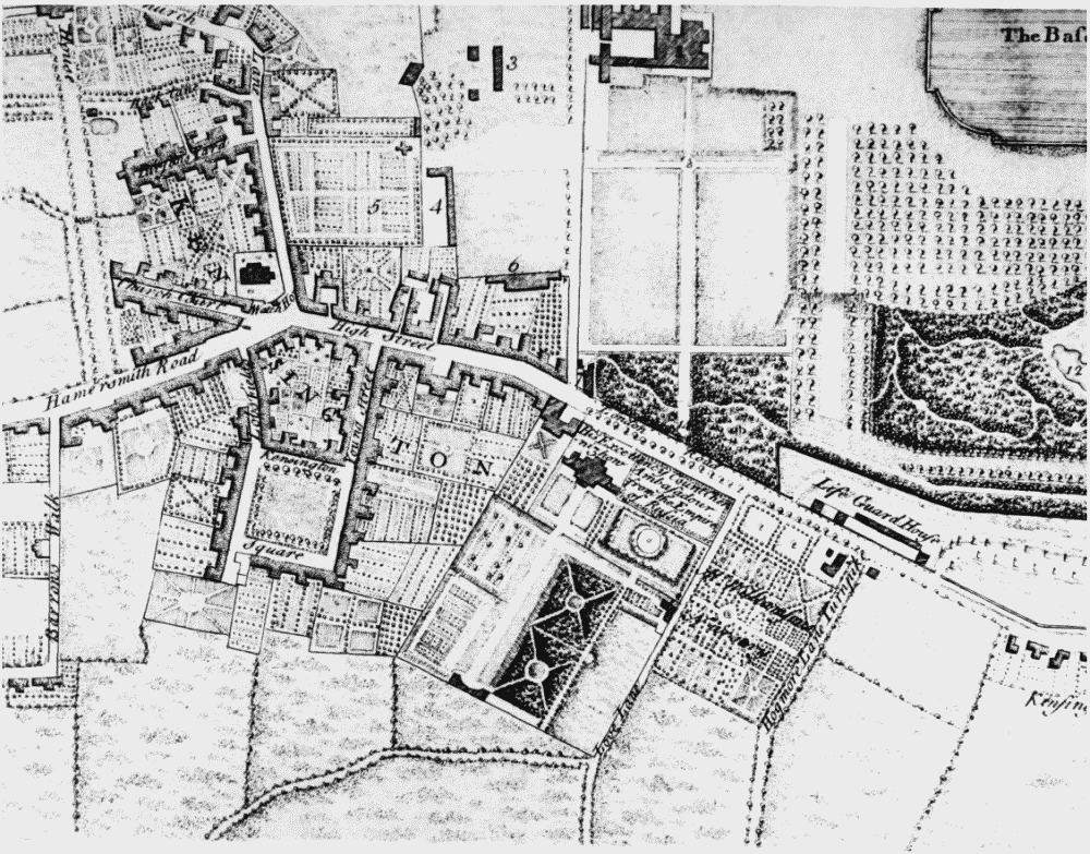
Extract from John Rocque's
Kensington in c. 1754.
Kensington Palace is shown at the top, with the 'town' to its south and west. The map extends as far west as Wright's Lane (the Barrow's Walk). Kensington House (center) is marked as in the occupation of the Russian Ambassador