Survey of London: Volume 42, Kensington Square To Earl's Court. Originally published by London County Council, London, 1986.
This free content was digitised by double rekeying. All rights reserved.
'The Edwardes estate: Warwick Road (north) and West Cromwell Road', in Survey of London: Volume 42, Kensington Square To Earl's Court, ed. Hermione Hobhouse (London, 1986), British History Online https://prod.british-history.ac.uk/survey-london/vol42/pp282-288 [accessed 1 February 2025].
'The Edwardes estate: Warwick Road (north) and West Cromwell Road', in Survey of London: Volume 42, Kensington Square To Earl's Court. Edited by Hermione Hobhouse (London, 1986), British History Online, accessed February 1, 2025, https://prod.british-history.ac.uk/survey-london/vol42/pp282-288.
"The Edwardes estate: Warwick Road (north) and West Cromwell Road". Survey of London: Volume 42, Kensington Square To Earl's Court. Ed. Hermione Hobhouse (London, 1986), British History Online. Web. 1 February 2025. https://prod.british-history.ac.uk/survey-london/vol42/pp282-288.
In this section
Warwick Road north of West Cromwell Road
Today the character of Warwick Road is largely determined by its role as a major traffic route. In the stretch to the north of West Cromwell Road the east side is dominated by the huge bulk of the Royal Borough's Central Depot with its impressive mass of noise-reducing brick walling, while the west side is predominantly a wasteland of car parks and yards and other car-related businesses. This side of the road was always associated with transport activities, firstly in connection with the Kensington Canal Basin and its associated wharves, warehouses and counting-houses, one or two of which survive, and later with the railway sidings and coal depot which were located here. There was, however, also a substantial quantity of domestic housing, much of it designed to accommodate those who worked in this little hub of commercial and industrial activity. Of the original houses, only three short terraces on the east side remain, but new housing complexes have recently been erected on top of the Central Depot, and no less than four public houses still survive in the street to testify to one of the basic needs of its once large residential and working population.
The northern end of the street was laid out as early as 1822, and for a short period it was called Moiety Road because it divided the two parcels of land which were taken under building agreements in that year for the erection of Warwick Square (now Warwick Gardens) and Kensington Crescent respectively. Some development took place in the street almost immediately and spread very gradually southwards over several decades. In 1890 the whole street was renumbered from south to north, and, for the sake of convenience, the succeeding account follows the direction taken by the street numbers rather than the chronological sequence of building.
East Side
Nos. 80–100 (even) Warwick Road are all that remain of a group of over a hundred small houses or cottages which were built hereabouts for a mainly artisan population in the 1850s and 1860s. Most of these dwellings were on the west side of the street, and their history is described below. Of the surviving houses, Nos. 94–100, which have two storeys above a basement and are faced in stock brick with plain stucco dressings, are the oldest and were erected in 1855 by William Handby of Pembridge Place, builder. (fn. 372) Originally this terrace consisted of six houses, but the two northernmost, Nos. 102 and 104, were demolished in about 1972 for the rebuilding of the borough council's Central Depot. No. 92 was added to this terrace by Handby about 1864, though not leased to him until 1867. (fn. 373) He lived there himself and in 1871, when he was sixty-five years old, he shared the house with a fancy warehouseman's assistant and also accommodated two lodgers in his part of the premises. (fn. 374)
Nos. 80–90 were erected in 1868 under building leases granted to Henry Kingham of High Street, Notting Hill. (fn. 375) Usually described as a confectioner and sometimes as a builder, Kingham was an entrepreneur who was responsible for the erection of a large number of small terraced houses in the vicinity, including several in the streets to the west of Warwick Road. His houses here are unusual in being faced with red brick, a material which at that time was considered suitable for the dwellings of artisans or advanced artists but not for the houses of the respectable middle class. No. 80 (Cromwell House), which has its entrance in West Cromwell Road, has three full storeys above a basement and a hipped roof, while Nos. 82–90 have only two main storeys (Plate 115c), to which low attics have recently been added during rehabilitation by the Family Housing Association as part of a project which included the conversion into flats of Nos. 68–94 (even) West Cromwell Road (see page 288).
To the north of No. 100 the borough's vast Central Depot, which was erected in 1972–5, has a frontage of over 550 feet to Warwick Road divided into two blocks by the roadway of Pembroke Road and the Kensington Arms public house on its north-west corner. The site to the south of Pembroke Road at one time formed part of the extensive premises of Erards, the piano manufacturers, and its early history is described on page 280. The part of the site to the north of the Kensington Arms was originally occupied by some twenty small terraced houses (Plate 113a). Of these, No. 110, a two-storey house with a plain stuccoed façade, still survives, but it was built on part of the curtilage of the Kensington Arms and is not typical of the three-storey houses to its north which have been demolished. The first of these to be built, latterly numbered 124–134 and 138–148 (even) Warwick Road, were erected in 1845–7 by the contractor Thomas Earle, who was also shortly to develop part of Warwick Gardens (see page 266). (fn. 376) They formed two ranges of six houses each with a passageway to a gravel pit between them. When the gravel pit was subsequently built over, another houses, No. 136, was erected on the site of the passageway in about 1859. (fn. 377) To the south of Earle's houses another six stucco fronted houses, Nos. 112–122 (even), were erected under building leases granted in June 1853 by Lord Kensington to James and Samuel Williams of Shepherd's Bush, contractors. (fn. 378) The Williamses also built the Kensington Arms, the lease of which was granted to them in November 1852. (fn. 379) A large public house with a surprisingly full panoply of italianate dressings for its date (Plate 113a), the Kensington Arms has now lost the elaborate centrepiece and ball finials from above its parapet and the interior has been denuded of any features of interest.
James and Samuel Williams also erected two houses on the north side of Pembroke Road to the east of the Kensington Arms and entered into an agreement with Lord Kensington to lay out a mews in the triangular space between the backs of the houses in Warwick Road, Pembroke Road and Warwick Gardens. They had begun work on this when, in 1863, the Kensington Vestry advertised for a suitable site for a depot to store stone and other materials, and the Williamses decided to offer this plot. After some negotiation, the Vestry paid them £1,000 for the site and £150 for the materials and structures on the ground. Lord Kensington, somewhat reluctantly agreeing to the change of use, granted the Vestry an eighty-five-year lease from 1863 at a rent of £50 per annum (£20 more than he would have received if the original proposal to build stables had been carried out). (fn. 380) In 1864 some buildings were erected including a house at the entrance from Pembroke Road for the depot's superintendent or foreman which also served as an office. (fn. 381)
In 1877 a part of the site of Erards' piano factory with a frontage to Warwick Road was purchased for £3,000 by the Vestry for the erection of stabling to be used in connection with the depot. This particular plot had originally been occupied by the Warwick Farm Dairy, which had been built by Stephen Bird in 1848 and had been annexed to the factory premises in about 1866 (see page 280). Some of the former dairy buildings were still usable, and new stabling was also erected in 1877 and 1879. (fn. 382) According to the census of 1881 no fewer than 283 men were then employed at the ‘Kensington Vestry Stables’, perhaps at both sites. (fn. 383)
In 1892, after the piano factory had closed down, the Vestry decided to expand its depot by taking a lease of the ground on the north and east sides of its stables at a rent of £250 per annum, and thus acquired an enlarged site with a frontage of 200 feet to Warwick Road and nearly 300 feet to Pembroke Road, in addition to its original premises on the north side of Pembroke Road. (fn. 384)
The freehold of the original depot site was purchased by Kensington Council for £1,600 in 1904, and shortly afterwards proposals were made to improve the facilities here. In 1912 £4,000 was paid for the freehold of Nos. 112–122 (even) Warwick Road, which were then occupied as tenements at weekly rentals, most of the tenants being considerably in arrears with their rents, and in 1913–14 these houses were demolished and new buildings erected for the depot with their main entrance from Warwick Road at a cost of some £6,500. A residence for one of the foremen of the depot was built next to the new entrance as part of the scheme. (fn. 385)
These much-enlarged premises to the north and south of Pembroke Road sufficed until 1965 when the newly formed Royal Borough of Kensington and Chelsea decided to reorganize its depot accommodation by rebuilding the whole depot in Warwick Road. Nos. 124–148 (even) Warwick Road and subsequently Nos. 102 and 104 and adjacent premises were acquired for demolition, and the architects, engineers and quantity surveyors, Arup Associates, were appointed to prepare a scheme which would include some housing accommodation. Their plans were approved in 1970 and work began in 1972, the builders being John Mowlem and Company at a tendered price of £2,729,528. The depot was completed in 1975 and the associated housing in the following year. (fn. 386)
Externally the new depot complex has long frontages of high stock-brick curtain walling and two to four storeys of terraced flats above, the lowest level being cantilevered out from the main wall surface (Plate 115d). The depot itself is of reinforced concrete construction, and the southern block contains a vast transport workshop with an area of over 2,400 square metres, its roof supported by a massive central column and sixteen radiating beams. This roof in turn forms the base of a paved and landscaped ‘garden square’, named Chesterton Square, around which flats and maisonettes, faced with the same stock brickwork, are arranged on three and four storeys (Plate 115c). The northern block of the depot, which is basically triangular in shape, contains parking facilities and another high-level landscaped area called Broadwood Terrace (fn. n1) with two and three storeys of flats on the Warwick Road perimeter. The blocks are joined by a striking open tubular steel bridge over Pembroke Road with walkways on two levels.
The chief element of the design is the conjunction of the austere and even forbidding mass of the depot with the intimate scale of the housing around spacious and well planted enclosures, especially in Chesterton Square. The housing itself is simple and unassertive, and the setting provides a remarkable degree of peace and seclusion in a particularly noisy part of Kensington.
Even before the new depot was completed the Council realized that it would still be short of space for all its vehicles, and in 1975 a decision was taken to purchase the redundant depositories of John Barker and Company to the east of the southern site. The cost of acquisition and conversion, for which Arup Associates were also the architects, amounted to some £1,600,000. Among the work carried out was the demolition of the southern block of the former piano factory. (fn. 387)
To the north of the depot is a surviving group of three storeyed late-Georgian houses, Nos. 150–160 (even) Warwick Road, with a stuccoed public house at each end and four brick-faced houses with shops or offices on the ground floor in between. The Warwick Arms at No. 160 was indeed the first building to be erected in the road under a building lease which was granted in February 1823 by Lord Kensington to George Benson of The Terrace, a painter, for ninety-eight years at a rent of £25 per annum. The intended public house was given the name Warwick Arms in the lease (after the Earls of Warwick and Holland who once owned the Edwardes estate) and this was shortly afterwards extended to the row of houses in the form of Warwick Place and eventually to the whole street. The public house was completed by 1828 when Benson himself was the ratepayer. In that year he took out a second mortgage of the premises from the brewers Combe and Dela field, but in the following year he assigned his lease to Thompson, Wood and Fuller of Chiswick, brewers, the forerunners of Fuller, Smith and Turner, and the public house has remained in their possession ever since. (fn. 388) Externally the Warwick Arms has a rendered façade above the ground storey, and inside there is much plain woodwork. At the rear the rough place bricks of the internal walls have been exposed in a modern decorative scheme.
The other houses in the terrace were leased to Benson, or in the case of Nos. 154–156 at his direction to Matthew Sherborn of Oxford Street, oil and colourman, between 1825 and 1829, but they were not completed until 1834. (fn. 389) No. 150 is now the Britannia Tap public house. It was a beer house from at least 1863 (fn. 301) and was purchased by William Wells and Company, in 1889. It is now owned by Young and Company, having been bought by them in 1924 (see page 114),. and was once said to be the smallest public house in London, but it has recently been extended and altered, both externally and internally. (fn. 390)
The short cul-de-sac to the north of the Warwick Arms is marked as ‘Chapel Street’ in the plan attached to the building lease of February 1823 for the public house, and may have been intended as a way to the chapel which it was then proposed to build at the south end of the equally abortive Warwick Square (see page 264). To the north of this opening was formerly a range of two-storey stables and coach-houses called Garibaldi Stables. They appear to have been erected about 1860 by the builder Samuel Johns in conjunction with houses he was then building on the west side of Warwick Gardens. Johns also gave the name Garibaldi Villa to the house he built for himself at No. 35 Pembroke Gardens.
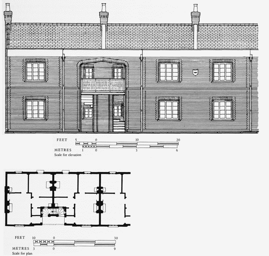
Shaftesbury Cottages, Fenelon Place, 1852–4, Plan and elevation.Demolished
West Side
The development of the area between the Kensington Canal and Warwick Road to the south of the canal basin began shortly after the Great Exhibition of 1851, when a Kensington resident, Henry Benjamin Kent, erected two model cottages, each containing four flats, to a simplified version of the design of Prince Albert's model lodging houses which had been built for the Exhibition. Kent's cottages, which were probably begun in 1852 and at least partially occupied by 1854, (fn. 391) were named Shaftesbury Cottages, (fn. 392) alter the philanthropist Antony Ashley Cooper, seventh Earl of Shaftesbury (Plate 115a, Fig. 117). The cottages were on the west side of a narrow road which was laid out parallel to Warwick Road and called Shaftesbury Road until renamed Fenelon Place in 1939. They had garden plots both at the rear and across the roadway in front, and were leased to Kent by Lord Kensington in 1856 for eighty-two years at a total ground rent of £12 per annum. (fn. 393)
Henry Benjamin Kent was then living at No. 1 Holland Place on the north side of Kensington High Street with his step-son, the builder and house agent, Frederick William Durrant. In the 1851 census, when aged forty-two, he had described himself as a retired coal merchant. (fn. 394) Durrant, who was probably the actual builder of the cottages, appears to have been using part of the ground hereabouts for brick making. (fn. 36)
The cottages must have been erected under an informal arrangement with the second Lord Kensington, and Kent also began to build some houses in the vicinity (fn. 395) before entering into a building agreement with the third Lord Kensington in May 1855 to develop the whole area as far south as a new road which was to be formed on the line of the present extension of West Cromwell Road. By the terms of this agreement houses were to be erected on the north side of this road (initially called Alma Road after the current fashion of adopting names from the Crimean War, before being renamed Fenelon Road in 1871 for unknown reasons) and on the west side of Warwick Road, while the group of model cottages was evidently intended to be extended to the north and south. Another range of small houses was to be built on the edge of the canal towing path, fronting on to a narrow road parallel to the canal. (fn. 396) When eventually erected the latter houses were called Ashley Cottages. The total ground rent for the whole plot, including Shaftesbury Cottages, was only £80 per annum, (fn. 397) and most of this was off-loaded on to other builders by Kent.
The range of houses along Warwick Road was called Shaftesbury Terrace, and the first eight of these were built by Durrant and leased to him by Lord Kensington at Kent's direction in 1855–6. (fn. 398) Durrant also took a sublease from Kent of a house in Alma Road, (fn. 399) but several other builders were also involved in the development during the late 1850s and early 1860s, mainly as sub-lessees of Kent, (fn. n2) and building proceeded at a somewhat desultory pace. After September 1863 all of the sub-leases were granted by Kent to Henry Kingham of High Street, Notting Hill, usually described as a confectioner but sometimes as a builder. Kingham erected terraced houses on the west side of Shaftesbury Road (later Fenelon Place, Plate 115a) to north and south of the model cottages, in an apparent change of plan, (fn. 401) and also built a number of small houses and a public house (the Royal Arms) in 1868–70 on the south side of Alma Road under direct leases from Lord Kensington (this side of the road not having been included in the area covered by Kent's building agreement). (fn. 402) The last seven houses in this terrace were leased in 1870 to William Henry Kingham of Hornton Street, builder, presumbly a relative, to whom Henry Kingham appears to have handed over building operations at about that time. (fn. 403) (fn. n3) Ashley Cottages appear to have been built directly for Kent in the 1860s, by which time the West London Extension Railway had been constructed along the former course of the canal.
Henry Benjamin Kent retired to Dulwich, where he died in 1887 with a personal estate worth over £10,500, which would have included the value of any leasehold property he had retained. (fn. 405)
The pattern of occupancy of this enclave of workingclass housing is shown in the detailed returns of the census of 1871. (fn. 406) The 120 occupied houses in the area to the south of the railway sidings on the west side of Warwick Road and the piano factory on the east were inhabited on census night by 967 persons (almost exactly eight per house) in 243 separate households. Two houses, one on the north side of Fenelon (formerly Alma) Road and one in Shaftesbury Road, had seventeen occupants divided between three and four households respectively. The heads of these households were a railway ticket collector, who put up five lodgers (all railway workers) with his family, a brewery traveller and a carman in the first house, and a decorator's labourer, a blacksmith, a labourer, and a coachman in the second. Even the small Ashley Cottages were sometimes multi-occupied, but the flats in the model cottages housed only a single family each with the exception of one which was shared by a laundress and a seamstress and their dependants. The most common single occupation was that of labourer, but other building workers and tradesmen (apart from those labourers who would have worked in the building industry) formed the largest occupational group. Several inhabitants were railway workers of one kind or another, while there were eight coal porters, and some of the labourers may also have worked at the coal depot further to the north in Warwick Road. Four pianoforte-makers and one tuner almost certainly worked at Erards, as did a porter who specified that he was employed there, and probably the five French polishers and some of the cabinet-makers and joiners who lived in the area.
No. 3 Shaftesburty Terrace (later No. 175 Warwick Road) was the residence of Leah Lee when she married the French poet Jules Laforgue on the last day of 1886. He came over from Paris on that morning and the marriage took place at St. Barnabas's, Addison Road, with Leah's landlady as one of the witnesses. (fn. 407)
The houses on each side of Fenelon Road were demolished shortly before the war of 1939–45 for the widening of the approach to the new bridge that was then being constructed over the railway as part of the West Cromwell Road extension. Prefabricated houses were erected on the vacant ground on the north side shortly after the end of the war. In 1951 an article about Shaftesbury Cottages could still speak in somewhat idyllic terms of ‘cottage gardens, sweet with briar roses, and tangled blackberry shoots that creep along the gravel path‘, (fn. 393) but five years later a medical officer of health appointed by the L.C.C. reported that the remaining houses in the area were unfit for human habitation and the Council declared it a Clearance Area. (fn. 408) Over the next four years all of the houses on the west side of Warwick Road and in Fenelon Place and Ashley Cottages were emptied and demolished. The former lock-keeper's cottage of the Kensington Canal survives (see page 326), but is now boarded-up. A short distance to its north is a two-storey district surveyor's office which was erected in 1961. (fn. 409)
To the north of this former residential area the west side of Warwick Road was originally occupied by the ware houses and counting houses of the companies which had wharves on the Kensington Canal Basin. Apart from some tumbledown brick structures, the only survivors of these are Nos. 187 and 189, the latter two-storeyed with a rendered exterior, probably dating from the early 1850s. (fn. 410) Of the later small single-storey offices which were built for the numerous coal merchants and other tradesmen who used the depot and railway goods yards, Nos. 189A–191 and 199–209 (odd) remain. More recent buildings are a four-storey garage, showrooms, workshop and offices at Nos. 181–183, built in 1962–3 to the desings of Wallis, Gilbert and Partners, (fn. 411) the four-storey West Kensington Telephone Exchange, erected in 1962 to the designs of G. R. Yeats of the Ministry of Public Buildings and Works, (fn. 412) and Warwick House, a three-storey block of flats (now derelict), built c. 1952 as married soldiers' quarters for the territorial army centre which occupied the sit of the coal depot for a short period after the war of 1939–45. (fn. 301)
North of the coal depot was another small group of some fifteen houses which were erected in two phases, in the 1830s and 1860s, and which were known by such names as Lily Terrace, Wallis Cottages and Radnor Villas. They were mostly demolished in the 1930s, the only survivor being the Radnor Arms, a three-storeyed public house faced with stock bricks and restrained Italianate dressings which was erected in 1862, probably to the designs of Josiah Houle, architect, of Guilford Street, St. Pancras, (fn. 413) who was later to be much involved in rebuildings on the south side of Kensington High Street (see pages 84 and 87).
West Cromwell Road
On 17 February 1869 the third Lord Kensington signed an agreement with the builder Thomas Huggett to develop six acres of the estate between Earl's Court Road and Warwick Road to the south of the mews which is now called Logan Place. The development was to be centred on a new road which would link the recently extended Cromwell Road to Alma (later Fenelon) Road with access roads to north and south on the line of the present Cromwell Crescent and Nevern Road and to the south only at Templeton Place. (fn. 414) The main road was originally considered to be a further extension of Cromwell Road, but was given the separate name of West Cromwell Road in 1873.
Huggett began by building on the frontage to Earl's Court Road, where he erected two terraces of five houses each to the north and south of West Cromwell Road. These were set back from the main road behind small plan tations and were originally named West Cromwell Gardens. (fn. 415) The southern terrace has been demolished and the northern, now Nos. 130–138 (even) Earl's Court Road, is presently being largely rebuilt behind the existing façades.
Building then proceeded quite steadily and quickly westwards along West Cromwell Road, all of the building leases except one being granted directly to Huggett by the third and fourth Barons Kensington between 1869 and 1874. (fn. 416) (The exception was the lease of No. 45 which was granted on Huggett's direction to the first occupant, a ‘Student of the Inner Temple’. (fn. 417) ) The development seems to have been substantially complete by 1876, (fn. 301) and consisted of 120 houses. These were all similar and of the most standard Italianate variety with semi-basements, three main storeys and garrets, and predominantly brickfaced with stucco dressings, Doric porticoes and bay windows up to the first floor.
Where West Cromwell Road joined the already-existing north-south roadway between the houses in Pembroke Road and the Erard piano factory (then unofficially known as Edwardes Road (fn. 418) ) Huggett laid out an intersection with convex-curved street frontages. He called this intersection, somewhat inappropriately, Cromwell Crescent, and the houses on the curved frontages were numbered in the Crescent. By a street-naming order of 1937, however, the name Cromwell Crescent was re-applied, equally inap propriately, to the whole roadway between Pembroke Road and West Cromwell Road, and of the surviving houses here only Nos. 1–9 (consec.) Cromwell Crescent have retained their original numbering, Nos. 10–13 becoming Nos. 58–64 (even) West Cromwell Road. At the same time the former Nos. 58–86 (even) West Cromwell Road were renumbered as 66–94 (even). The houses num bered in Cromwell Crescent on the south side of West Cromwell Road were renumbered either as part of the latter road or in Nevern Road, but all have now been demolished.
Surviving groups of deeds for three of Huggett's houses provide some evidence of his methods of financing his operations. Shortly after receiving his leases of these houses he mortgaged them to various private individuals, usually for sums in the region of £700, to which further small sums might be added. Some of his mortgagees came from the West Country, apparently through his use of a firm of solicitors, Newman and Lyon, with connections there. In 1875–6 he sold the houses for £1,200, £1,200 and £1,500, receiving respectively £300, £350 and £800 above the amounts he owed on mortgage. In two instances the purchasers who had contracted to buy the houses from Huggett sold them again immediately at profits of £150 and £100. (fn. 419)
As these prices would indicate, Huggett was catering for a solidly middle-class market. The occupants of the eighteen houses in West Cromwell Road which had been completed by the time the 1871 census was taken included stockbrokers, owners of house-property and land, senior clerks in the Civil Service, merchants, members of the professions and officers of the armed services, mostly retired, but including one lieutenant on the active list aged thirty who had four servants. Most households had two servants, but some had three or four. (fn. 420)
The writer and publisher Leonard Woolf, who was the son of a barrister, was born at No. 72 (later No. 80) in 1880, but his parents shortly afterwards moved to a new house in Lexham Gardens (see page 299). (fn. 421)
Huggett himself occupied No. 4 West Cromwell Road briefly before moving c. 1874 to another house he had just completed at No. 9 Cromwell Crescent. He continued to live there until his sudden death at the age of sixty-two in 1899. By then he was a prominent vestryman and a member of the London School Board, and had sent his only son to Oxford. (fn. 422) When his will was proved early in 1900 The Kensington News commented: ‘A good many people opened their eyes when they read that the late Mr. Thomas Huggett had left by will a sum of £81,000, the exact amount of his wealth being probably another £20,000. It must not be forgotten, however, that the deceased commenced building at the right time [about 1860], when land was far cheaper than now, and that he erected just the sort of houses that were sure to let. Mr. Huggett also possessed a quantity of small property, and took good care to be his own rent collector. Although considered to be a retired builder, he was practically in business until his death. He kept a small staff of men, and at his private residence a part of the basement was stored with chimney-pots, paint-pots, wall-paper, and other materials required in the repair of house property’. (fn. 423)
In 1901 No. 69 West Cromwell Road, which had been bought for £1,600 in 1876, was sold for £875, with sixtyseven years of its lease still to run, and in 1919 No. 52, which had cost its purchaser £1,350 in 1876, was sold for £525. (fn. 424) By this time some houses were listed in directories as ‘residential chambers’ and others were boardinghouses, and in 1922 at least one house was being let in separate flats at weekly rents. (fn. 425) Further decline in the status of the street occurred after the war of 1939–45 when it became part of a major east-west traffic route, and the houses were either turned into small hotels or divided into bed-sitting-rooms and flats.
The history of this road improvement is long and complicated. The construction of a bridge over the West London Extension Railway with approach roads linking West Cromwell Road to Talgarth Road in Fulham was mooted very shortly after those roads were themselves laid out. In 1884 a private Act of Parliament was passed to enable the builders Gibbs and Flew, who were developing the area to the west of the railway, to build the bridge. The firm went into liquidation before it could carry out its plans, however, and although the proposal was raised again at frequent intervals, an inability to reconcile the various interests (and contributions) of vestries, councils, private landowners and the government delayed its implementation. Finally in 1935 the London County Council and the Middlesex County Council co-operated in drawing up a scheme, and the government agreed to meet 60 per cent of the cost. An Act authorizing the project was passed in 1936 and all of the houses in Fenelon Road and some in Shaftesbury Road (later Fenelon Place) and Warwick Road were demolished shortly afterwards. The bridge over the railway was completed by December 1941, and in the following year the approach roads which had replaced Fenelon Road to the east of the bridge and Conan Street, Fulham, to the west were officially renamed as part of West Cromwell Road. (fn. 426)
The original section of West Cromwell Road which had been laid out by Huggett was only sixty feet wide while both the bridge and its approach roads and Cromwell Road itself were eighty feet wide. As the amount of traffic using the new east-west route grew, the variation in width began to pose problems, and in 1967 the Greater London Council approved a scheme for widening this section of the road. All of the houses built by Huggett on the south side of the street and in the roads leading out of its south side were demolished in 1971–2, and the roadway of West Cromwell Road was made into a dual carriageway. (fn. 427)
In 1977–81 Nos. 68–94 (even) West Cromwell Road were rehabilitated and converted into flats for the Family Housing Association. Six-storey blocks of flats were built behind the façades of Nos. 68–92 with their principal access at the rear, while No. 94 (Latham Court) was completely rebuilt as a red-brick block of flats with the same external appearance as those at the rear of the houses. Nos. 80–90 (even) Warwick Road were also included in this scheme, which was carried out under the direction of Barry J. Martin and Partners, chartered surveyors. (fn. 428)