Survey of London: Volume 27, Spitalfields and Mile End New Town. Originally published by London County Council, London, 1957.
This free content was digitised by double rekeying. All rights reserved.
'Plate 54', in Survey of London: Volume 27, Spitalfields and Mile End New Town, ed. F H W Sheppard (London, 1957), British History Online https://prod.british-history.ac.uk/survey-london/vol27/plate-54 [accessed 11 February 2025].
'Plate 54', in Survey of London: Volume 27, Spitalfields and Mile End New Town. Edited by F H W Sheppard (London, 1957), British History Online, accessed February 11, 2025, https://prod.british-history.ac.uk/survey-london/vol27/plate-54.
"Plate 54". Survey of London: Volume 27, Spitalfields and Mile End New Town. Ed. F H W Sheppard (London, 1957), British History Online. Web. 11 February 2025. https://prod.british-history.ac.uk/survey-london/vol27/plate-54.
In this section
a. Nos. 52 Artillery Lane and 9a Artillery Passage.
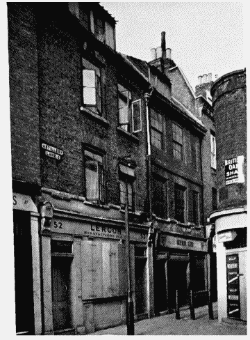
Nos. 52 Artillery Lane and 9a Artillery Passage
Nos. 52 Artillery Lane and 9a Artillery Passage.
? Built in 1680's by William Parker, bricklayer (p. 226)
b. Houses in Steward Street and Fort Srreet in 1914, built in 1680's (p. 33) Demol.
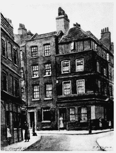
Houses in Steward Street and Fort Street.
Houses in Steward Street and Fort Srreet in 1914, built in 1680's (p. 33) Demol.
c. Plan of Old Artillery Ground, 1681/2 (p. 29)

Plan of the Old Artillery Ground, 1680/1.
Plan of Old Artillery Ground, 1681/2 (p. 29)