Survey of London: Volume 41, Brompton. Originally published by London County Council, London, 1983.
This free content was digitised by double rekeying. All rights reserved.
'Plate 13', in Survey of London: Volume 41, Brompton, ed. F H W Sheppard (London, 1983), British History Online https://prod.british-history.ac.uk/survey-london/vol41/plate-13 [accessed 8 February 2025].
'Plate 13', in Survey of London: Volume 41, Brompton. Edited by F H W Sheppard (London, 1983), British History Online, accessed February 8, 2025, https://prod.british-history.ac.uk/survey-london/vol41/plate-13.
"Plate 13". Survey of London: Volume 41, Brompton. Ed. F H W Sheppard (London, 1983), British History Online. Web. 8 February 2025. https://prod.british-history.ac.uk/survey-london/vol41/plate-13.
In this section
a. Nos. 11-29 (odd) Rutland Street (left to right) in 1982.
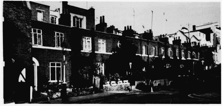
Nos. 11–29 (odd) Rutland Street in 1982.
Nos. 11-29 (odd) Rutland Street (left to right) in 1982.
? William Aslat, builder, c. 1830 (p. 44)
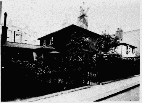
b. Cottage Place, east side in c. 1910.
Nos. 11–29 (odd) Rutland Street in 1982.
Cottage Place, east side in c. 1910.
Built under William Farlar, 1823 (p. 40)Demolished
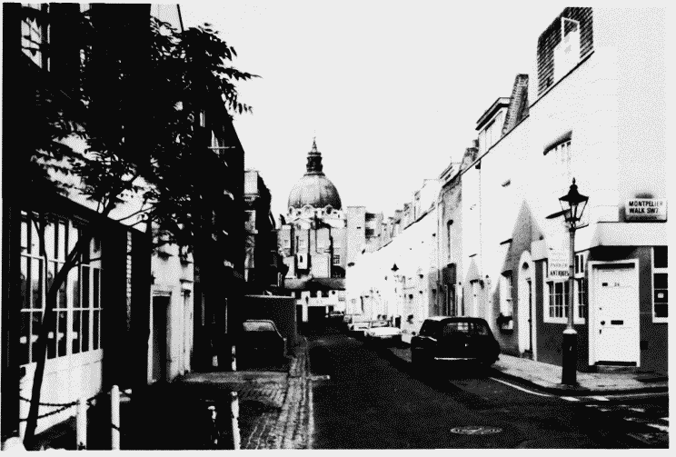
c. Cheval Place, looking west from Montpelier Walk in 1982 (p. 39).
Nos. 11–29 (odd) Rutland Street in 1982.
Cheval Place, looking west from Montpelier Walk in 1982 (p. 39).
Brompton Square and the dome of the Oratory are in the distance
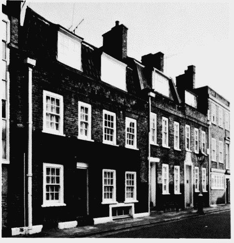
d. Nos. 3-5 (right to left) Fairholt Street in 1982.
Nos. 11–29 (odd) Rutland Street in 1982.
Nos. 3-5 (right to left) Fairholt Street in 1982.
Baillie Scott and Beresford, architects, 1925-8 (p. 39)