Survey of London: Volumes 43 and 44, Poplar, Blackwall and Isle of Dogs. Originally published by London County Council, London, 1994.
This free content was digitised by double rekeying. All rights reserved.
'Plan pocket', in Survey of London: Volumes 43 and 44, Poplar, Blackwall and Isle of Dogs, ed. Hermione Hobhouse (London, 1994), British History Online https://prod.british-history.ac.uk/survey-london/vols43-4/plan-pocket [accessed 11 February 2025].
'Plan pocket', in Survey of London: Volumes 43 and 44, Poplar, Blackwall and Isle of Dogs. Edited by Hermione Hobhouse (London, 1994), British History Online, accessed February 11, 2025, https://prod.british-history.ac.uk/survey-london/vols43-4/plan-pocket.
"Plan pocket". Survey of London: Volumes 43 and 44, Poplar, Blackwall and Isle of Dogs. Ed. Hermione Hobhouse (London, 1994), British History Online. Web. 11 February 2025. https://prod.british-history.ac.uk/survey-london/vols43-4/plan-pocket.
Plan pocket
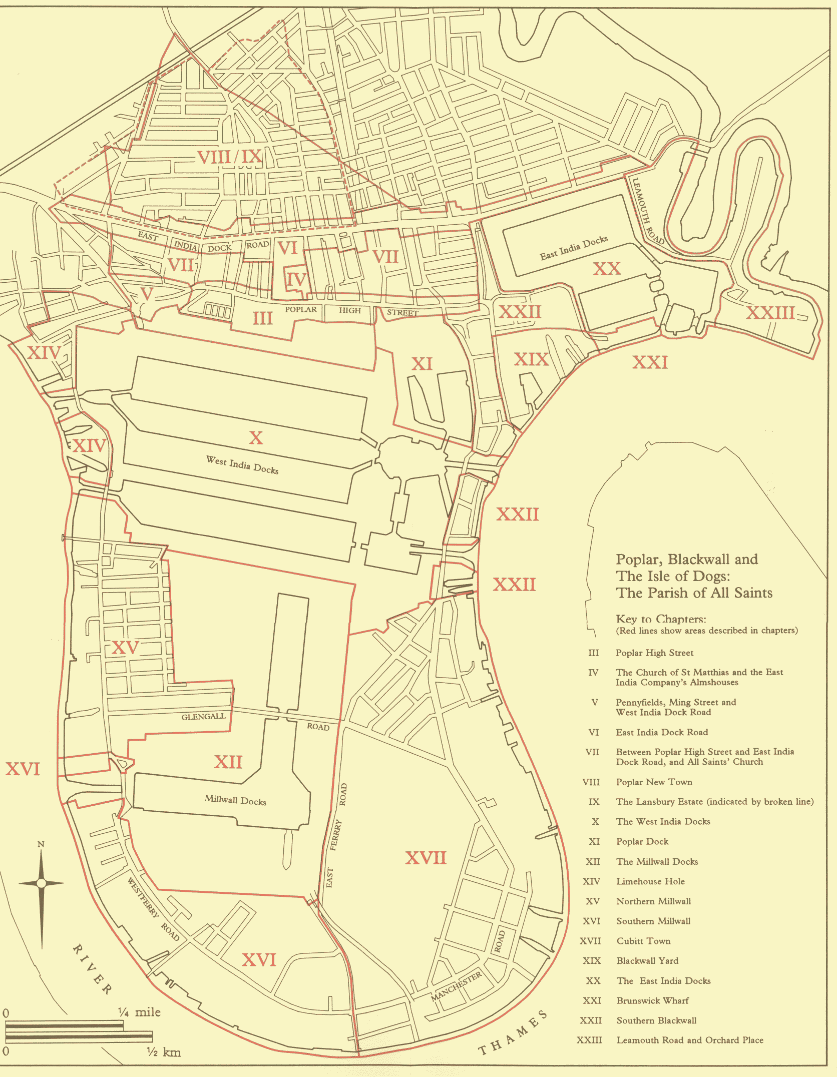
Poplar, Blackwall and The Isle of Dogs: The Parish of All Saints
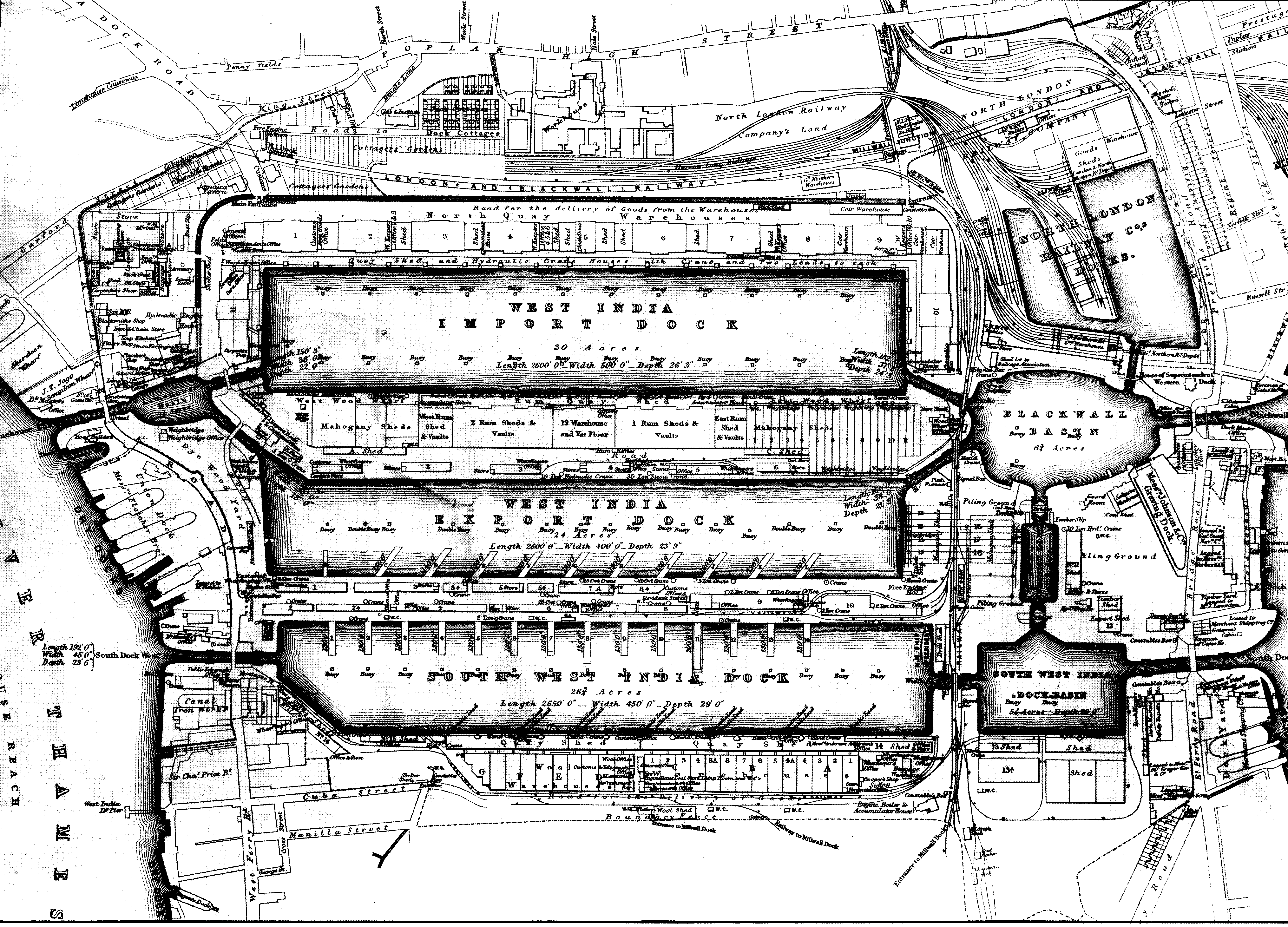
The West India Docks in 1881
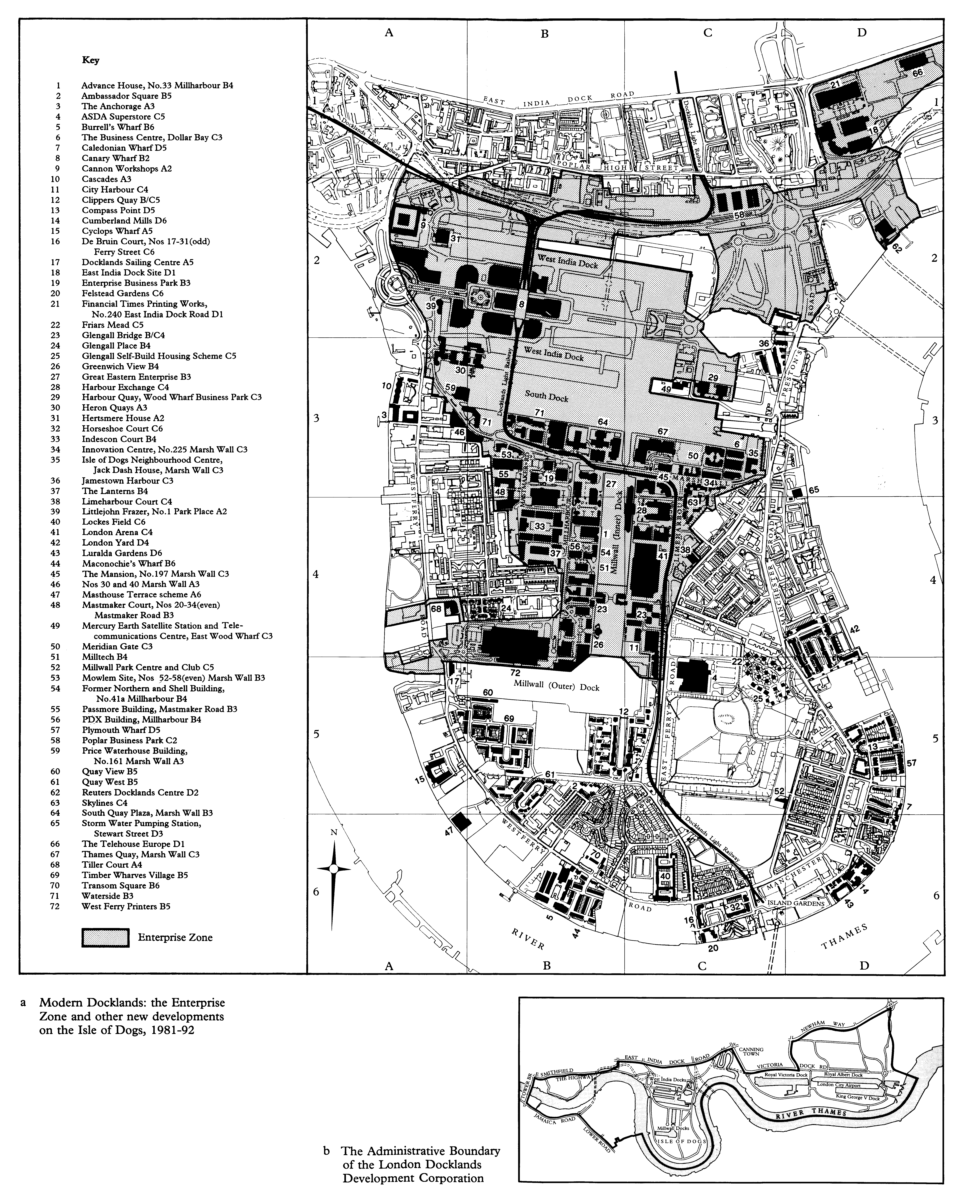
a Modern Docklands: the Enterprise Zone and other new developments on the Isle of Dogs, 1981-92. b The Administrative Boundary of the London Docklands Development Corporation