A History of the County of Lancaster: Volume 4. Originally published by Victoria County History, London, 1911.
This free content was digitised by double rekeying. All rights reserved.
'Townships: Abram', in A History of the County of Lancaster: Volume 4, ed. William Farrer, J Brownbill (London, 1911), British History Online https://prod.british-history.ac.uk/vch/lancs/vol4/pp111-115 [accessed 7 February 2025].
'Townships: Abram', in A History of the County of Lancaster: Volume 4. Edited by William Farrer, J Brownbill (London, 1911), British History Online, accessed February 7, 2025, https://prod.british-history.ac.uk/vch/lancs/vol4/pp111-115.
"Townships: Abram". A History of the County of Lancaster: Volume 4. Ed. William Farrer, J Brownbill (London, 1911), British History Online. Web. 7 February 2025. https://prod.british-history.ac.uk/vch/lancs/vol4/pp111-115.
In this section
ABRAM
Edburgham, 1212; Adburgham, 1246, and common; Abraham, xvi cent.; Abram, xviii cent. Pronounced Abbram.
Abram is situated in the centre of a coal-mining district; the surface of the country is flat except in the south, where it is very slightly undulating. The surroundings are characteristic of a coal-producing district, distinctly unpicturesque, dingy grass-fields alternating with collieries, pit-banks, and railway lines. Some fields are arable and produce crops of wheat and oats. There is much pasture land. Trees are in the minority, and stunted and blackened with smoke. The hawthorn hedges which divide the fields are low and spare. The soil is a stiff clay which holds a quantity of water on its surface, for besides occasional 'flashes' caused by mining, the fields appear to be slightly flooded at most seasons of the year. It is a district of sett-laid roads and cinder-paths. In the northern part of the township the geological formation consists of the Coal Measures. At some distance from the southern boundary this formation dips under the New Red Sandstone and the intervening Permian Beds.
The area is 1,982 acres, (fn. 1) and in 1901 the population numbered 6,306. Part of the western and nearly all of the southern boundary is formed by a brook running through Hindley, and called successively Eye Brook and Glazebrook; by it Bamfurlong, (fn. 2) in the extreme west, is cut off from the main portion of the township.
Abram village lies in the north-western corner, where the road from Wigan to Warrington by Golborne crosses the township, meeting at the village other roads from Ashton on the south-west, and from Leigh on the east. Bickershaw (fn. 3) lies by the lastnamed road, near the eastern boundary. Plank Lane is a hamlet in the south-eastern corner, situate on the road from Leigh to Newton. Dover is a hamlet on the south-west border.
The London and North Western Company's railway from Warrington to Wigan crosses the western corner of the township, with a station called Bamfurlong; a branch of its Wigan and Manchester line has a station at Plank Lane; the Great Central Company's Manchester and Wigan line passes north through the middle of the township, with two stations called Westleigh and Bedford, and Bickershaw and Abram. The Leigh branch of the Leeds and Liverpool Canal passes through near the southern border.
Coal-mining began about sixty years since.
A local board was formed in 1880. The township is now governed by an urban district council of twelve members, elected by four wards.
MANOR
Before the Conquest, as after, ABRAM appears to have been a member of the manor and fee of Newton. (fn. 4) Henry II gave it to Warine son of Godfrey, and his descendants, assuming the local name, held it to the 17th century. This Warine confirmed a grant by his nephew, William de Occleshaw, to Cockersand Abbey, for the souls of King Henry and others. (fn. 5) His son Richard was a benefactor to the same house, granting Bernegrenes, on the south of Walter's Pool, with other lands and liberties. (fn. 6) Richard de Abram was in possession in 1212, holding the manor as 4 oxgangs by a rent of 4s.; a third part had been given in alms. (fn. 7) John son of Richard confirmed the previous grants to Cockersand and added a ridding by Glazebrook. (fn. 8) Warine Banastre granted an oxgang of his demesne to the same canons, (fn. 9) and Robert son of Robert Banastre gave a general confirmation about 1250. (fn. 10)
The family pedigree cannot be traced satisfactorily. (fn. 11) A Gilbert Abram died about 1470 leaving two daughters as heirs; Constance married Henry Byrom and Isabel married James Holt; (fn. 12) and the later holdings of these families probably represent the inheritance of the daughters. (fn. 13) The manor, however, continued in the male line (fn. 14) to Thomas Abram, who died in 1606, also leaving two daughters to divide the property. (fn. 15) The elder, Susan, married Henry Lance, of a Cornish family, (fn. 16) and the manor was assigned to her; the younger daughter, Mary, married Philip Langton of the Lowe in Hindley. (fn. 17) All adhered to the ancient religion, and suffered accordingly under the persecuting laws in force. (fn. 18) In 1652, however, Abraham Lance, the son and heir of Henry and Susan, being 'conformable,' petitioned for the removal of the sequestration of his mother's lands, and on condition that he abjured his religion they were allowed to him. (fn. 19) It does not appear whether he actually regained possession or not, but the ruin of the family, several members of which fell in the Civil War fighting as Royalists, could not be averted. (fn. 20)

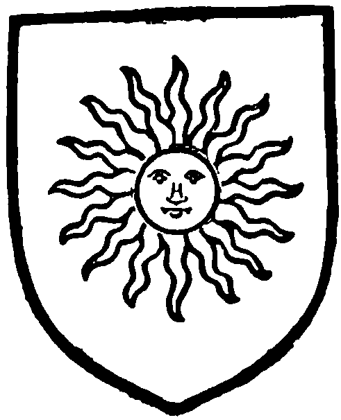
Abram. Azure a sun in splendour or.
Shortly afterwards William Gerard and Anne his wife were in possession, (fn. 21) and sold the manor to Richard Hilton, (fn. 22) with whose daughter Abigail it descended to her children by her husband Thomas Crook. (fn. 23)
The new owner it appears was a zealous Protestant, and his son Richard Crook was the builder of the Nonconformist chapel at Hindley, after the existing one had been recovered by the Bishop of Chester. (fn. 24) Richard died without issue in November 1727, and the inheritance, which, besides Abram, included lands in Walton le Dale and elsewhere in the county, (fn. 25) passed to his five sisters as co-heirs. (fn. 26) The manor of Abram seems to have been the portion of the second sister, Anne, who married John Darbyshire of Warrington, and her only child, Abigail, married Thomas Clayton, M.D., of Little Harwood. (fn. 27) Their grandson, Thomas Clayton, in 1785 sold the manor to Peter Arrowsmith of Astley, who in 1828 sold it to John Whitley, and his son Henry Jackson Whitley, of Biggleswade, succeeded. (fn. 28) His son, Mr. John Henry Arthur Whitley, of Bourton, Salop, is the present owner; but no manorial rights are claimed. (fn. 29)
The portion called OCCLESH AW, as has been seen, was granted to Cockersand Abbey, (fn. 30) and was occupied by the Urmston family; (fn. 31) after the Dissolution it came into the possession of the Earl of Derby. (fn. 32) The Occleshaw family long continued to hold an estate in the township; (fn. 33) this eventually passed into the hands of Abigail Crook, and became part of her Abram estate. (fn. 34)
BAMFURLONG
BAMFURLONG was the possession of the Ashton family for a long period (fn. 35); it then passed to a junior branch of the Gerards, described as 'of Brindle' (fn. 36); and probably by sale to the later Gerards of Ince, and has descended with the Westwood property. (fn. 37)
Nothing definite can be stated about the descent of BICKERSHAW, formerly called a manor. (fn. 38) In the 16th century it was owned by the Holcrofts, and sold by them to Richard Ashton in 1599. (fn. 39) Ralph Ashton about thirty years later sold it to Frances widow of Robert Dukinfield of Dukinfield near Stockport. (fn. 40) It descended in this family until 1760, when it was sold to Richard Clayton of Adlington; and it was again sold in 1790 to Edward Ackers of Newton, surgeon. The trustees of Abraham Ackers, who died in 1864, are the owners; it is leased to the Abram Coal Company. (fn. 41)
A branch of the Culcheths were long seated in Abram. (fn. 42) The inquisition taken after the death of John Culcheth in 1586 shows that he had held lands in Abram of Thomas Abram by a rent of 1d., and in Hindley of John Culcheth of Culcheth by a rent of 6d. (fn. 43) A pedigree was recorded in 1664, (fn. 44) but the family afterwards migrated to Warwickshire, and in 1750 sold the property. (fn. 45)

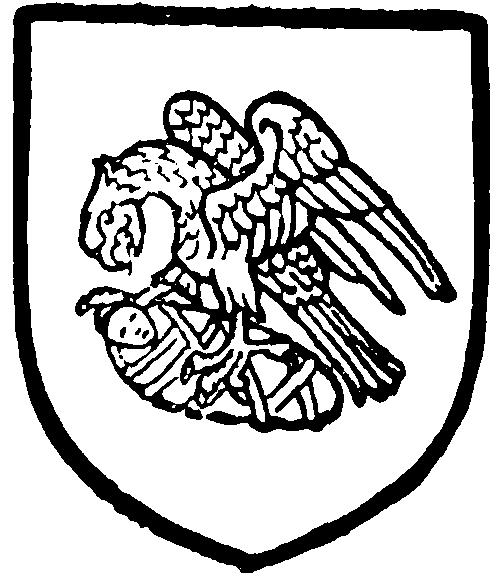
Culcheth. Argent an eagle sable preying upon a child swaddled gules.
Adam Bolton, (fn. 46) John Occleshaw, John Southworth, Roger Culcheth, Cecily Ashton, and Nicholas Huyton, were the landowners contributing to a subsidy collected about 1556. (fn. 47) The Corless, (fn. 48) Lithgoe, (fn. 49) and Leyland (fn. 50) families were long resident here.
A plot of land in Park Lane, known as the Morris Dancers' ground, is popularly supposed to be held by them on condition that a morris dance be celebrated there once in twenty years. (fn. 51)
The church of St. John was erected in 1838 for the accommodation of members of the Established Church. (fn. 52) The rector of Wigan is patron of this, but trustees present to the new church of St. James and St. Elizabeth, Bickershaw.
A Congregational chapel was built in 1897.
A school was founded at Lowe in 1632 by Mrs. Mary Abram. (fn. 53)
