A History of the County of Lancaster: Volume 3. Originally published by Victoria County History, London, 1907.
This free content was digitised by double rekeying. All rights reserved.
'Townships: Warrington', in A History of the County of Lancaster: Volume 3, ed. William Farrer, J Brownbill (London, 1907), British History Online https://prod.british-history.ac.uk/vch/lancs/vol3/pp316-324 [accessed 31 January 2025].
'Townships: Warrington', in A History of the County of Lancaster: Volume 3. Edited by William Farrer, J Brownbill (London, 1907), British History Online, accessed January 31, 2025, https://prod.british-history.ac.uk/vch/lancs/vol3/pp316-324.
"Townships: Warrington". A History of the County of Lancaster: Volume 3. Ed. William Farrer, J Brownbill (London, 1907), British History Online. Web. 31 January 2025. https://prod.british-history.ac.uk/vch/lancs/vol3/pp316-324.
In this section
WARRINGTON
Walintune, Dom. Bk.; Werinton, 1242; this and Werington common to 1550; Warington, 1330.
Warrington lies on flat ground near the Mersey, (fn. 1) which winds with sudden swoops and curves all along its southern margin. From Little Sankey to Padgate Brook an alluvial terrace fringes the low ground lying by the course of the river, of which, for a considerable part of the distance, it constitutes the northern bank, concealing over a large area the underlying mottled sandstones of the bunter series. Along the riverside the land is composed of marshy pastures called Arpley and Howley, dotted over with cattle, or where the river nears the big industrial town of Warrington huge factories line the water's edge. With the exception of a fringe of open country on the edges of the township the land is covered with houses, streets, railways, and factories. The soil is loamy and fertile and produces crops of potatoes, and other market produce. Good broad roads run into the town from all quarters and become quickly narrowed as they approach the centre of the town, where is a curious mixture of really picturesque old houses and great modern factories which overshadow the antique. In the floor of the old schoolhouse near the parish church of Warrington is St. Elphin's Well, now disused. This is generally reported to be in the churchyard. The Sankey Brook forms the western boundary of the township on its way to join the Mersey.
The town grew up beside the river, about the centre of the boundary. Little Sankey lay on the western side and Oxford on the north; between these hamlets and the town was the heath. Orford was divided from Hulme in Winwick by a brook and tract of marshy ground; and probably in the same way from Warrington town. The area is 2,817 acres. The population in 1901 was 64,242. (fn. 2)
The road from Prescot and the west passed the Sankey Brook by a bridge, (fn. 3) then north-eastwardly through Little Sankey, with its green, and wound and still winds eastwardly through Warrington till it reaches the parish church at the extreme east end of the town; it is called in turns Sankey Street, Buttermarket Street, Irlam Street, and Church Street. After passing the church and the ancient mote hill the road divides; the main road goes to Manchester, and a northerly branch, Padgate Lane, to Bolton.
From the bridge over the Mersey a cross-road leads north, as Bridge Street, Horsemarket Street, and Winwick Street, to Winwick and Wigan; it crosses the former road near the highest land of the town, about a thousand yards west of the church. The market stands to the north-west of the crossing (fn. 4) and marks the western limit of the old town, as the church marks the eastern.
Mersey Street leads from the bridge north-east to Irlam Street, about half way between the market and the church. From this point Fennel Street and Battersby Lane lead north to Orford Hall. From Buttermarket Street, Bank Street and Academy Street lead down to Mersey Street—in the former was the county court; in the latter stood the famous Academy.
From Horsemarket Street a narrow crooked lane called Town Hill, Cockhedge Lane, and School Brow leads eastward to the Boteler Grammar School, and then turns into the Manchester Road near the parish church.
On the western side of the town Cairo and Bold streets lead south from Sankey Street; in the latter is the Museum and Library, with the School of Art adjacent. King Street, Golborne Street, and Legh Street lead north from Sankey Street; and farther to the west, on the same side, is the Town Hall, formerly Bank Hall. These streets indicate the extent of the town about a century ago. Now it has spread over a much larger area, especially to the north-west and west. At the west end of Sankey Street and Green Street, which marks the site of the old green, two other ancient lanes remain. One runs north and east to near the market-place; the other makes a more extended circuit in the same direction, and is known as Lovely Lane, Folly Lane, Longford Street, Conies Corner, and Marsh House Lane. The last named, on the north side of which are the Orford Barracks, opened in 1878, ends at Padgate Lane, close to its junction with the Manchester Road.
Orford Barracks is the depôt of the combined 8th and 40th regimental districts, or the King's (Liverpool Regiment), late 8th King's, and the Prince of Wales' Volunteers (South Lancashire Regiment), late 40th and 82nd Foot.
A dispensary was opened in the market-place in 1810, and removed in 1818 to a more commodious building in Buttermarket Street. The new infirmary and dispensary in Kendrick Street was built in 1872.
The public cemetery is on the eastern extremity of the town. The workhouse lies on the northwestern boundary; near it is the infectious diseases hospital.
The post office, formerly accommodated in a building at the corner of King and Sankey streets, was in 1882 removed to the opposite side of the latter street. A new one is being built. New police courts were erected in 1900 near Bank Quay Station.
Warrington is crossed by the railways of the London and North Western Company and the Cheshire Lines Committee. The former company's railway from London to Carlisle passes north through the town on a high-level line. There are two adjacent bridges over the Mersey and Ship Canal, one for the main line from Crewe, and the other for the branch from Chester, which here join. (fn. 5) The station is at Bank Quay on the south-west of the town. The same company's railway from Liverpool to Stockport through Widnes has stations at Bank Quay (low level) and Arpley; near the latter it crosses the Mersey into Cheshire. The Cheshire Lines Committee's Liverpool and Manchester railway has a station (Central) in Horsemarket Street. This necessitates a deviation of over half a mile from the direct line, the junctions being near Sankey Brook on the west, and Padgate on the east.
From its position at the head of the tidal part of the Mersey, half way between Liverpool and Manchester, and as having what was formerly the lowest bridge across the river, Warrington has always been a good market town, and many industries have sprung up and flourished in it. A century ago the manufactures were huckabacks and coarse cloths, sailcloth, canvas, fustian, pins, and glass; and it was also noted for the excellence of its malt. The Wednesday market was noted for fish, provisions, and all kinds of cattle and sheep, 'not inferior to the Leicestershire breed.' (fn. 6)
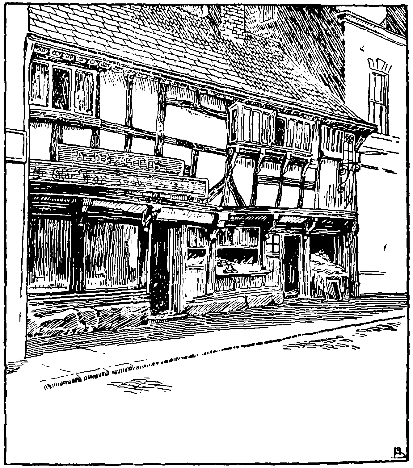
The Old Fox Inn, Warrington
In 1825 sugar-refining and copper works were among the industries that had been lost to the town; cotton yarn, velveteens, calicoes, and muslins were the chief manufactures, and pins, files, and other tools were made. (fn. 7)
More recently great forges and iron-foundries and soapworks have been established, but the older industries of wire-drawing, file-making, and fustiancutting have been retained; the breweries are also well known. Boats are built. There are extensive tanneries, heavy sole leather and belting being made. (fn. 8)
In several of the riverside localities in the township osiers are much grown, this industry having been introduced in 1803, when a successful attempt was made by a Warrington resident to supply English basket-makers with willow, when the foreign materials were unobtainable.
Though the growth of the town has caused the destruction of many of the small two-story houses which were characteristic of its streets, a good number still remain. The oldest are of timber construction, such as the old Fox Inn in Buttermarket Street, now a tobacconist's shop, and though much altered retaining sufficient old work to mark its date as belonging to the sixteenth century. (fn. 9) In the seventeenth century Warrington houses seem to have been commonly dated by inscriptions over the doorways, giving not only the year but the day of the month, with the owners' initials. Nearly opposite the Fox Inn is a house with 1vn. XXI. 1649. AK IK EK, and in the Warrington Museum are several beams from destroyed houses with similar inscriptions, all ranging between 1645 and 1658. In Church Street is a good timber house with a projecting upper story, of early sixteenth-century date, but the finest specimen of timber work is the Barley Mow Inn, on the west side of the market place, belonging to the latter part of the sixteenth century, with low woodmullioned lattice windows and quatrefoil panelling of black wood filled in with plaster. The gables toward the market place are now covered with flimsy weather boarding, but otherwise the outside of the house has preserved much of the original work. The interior is naturally less perfect, but on the first floor is a room completely panelled and with a good chimney-piece of Jacobean style, and the staircase has good turned balusters and newels of seventeenth-century date. In the windows are a few quarries of coloured glass, and in one of the ground-floor rooms is a fine carved and panelled chimney-piece, removed from a small room on the first floor. (fn. 10)
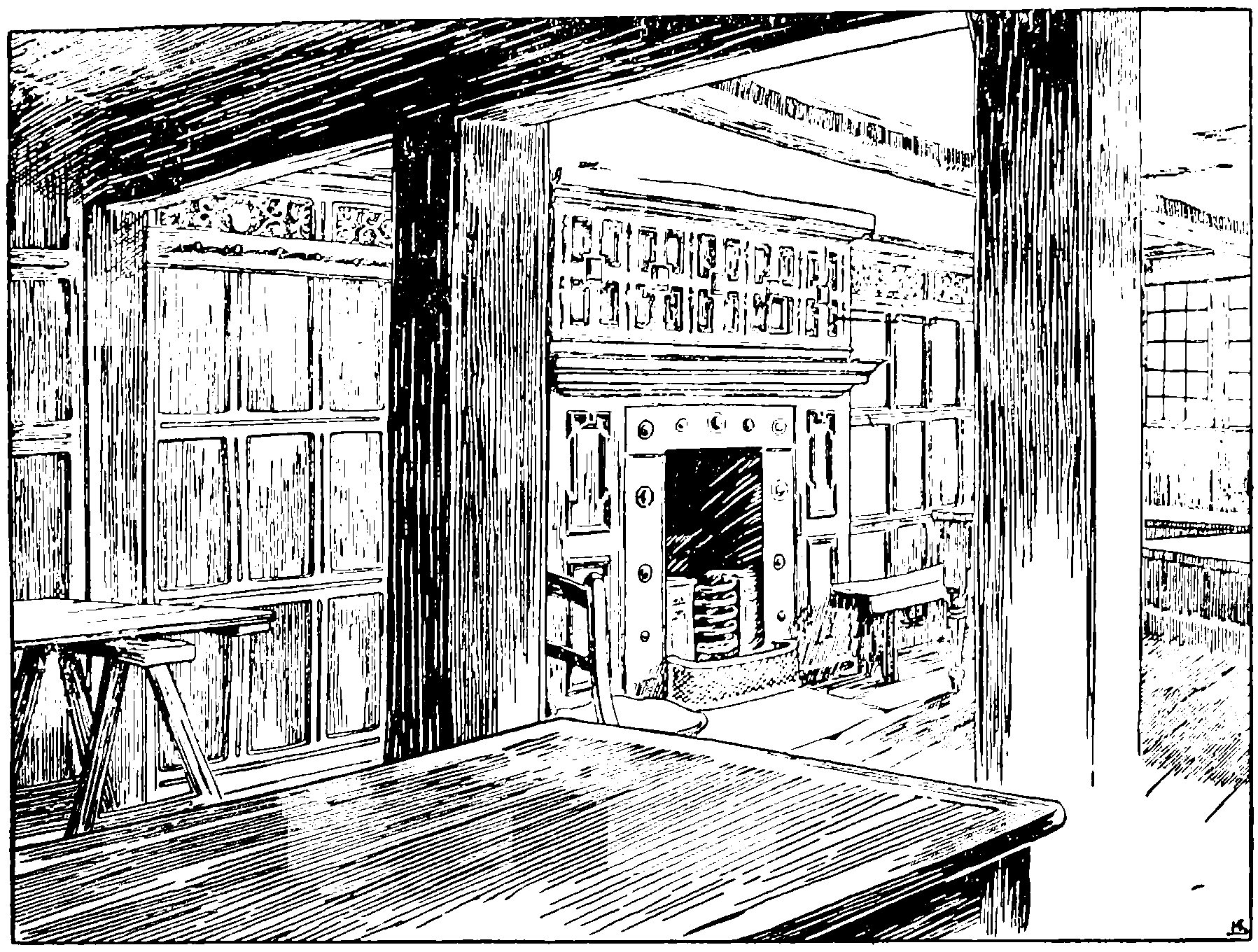
Barley Mow Inn, Warrington: Room on First Floor
A second type of house which is found in the town is of brick with projecting labels over the windows and simple patterns on the wall surfaces; such houses appear to be of seventeenth-century date, and an earlier example of the kind occurs at Newtonle-Willows Hall.
The White Cross, formerly at the west entrance of the town, has disappeared. (fn. 11)
HUNDRED
Before the Conquest WARRINGTON was the head of a hundred comprising the parishes of Warrington, Prescot, and Leigh, and the township of Culcheth in Winwick. (fn. 12) Afterwards this was merged in the hundred of West Derby, in which it has since remained.
BARONY
In the time of Henry I a barony or fee was formed for Pain de Vilers, Warrington being its head and giving it a name. It descended in regular hereditary succession in the Vilers and Pincerna or Boteler family until nearly the end of the sixteenth century, when the Boteler manors and estates were broken up and the Irelands, who purchased the principal share, enfranchised the subordinate manors of the fee. (fn. 13)
MANOR
The manor descended in the same way as the barony of which it was the principal member, although the Botelers' chief residence had long been at Bewsey in Burtonwood. (fn. 14) It was purchased by Thomas Ireland, afterwards a knight, in 1597. In 1628, however, his son Thomas Ireland of Bewsey and Margaret his wife, together with George and Robert Ireland, joined in selling the manors of Warrington, Orford, and Arpley, with various lands and rents, to William Booth, eldest son of Sir George Booth, baronet, of Dunham Massey in Cheshire. (fn. 15)
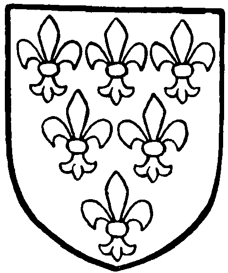
Ireland of Bewsey. Gules, six fleurs-de-lis. 3, 2, and 1, argent.
William's son George, a Presbyterian, fought for the Parliament in the Civil War, and took part in one of the successful attacks on Warrington in 1643; he was, like many of his party, dissatisfied with the Protector and his son and in 1659 endeavoured to raise the country in favour of Charles II. His attempt was defeated, and he was committed to the Tower, but when the Restoration took place the king raised him to the peerage as Lord Delamere. (fn. 16)
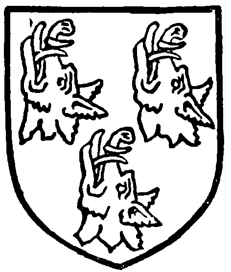
Booth of Dunham. Argent, three boars' beads erect and erased sable.
He died in 1684, and was succeeded by his son Henry, who adhering to his father's politics fell under the suspicion of James II at the time of the Monmouth insurrection and was charged with high treason. He was acquitted, but took part with other Whigs in the Revolution and was rewarded by an advance in the peerage, being created earl of Warrington in 1690. He died three years later and was succeeded by his son George, who, dying in 1768, left an only daughter Mary as heiress, the earldom (fn. 17) becoming extinct.
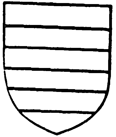
Grey of Stamford. Barry of six argent and azure.
This daughter married Henry Grey, fourth earl of Stamford, and in the year after her father's death joined with her husband in the sale of the manor of Warrington to John Blackburne of Orford. (fn. 18) The lordship descended in the same manner as Orford and Hale until 1851, when it was purchased by the corporation. (fn. 19)
BOROUGH
William le Boteler, who died in 1233, created a borough in Warrington. His charter does not seem to have been preserved, but the burgage had an acre of land with it and was liable to a rent of 12d. William's son and heir Emery died in 1235, leaving a son William, a minor, as heir. William de Ferrers, earl of Derby, who was the guardian, created some new burgages, but about forty years afterwards William le Boteler appears to have become alarmed at the growing claims of 'the Commonalty of Warrington,' and set himself to resist them. (fn. 20) In 1292 he granted a number of privileges to his 'free tenants' in the town, (fn. 21) but at the same time succeeded in destroying the borough court which had grown up. Eight years later the free tenants and burgesses finally renounced all claim to have such a court (curia burgensium). (fn. 22) For the next five hundred years Warrington was governed by means of the lord's manor court.
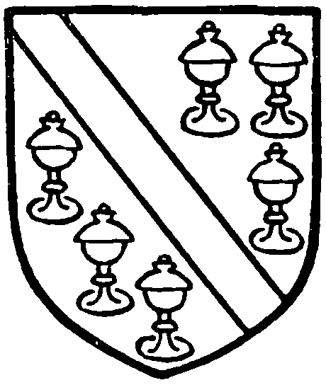
Boteler. Azure, a bend between six covered cups or.
In 1254–5 William le Boteler obtained a charter for an annual fair at Warrington to be held on the eve, day, and morrow of the Translation of St. Thomas the Martyr. (fn. 23) A second fair of eight days, beginning on the eve of St. Andrew, was conceded by Edward I in 1277; at the same time a weekly market on Friday was allowed. (fn. 24) Eight years later the summer fair was extended to eight days, and a weekly market for Wednesday was allowed— apparently in substitution for the Friday market, which was not afterwards held. At the same time a grant of free warren in his demesne lands of Sankey, Penketh, Warrington, and Layton was allowed to the lord. (fn. 25) The fairs have continued to the present time, the days being 18 July (old St. Thomas's) and 30 November; the Wednesday market also survives, and another on Saturday has been established, by custom probably.
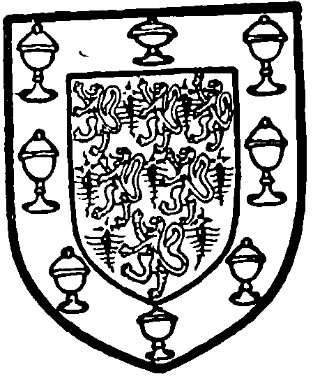
Warrington Borough. Ermine, six lioncels rampant, 3, 2, and 1 gules within a bordure azure charged with eight covered cups or.
The claim of William le Boteler to have markets and fairs, as well as free warren, wreck of the sea, and gallows in Warrington and Layton was tried at Lancaster in 1292. He produced the charters mentioned, and claimed to have had wreck of the sea at Layton and gallows in Warrington without interruption from the time of the Conqueror. The jurors found that his claim was valid, and further that he and his ancestors had held a market and fair from beyond the memory of man. (fn. 26)
The constables chosen each October at the lord's court governed the town, under the justices of the peace, down to 1813, when commissioners appointed by the local Improvement Act of that year were associated with them. (fn. 27) In 1832 the town became a parliamentary borough under the Reform Act, returning one member; and in 1847 it was incorporated, (fn. 28) and has since been governed by the council. As already stated the manorial rights, including the market tolls, were purchased by the corporation. The municipal boundary at first included only about half the area of the township, Orford and Little Sankey remaining outside.
Some portions of the township of Latchford and Thelwall in Cheshire were also included in the borough. (fn. 29) The boundary was extended in 1890, and again in 1896; it now includes all the ancient township of Warrington (except Orford) and Latchford as far south as the Manchester Ship Canal. (fn. 30)
In 1890 the enlarged town was divided into nine wards, (fn. 31) each with an alderman and three councillors. The gas and water supplies are in the hands of the council, which has also instituted an electric light and power supply, and an electric tramway service. Baths, gymnasium, and other useful and necessary institutions have been established. (fn. 32)
A grant of arms was made in 1897. (fn. 33)
A circulating library, begun in 1760 by the projector of the Warrington Academy, was in 1848 united with the museum of the local Natural History Society, founded in 1835, and being taken over by the corporation became the public museum. (fn. 34) This was the first town in the kingdom to open a rate supported library. After occupying hired premises in Friar's Green, buildings were erected for it in 1855, and enlarged in 1876 by the addition of an art gallery, and again in 1881. The School of Art adjoins; it was founded in 1853. A technical institute was built in 1902.
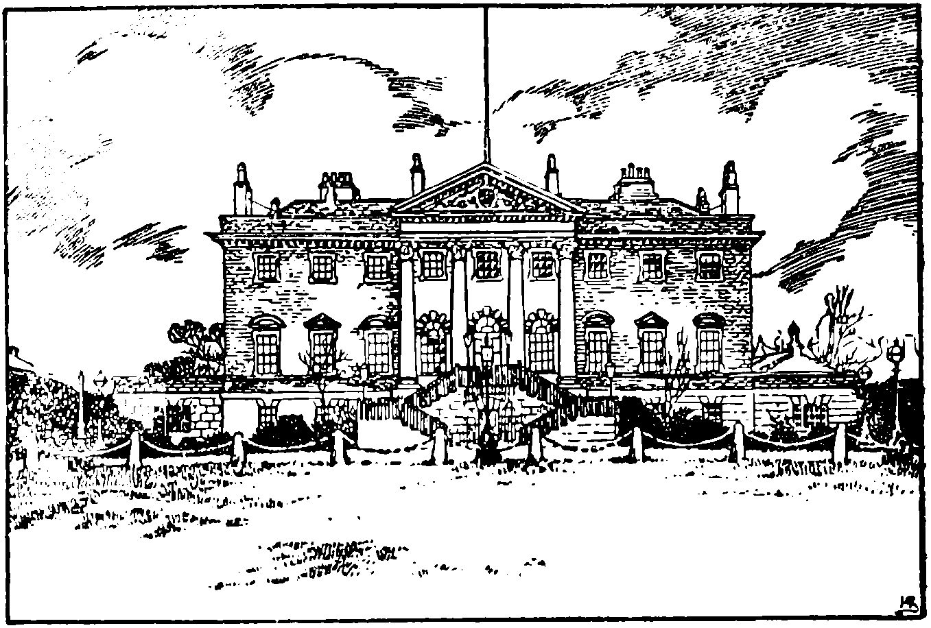
Bank Hall, Warrington; now the Town Hall
A town hall and bridewell were built under the Act of 1813; the building was till recently used as a court for the magistrates, &c. The present town hall, formerly Bank Hall, was purchased in 1872; it was the seat of the Patten family, and erected in 1750. It is a fine specimen of a large country house of the time, with good plaster wall and ceiling decorations, and a pediment on the front with the Patten arms. The rain-water heads and wrought-iron railings are excellent of their kind. The grounds have been thrown open to the public. Parr Hall, presented to the town by Mr. J. Charlton Parr in 1895, is used for public meetings.
The markets were held in an open space in the angle formed by Sankey and Horsemarket Streets. There the present market-hall was built in 1856 under an Act obtained in 1854; a large covered shed adjacent was erected in 1879 to give further accommodation. Horsemarket and Buttermarket Streets show by their names how they were formerly used.
Apart from the Boteler family the chief landowners in Warrington were the Haydocks and their successors the Leghs of Lyme. An account of their holding has been printed in William Beamont, Warrington in 1465. (fn. 35) One or more families bore the local name; (fn. 36) others took a surname from their trades or offices, as the Arrowsmiths; (fn. 37) others again had come into the town from the adjacent townships, as Rixton and Southworth, and may have been younger branches of the manorial families. (fn. 38) Other surveys of the town were made in 1587 and 1593, and are now in the possession of Lord Lilford; there is a copy in the museum.
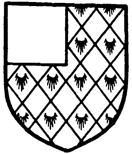
Patten of Bank Hall. Lozengy ermine and sable, a canton gules.
In more recent times the chief local family was that of Patten, whose residence, as already stated, is now the town hall. (fn. 39) The Borrons recorded a pedigree in 1664. (fn. 40)
The prior of the Hospitallers (fn. 41) and the abbot of Whalley (fn. 42) had exemptions from toll. William le Boteler early in the thirteenth century granted to Cockersand Abbey a burgage which the priest had held. (fn. 43) Norton Priory or Abbey, Birkenhead Priory, and the hospital of St. John at Chester also held lands in the town. (fn. 44)
The hamlet of ORFORD (fn. 45) was held of the lords of Warrington by several tenants. Among these were the Haydocks and their successors the Leghs, (fn. 46) and the Norris family. The latter appear to have acquired a holding about 1300, (fn. 47) and remained in possession till the end of the sixteenth century, when they were succeeded by a branch of the Tyldesley family, by marriage with the heiress of Thomas Norris. (fn. 48)
Shortly afterwards the Blackburnes of Newton-inMakerfield acquired an estate here, and Orford was their principal residence until the beginning of last century, when Hale Hall became their seat. (fn. 49) Orford Hall has since been let; it was for many years the residence of William Beamont, the well-known antiquary. (fn. 50) It is now occupied by the Warrington Training College, and stands among the wreckage of what was once a well laid-out and planted garden, with a little wood behind it and a small stream and duck decoy. (fn. 51) The smoke has killed all the trees and defaced the garden, the stream is foul and the decoy long since disused, while the house itself, a plain square building of three stories, has nothing of interest to show beyond a well-designed entrance doorway at the east front with a window over it, on the keystone of which is the date 1716. This may mark a refacing of older work, as the windows on the south side, with wooden transoms and casements, appear to be some thirty to forty years older than the date.
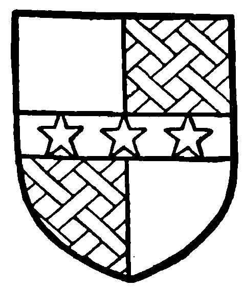
Norris of Orford. Quarterly argent and gules; in the second and third quarters a fret or; over all on a fesse sable three mullets of the first.
The manor of LITTLE SANKEY (fn. 52) was granted by Pain de Vilers, lord of Warrington, to Gerard de Sankey the carpenter, in the early part of the twelfth century. It was assessed as one plough-land and held by knight's service. In 1212 Robert son of Thomas was holding it; (fn. 53) and thirty years later Robert de Samlesbury was the tenant. (fn. 54) He or his descendants probably adopted the local surname; but little or nothing is known of the place (fn. 55) until the end of the fifteenth century, when Randle, son of Randle Sankey, did homage and paid 10s. as his relief for one plough-land in Little Sankey. (fn. 56) Edward Sankey died 1 December, 1602, holding the tenth part of a knight's fee in Little Sankey, Warrington, and Great Sankey; Thomas, his son and heir, was under sixteen years of age. (fn. 57) Nothing further seems to be known of the family or manor. The latter may have been acquired by the Irelands. (fn. 58) It is now considered a member of Lord Lilford's manor of Bewsey. (fn. 59)
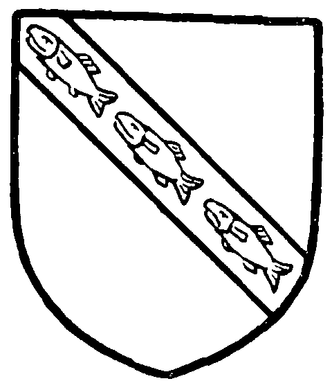
Sankey of Sankey. Argent, on a bend sable three fishes or.
The parish church has already been described; it has two mission churches—St. Clement's and St. George's. The following also are used for the Established worship:—
Holy Trinity, founded by Peter Legh of Lyme in 1709, in Sankey Street, in the centre of the town; it was rebuilt in 1760 and restored in 1872. (fn. 60) It is divided by pillars which support galleries into nave and aisles, the galleries being on north, south, and west, and there is a west tower, which contains the corporation clock and bell, the latter rung every evening at 8 p.m. (fn. 61) The pulpit and reading-desk are good examples of woodwork, with well-designed balusters; and in the middle of the church hangs a fine eighteenth-century brass chandelier, formerly in the House of Commons, and presented to the church in 1801. All pews are of oak and probably coeval with the church, but the font, of baluster shape, is more modern. The registers begin in 1816, but no district was assigned to the church until 1870. (fn. 62) The incumbents are now presented by the rectors of Warrington. (fn. 63) St. Luke's, Liverpool Road, built in 1893, is a chapel of ease to Holy Trinity.
St. Paul's, Bewsey Road, was built in 1830, and formed into an ecclesiastical parish in 1841. (fn. 64) The patronage is in the hands of trustees. St. Anne's, Winwick Road, had an ecclesiastical district assigned to it in 1864, services being held in the schools; the church followed in 1868. The patronage is vested in Simeon's Trustees. (fn. 65) St. Peter's, Birchall Street, began with a temporary church in 1874; the present building was erected in 1890. The rector of Warrington and the vicar of St. Paul's present alternately. (fn. 66) St. Barnabas, Bank Quay, was built in 1879 as a chapel of ease to St. Paul's, the vicar of this church being patron. A district was assigned to it in 1884.
At Orford there is a licensed chapel of ease under Padgate in Poulton.
The Reformed Church of England has a place of worship called Emmanuel.
The Presbyterian Church of England uses St. John's, in Winwick Street, built in 1807 for a congregation of seceders from St. James's, Latchford. Down to 1830 it belonged to the Countess of Huntingdon's Connexion, and again from 1836 to 1850. The congregation ceased to exist, but was re-formed in 1851; becoming Congregational next year it took Salem Chapel, St. John's being disused, and re-opened as a Presbyterian place of worship in 1854. From 1830 to 1836 it had been used by the Scottish Secessionists, afterwards the United Presbyterians. (fn. 67)
The Wesleyan Methodists have churches in Bold Street, Bewsey Road, and Liverpool Road; also two mission-rooms. John Wesley preached in Warrington several times between 1757 and 1768; a Methodist Chapel was built in Upper Bank Street in 1782. The Primitive Methodists have a church in Legh Street. The United Methodists have a church in Dallam Lane, and the Independent Methodists one in Friar's Green, built in 1802. There are Free Gospel churches at Bank Quay and Academy Street. In the latter street is also an unsectarian missionroom.
In 1824 there was a Baptist meeting in Bridge Street, an offshoot from the old Hill Cliff Chapel in Cheshire. A Particular Baptist church exists in Legh Street. Another Baptist church is in Golborne Street; it was built in 1811 for Congregationalists who had seceded from Stepney Chapel, and has had a chequered history. The Baptists had it from 1855 for a few years, and regained it in 1876. (fn. 68)
Wycliffe Congregational Church, Bewsey Street, is the outcome of secessions from Cairo Street Chapel on account of the Unitarian doctrine prevailing there. Stepney Chapel, in King Street, was built in 1779, and a church was formed in 1797; the Rylands family were connected with it. In 1848 it was closed. Services were for a time held at the 'Nag's Head,' Wycliffe Church being opened in 1852. (fn. 69)
The Welsh Calvinistic Methodists have a church.
The Society of Friends has long had members here. Their meeting-house in Buttermarket Street was built in 1720 as a branch of the Penketh meeting; it was rebuilt in 1830. (fn. 70)
Robert Yates, when ejected from the rectory in 1662, continued to minister in the town and district. Ten years later, during a temporary indulgence, he was licensed. The old court-house, on the site of the market hall, was a meeting-place, perhaps by favour of the lord of the manor, a Presbyterian. The first chapel was built in Cairo Street in 1702, for the Nonconformist congregation resulting from Mr. Yates's labours; this was rebuilt in 1745. About the latter date the minister and most of his flock became Unitarian; and this chapel, which in its time was the centre of the town's intellectual life, remains in the hands of the Unitarians. (fn. 71)
Those who remained faithful to the Roman Church at the Reformation had opportunities of worship, in spite of legal proscription, at some of the halls in the neighbourhood. (fn. 72) A room in the Feathers Inn, Friarsgate, now pulled down, was used as a chapel about 1750. Dom Thomas Benedict Shuttleworth, a Benedictine stationed at Woolston, removed into Warrington in 1771, and a hall in Dallam Lane, now belonging to the Primitive Methodists, was occupied until 1778, when a chapel was built off Bewsey Street. In 1823 the present church of St. Alban was built close by, Dr. Molyneux, titular abbot of St. Albans, being then in charge. He procured the gift of the chasuble found in 1835 hidden in the crypt of the parish church, and this is preserved at St. Alban's. (fn. 73) The orphreys only are ancient, of late fifteenth-century date, the body of the vestment having been renewed in red velvet. In the church is preserved another English chasuble of somewhat later date, but the silkembroidered orphreys are much repaired. In 1877 the Benedictines built the fine church of St. Mary on the eastern side of the town. More recently they have opened St. Benedict's school-chapel (1896). The church of the Sacred Heart, built in 1894, is in the hands of the secular clergy. There is a house of sisters of the Holy Cross and Passion, who teach in the schools. (fn. 74)
