Survey of London: Volumes 29 and 30, St James Westminster, Part 1. Originally published by London County Council, London, 1960.
This free content was digitised by double rekeying. All rights reserved.
'Plate 8: St. James's Church', in Survey of London: Volumes 29 and 30, St James Westminster, Part 1, ed. F H W Sheppard (London, 1960), British History Online https://prod.british-history.ac.uk/survey-london/vols29-30/pt1/plate-8 [accessed 12 February 2025].
'Plate 8: St. James's Church', in Survey of London: Volumes 29 and 30, St James Westminster, Part 1. Edited by F H W Sheppard (London, 1960), British History Online, accessed February 12, 2025, https://prod.british-history.ac.uk/survey-london/vols29-30/pt1/plate-8.
"Plate 8: St. James's Church". Survey of London: Volumes 29 and 30, St James Westminster, Part 1. Ed. F H W Sheppard (London, 1960), British History Online. Web. 12 February 2025. https://prod.british-history.ac.uk/survey-london/vols29-30/pt1/plate-8.
In this section
St. James's Church
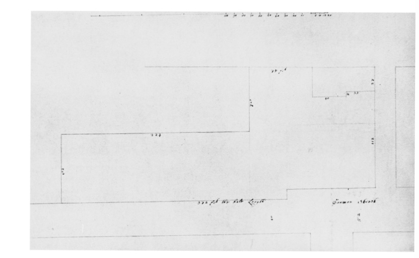
a. Plan of site of church, churchyard and minister's house
St. James's Church
Plan of site of church, churchyard and minister's house
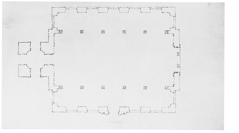
b. Ground plan
St. James's Church
Ground plan